
Get matched with top land surveyors in Camp Pendleton, CA
Enter your zip and get matched with up to 5 pros
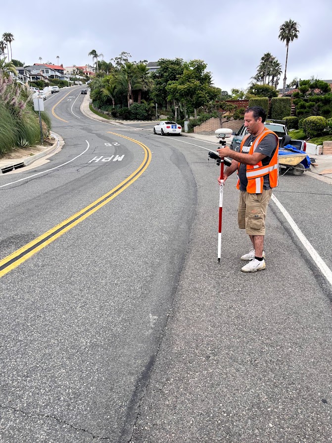
Need a pro for your land surveying project in Camp Pendleton, CA?
Select your specific project to find the pro for you.
Verified Reviews for Land Surveying pros in Camp Pendleton, CA
*The Angi rating for Land Surveying companies in Camp Pendleton, CA is a rating based on verified reviews from our community of homeowners who have used these pros to meet their Land Surveying needs.
*The HomeAdvisor rating for Land Surveying companies in Camp Pendleton, CA is a rating based on verified reviews from our community of homeowners who have used these pros to meet their Land Surveying needs.
Last update on January 12, 2026

Find Land surveyors in Camp Pendleton
Wounded Warrior Surveying
Wounded Warrior Surveying
Customers say: Quick response
8 years of experience
Free onsite estimate
Wounded Warrior Surveying, is committed to excellence and continues to be an outstanding business in the Murrieta, CA area. Wounded Warrior Surveying, prides itself on an outstanding record of quality service. Our longevity is a testament to the level of service and quality you will get when you choose Wounded Warrior Surveying, for your land surveying needs. We are excited that you have expressed an interest in our services and we look forward to working with you.
"thanks again for your help in this matter would be speaking with you about my friend is coming over to watch the game last night so I can get my hands on your hips and I will be in the"
Michael Ryan S on December 2019
KARN Engineering & Surveying, Inc.
KARN Engineering & Surveying, Inc.
Customers say: Quality work
Recommended by 92% of Angi customers
Recommended by 92% of HomeAdvisor customers
66 years of experience
KARN Engineering & Surveying, Inc. has been servicing southern California for over 50 years. We provide surveying, civil engineering, and land development services through client service based consulting. No job is too big or small for us. Call today!
"NA"
Stanley M on May 2023
KARN Engineering & Surveying, Inc. has been servicing southern California for over 50 years. We provide surveying, civil engineering, and land development services through client service based consulting. No job is too big or small for us. Call today!
"NA"
Stanley M on May 2023
Sawyer Land Surveying, Inc.
Sawyer Land Surveying, Inc.
Customers say: Quick response
Recommended by 94% of Angi customers
Recommended by 94% of HomeAdvisor customers
Sawyer Land Surveying, Inc. is a company dedicated to achieving the highest standards in the Professional Land Surveying industry. With eighteen years of experience serving the public, we provide land surveying, civil engineering support, consulting, land planning and mapping services in San Diego, Orange and Riverside Counties. Using state of the art technology to produce the greatest levels of accuracy, our goal is to provide a high quality product at a very competitive rate and a superior customer service experience to set us apart from the competition. We are conveniently located in the Carmel Valley area between Hwy 5 and Hwy 15 which provides easy access to all of San Diego County as well as most of Southern California. Our clients range from residential property owners, Architects, Contractors, Developers, Mortgage and Title Insurance companies.
"Spring of 2015, I commissioned Sawyer Land Surveying Inc to survey my newly-purchased property, a single family home. The new survey monuments Matt Sawyer placed showed that part of a dilapidated block wall which was an architectural match to and had originally enclosed my home appeared to encroach on my neighbor's property by a few inches. I brought up this inconsistency to Matt, who dismissed my concerns. I relied on Matt's survey to make significant development improvements to the property, including replacing the dilapidated wall with a new one, within my property boundaries. My tearing down the old wall, which had been part of my property for eighty years, caused my next door neighbor to react violently: he threatened to kill me, threatened my contractors, one of whom quit as a result, harassed my family, abused his position at the City to interfere in the development of my property, and even sued me frivolously, an action he lost with prejudice, but I still had to waste my time and resources in litigation. The neighbor relied on Matt's survey to build himself a wood fence, and had the permit signed off by a City inspector friend of his who did not verify the fence was not encroaching on my property. Then, in 2019, while browsing the Survey Records System, I found another neighbor's survey subsequent to Matt's, by another surveyor, who identified a four inch error in Matt's calculations. I pointed this out to Matt, who admitted to his error, quickly refunded my fees, and tried to get me to sign a release so I would not take action against him, a release I refused to sign. After confirming that the neighbor's fence was now on my property by several inches, I asked Matt for his insurance information so I could file a claim, but he refused, clinging to the disingenuous argument that "a few inches is not an encroachment". My goal was for Matt to acknowledge that his error had consequences on my family and me but he refused. So I sued Matt in small claims court in the hope that he would take some measure of responsibility for the impact the erroneous survey had on my family. Too late to sue, said the judge, erroneously referring to the wrong statute of limitations. Courts don’t always get it right, but no matter…. Damage caused by Matt’s error was done, I will never get my time and energy back. Relationship with the neighbor is forever damaged. The goal of the lawsuit was not to get money from Matt. Indeed, prior to the hearing, Matt offered me $1K to avoid the lawsuit, but he missed the point of the whole thing; Take responsibilty, be accountable, acknowledge that errors have consequences. When we buy land survey services, we expect accuracy within established standards. Matt's survey of my property was off by a magnitude of five times those standards. It is possible, even probable that Matt Sawyer nowadays double-checks his work, but the reality is that the probability of anybody catching him on an error is low to none. What is certain, though, in my opinion, is that Matt Sawyer is unwilling, and unable to recognize that errors in his work have consequences. Not in his character."
William S on May 2025
Beach City Builders Inc
Beach City Builders Inc
Customers say: Quick response
Recommended by 100% of Angi customers
Recommended by 100% of HomeAdvisor customers
Family owned & operated. Additional e-mail - [email protected]. Additional contact name - David Norman.
"Professional, Honest and did the work on-time. High quality work done by professionals. We did hit an un-foreseen snag and we worked it out like adults. Eventually we paid a portion of the extra work needed before proceeding but the discussion was adult and professional. Overall, a great crew of guys who I felt safe having inside my home to do work."
James J on August 2021
Ray drafting
Ray drafting
Customers say: Quick response
Recommended by 100% of Angi customers
Recommended by 100% of HomeAdvisor customers
profile: • Masters of Architecture Degree • 11+ years of experience in architectural and interior design projects (commercial & residential) • Team of licensed General Contractors • Licensed structural Engineers
profile: • Masters of Architecture Degree • 11+ years of experience in architectural and interior design projects (commercial & residential) • Team of licensed General Contractors • Licensed structural Engineers

WALSH ENGINEERING & SURVEYING INC
WALSH ENGINEERING & SURVEYING INC
Customers say: Quick response
Recommended by 100% of Angi customers
Recommended by 100% of HomeAdvisor customers
Walsh Engineering & Surveying, Inc. has been actively serving the San Diego area for over 15 years. We offer a wide range of land development services in the areas of Civil Engineering, Land Surveying and Land Planning. These services range from tentative parcel maps, subdivision maps, feasibility studies, drainage studies, grading plans, storm water management plans, street improvement plans, topographic surveys, boundary surveys, ALTA surveys, conditional use permits and land use/site planning. We believe in providing personalized and professional service on every job, no mater the size. We want our clients to look at every stage of their land development experience and know they have selected the best firm for the job. We achieve this by preparing top quality plans & maps, adopting a sense of urgency, and taking a proactive role in all communication aspects of our projects. Each member of our staff takes personal ownership in the success of their projects. Every day we strive to build our reputation on integrity, communication and creative solutions.
Walsh Engineering & Surveying, Inc. has been actively serving the San Diego area for over 15 years. We offer a wide range of land development services in the areas of Civil Engineering, Land Surveying and Land Planning. These services range from tentative parcel maps, subdivision maps, feasibility studies, drainage studies, grading plans, storm water management plans, street improvement plans, topographic surveys, boundary surveys, ALTA surveys, conditional use permits and land use/site planning. We believe in providing personalized and professional service on every job, no mater the size. We want our clients to look at every stage of their land development experience and know they have selected the best firm for the job. We achieve this by preparing top quality plans & maps, adopting a sense of urgency, and taking a proactive role in all communication aspects of our projects. Each member of our staff takes personal ownership in the success of their projects. Every day we strive to build our reputation on integrity, communication and creative solutions.
Mission Land Surveying
Mission Land Surveying
Recommended by 100% of Angi customers
Recommended by 100% of HomeAdvisor customers
Topographical surveys Story poles Aerial targets FEMA flood certifications Roof certifications Line and grade certifications Story pole certifications and Staking Building staking Search and find monuments Final grade certifications Property corners Monitoring wells Measurements Record of survey Corner records Parcel map Lot line adjustments Construction staking ALTA/ACSM surveys Easements Monitor buildings for movement
""Exceptional experience with Mission Land Surveying. Their team demonstrated utmost professionalism, delivering accurate surveys on time. Communication was clear throughout the process, and they efficiently addressed all inquiries. Highly recommend for their expertise, adherence to deadlines, and comprehensive understanding of local regulations."
Mory k on May 2024
Rowland Development and Entitlement
Rowland Development and Entitlement
21 years of experience
Civil Engineering and New Construction Development and Entitlement
Civil Engineering and New Construction Development and Entitlement

RamFLEX Builders
RamFLEX Builders
14 years of experience
RAMFLEX BUILDERS IS COMMITED TO SERVING OUR COMMUNITIES AND NEIGHBORHOODS. RAMFLEX IS AN INNOVATIVE DESIGN AND CONSTRUCTION CORPORATION, AIMED AT RESIDENTIAL AND LIGHT-COMMERCIAL CONSTRUCTION MARKETS. OUR TEAM’S EMPHASIS IS ON PROVIDING CLIENTS WITH PROJECT COST EFFICIENCY, EXPEDIENT AND RELIABLE ACCESS TO EACH PHASE OF CONTRACTING AND THE HIGHEST QUALITY, FROM SMALL RENOVATIONS TO NEW CONSTRUCTION AND DEVELOPMENTS. RAMFLEX ALSO IS REINVESTING IN THEIR LOCAL COMMUNITIES THROUGH UNDERPRIVILEGED-EMPLOYMENT OPPORTUNITIES, CHARITY SPONSORSHIPS AND AWARENESS, AND OTHER SMALL BUSINESS INVESTMENTS THAT BRING GREAT SERVICES TO LOCAL CUSTOMERS EVERYDAY. RAMFLEX’S MOTTO IS: “COMPETITION BREEDS INNOVATION, FROM CONCEPT TO COMPLETION.”
RAMFLEX BUILDERS IS COMMITED TO SERVING OUR COMMUNITIES AND NEIGHBORHOODS. RAMFLEX IS AN INNOVATIVE DESIGN AND CONSTRUCTION CORPORATION, AIMED AT RESIDENTIAL AND LIGHT-COMMERCIAL CONSTRUCTION MARKETS. OUR TEAM’S EMPHASIS IS ON PROVIDING CLIENTS WITH PROJECT COST EFFICIENCY, EXPEDIENT AND RELIABLE ACCESS TO EACH PHASE OF CONTRACTING AND THE HIGHEST QUALITY, FROM SMALL RENOVATIONS TO NEW CONSTRUCTION AND DEVELOPMENTS. RAMFLEX ALSO IS REINVESTING IN THEIR LOCAL COMMUNITIES THROUGH UNDERPRIVILEGED-EMPLOYMENT OPPORTUNITIES, CHARITY SPONSORSHIPS AND AWARENESS, AND OTHER SMALL BUSINESS INVESTMENTS THAT BRING GREAT SERVICES TO LOCAL CUSTOMERS EVERYDAY. RAMFLEX’S MOTTO IS: “COMPETITION BREEDS INNOVATION, FROM CONCEPT TO COMPLETION.”
Szytel Engineering & Surveying Inc.
Szytel Engineering & Surveying Inc.
48 years of experience
Providing civil engineering and land surveying services to the public, the development community, and public agencies since 1978
Providing civil engineering and land surveying services to the public, the development community, and public agencies since 1978
Land Surveying questions, answered by experts
The Camp Pendleton, CA homeowners’ guide to land surveying services
From average costs to expert advice, get all the answers you need to get your job done.
 •
•Find out how much an elevation certificate costs, including average prices, cost factors, and tips to save money when hiring a surveyor for your property.
 •
•Get transparent land appraisal cost info. Learn average prices, key cost factors, and tips to save on your next land appraisal.
 •
•Just bought a plot of land and need to get it build-ready? Learn how much it costs to clear land to gauge your initial budget before you break ground.

If you've just been told that you need a land survey to continue your project, what time of land survey do you really need? Here are eight main options.

Land surveys provide an accurate record of your property. Learn how long a land survey is good for and when you should have your property resurveyed.

What is a property line? Find out everything you need to know about property lines, from easements to where to build a fence and how land surveys work.
- Oceanside, CA Land surveyors
- Vista, CA Land surveyors
- Carlsbad, CA Land surveyors
- Bonsall, CA Land surveyors
- Fallbrook, CA Land surveyors
- San Marcos, CA Land surveyors
- Encinitas, CA Land surveyors
- Cardiff By The Sea, CA Land surveyors
- Escondido, CA Land surveyors
- Valley Center, CA Land surveyors
- Rancho Santa Fe, CA Land surveyors
- Solana Beach, CA Land surveyors
- Del Mar, CA Land surveyors
- Pauma Valley, CA Land surveyors
- Temecula, CA Land surveyors
- San Clemente, CA Land surveyors
- Wildomar, CA Land surveyors
- Capistrano Beach, CA Land surveyors
- Murrieta, CA Land surveyors
- Dana Point, CA Land surveyors
- Poway, CA Land surveyors
- Lake Elsinore, CA Land surveyors
- La Jolla, CA Land surveyors
- San Juan Capistrano, CA Land surveyors
- Mission Viejo, CA Land surveyors
- Ladera Ranch, CA Land surveyors
- Laguna Niguel, CA Land surveyors
- Winchester, CA Land surveyors
- Menifee, CA Land surveyors
- Coto De Caza, CA Land surveyors
What do you need done? We’ll find top pros.
- 🌱 "Mow a small front yard"
- 🛠 "Fix a leaking pipe under the sink"
- 🏠 "Repair shingles on an asphalt roof"