
Get matched with top land surveyors in Oceanside, CA
Enter your ZIP and get matched with up to 5 pros
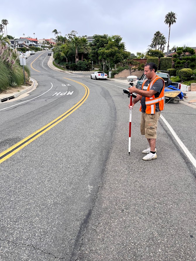
Need a pro for your land surveying project in Oceanside, CA?
Select your specific project to find the pro for you.
Verified Reviews for Land Surveying pros in Oceanside, CA
*The Angi rating for Land Surveying companies in Oceanside, CA is a rating based on verified reviews from our community of homeowners who have used these pros to meet their Land Surveying needs.
*The HomeAdvisor rating for Land Surveying companies in Oceanside, CA is a rating based on verified reviews from our community of homeowners who have used these pros to meet their Land Surveying needs.
Last update on December 04, 2025

Find Land surveyors in Oceanside
KARN Engineering & Surveying, Inc.
KARN Engineering & Surveying, Inc.
Customers say: Quality work
Recommended by 92% of Angi customers
Recommended by 92% of HomeAdvisor customers
34 local quotes requested
KARN Engineering & Surveying, Inc. has been servicing southern California for over 50 years. We provide surveying, civil engineering, and land development services through client service based consulting. No job is too big or small for us. Call today!
"NA"
Stanley M on May 2023
KARN Engineering & Surveying, Inc. has been servicing southern California for over 50 years. We provide surveying, civil engineering, and land development services through client service based consulting. No job is too big or small for us. Call today!
"NA"
Stanley M on May 2023
Mission Land Surveying
Mission Land Surveying
Recommended by 100% of Angi customers
Recommended by 100% of HomeAdvisor customers
Topographical surveys Story poles Aerial targets FEMA flood certifications Roof certifications Line and grade certifications Story pole certifications and Staking Building staking Search and find monuments Final grade certifications Property corners Monitoring wells Measurements Record of survey Corner records Parcel map Lot line adjustments Construction staking ALTA/ACSM surveys Easements Monitor buildings for movement
""Exceptional experience with Mission Land Surveying. Their team demonstrated utmost professionalism, delivering accurate surveys on time. Communication was clear throughout the process, and they efficiently addressed all inquiries. Highly recommend for their expertise, adherence to deadlines, and comprehensive understanding of local regulations."
Mory K on May 2024
American Landscape Improvements
American Landscape Improvements
Helping you with all of your Outdoor needs! Landscaping, Maintenance, Irrigation, Hardscape, Troubleshooting/Advice & much more
Helping you with all of your Outdoor needs! Landscaping, Maintenance, Irrigation, Hardscape, Troubleshooting/Advice & much more
DEVCO RT INC.
DEVCO RT INC.
2 years of experience
Site Development, Excavating, Grading, Earthwork, Underground Construction, Erosion Control, Drainage, Water & Sewer Lines As a certified Disabled Veteran Owned Business, we are not just constructing structures, our mission extends to building a better future for our fellow veterans and the local communities we serve. Our commitment to this goal is reflected in our every endeavor, from the quality of work to our unrivaled customer service.
Site Development, Excavating, Grading, Earthwork, Underground Construction, Erosion Control, Drainage, Water & Sewer Lines As a certified Disabled Veteran Owned Business, we are not just constructing structures, our mission extends to building a better future for our fellow veterans and the local communities we serve. Our commitment to this goal is reflected in our every endeavor, from the quality of work to our unrivaled customer service.
LiDAR America inc
LiDAR America inc
Lidar America Inc, is a company specialized in Aircraft and Drone mapping, providing Lidar and photogrammetry services in aircrafts and UAS (drone). Manned (aircraft) and unmanned (Drone UAV) aerial survey with LiDAR (Light Detection and Ranging) to produce topographic Lidar products and photogrammetry images. We perform, Topographic Lidar, Lidar Aerial, Lidar Survey, Aerial Mapping, Aerial Lidar, Topographic survey, Drone Survey, UAV Survey, Drone Lidar Mapping, Aerial Drone Services, Drone Inspection and drone services in California, South Nevada and West Arizona.
Lidar America Inc, is a company specialized in Aircraft and Drone mapping, providing Lidar and photogrammetry services in aircrafts and UAS (drone). Manned (aircraft) and unmanned (Drone UAV) aerial survey with LiDAR (Light Detection and Ranging) to produce topographic Lidar products and photogrammetry images. We perform, Topographic Lidar, Lidar Aerial, Lidar Survey, Aerial Mapping, Aerial Lidar, Topographic survey, Drone Survey, UAV Survey, Drone Lidar Mapping, Aerial Drone Services, Drone Inspection and drone services in California, South Nevada and West Arizona.
ASAPDVBE
ASAPDVBE
Emergency services offered
General engineering and general building contractor. Call us for a quote.
General engineering and general building contractor. Call us for a quote.

DIMENSIONS
DIMENSIONS
We are an as-built company that provides on-site measuring, drafting, and BIM modeling services. Our goal is to become an extension of your business, allowing you to leverage the most advanced technologies and practices in the industry. We are a local owner-operated business that services Los Angeles and Orange County. Let's get started on your next project!
We are an as-built company that provides on-site measuring, drafting, and BIM modeling services. Our goal is to become an extension of your business, allowing you to leverage the most advanced technologies and practices in the industry. We are a local owner-operated business that services Los Angeles and Orange County. Let's get started on your next project!

LG Land Surveying, Inc
LG Land Surveying, Inc
Free onsite estimate
LG Land Surveying, Inc. is a full service land surveying and mapping company. Using the latest surveying technologies, such as GPS and Robotic Total Stations, our field crews have the ability to get the work done accurately and efficiently. We provide services to both the private sector and governmental agencies, including residential, industrial, commercial and public works projects.
LG Land Surveying, Inc. is a full service land surveying and mapping company. Using the latest surveying technologies, such as GPS and Robotic Total Stations, our field crews have the ability to get the work done accurately and efficiently. We provide services to both the private sector and governmental agencies, including residential, industrial, commercial and public works projects.
MJRobert Surveying
MJRobert Surveying
Free onsite estimate
Many years of experience and I only work with hand selected professionals.
Many years of experience and I only work with hand selected professionals.

Aguirre & Associates
Aguirre & Associates
39 years of experience
AGUIRRE & ASSOCIATES was founded in La Mesa 1986 and has been successfully providing land surveying, mapping and right-of-way engineering services for the past 29 years
AGUIRRE & ASSOCIATES was founded in La Mesa 1986 and has been successfully providing land surveying, mapping and right-of-way engineering services for the past 29 years
Land Surveying questions, answered by experts
The Oceanside, CA homeowners’ guide to land surveying services
From average costs to expert advice, get all the answers you need to get your job done.
 •
•Discover site preparation cost estimates, including average prices, cost factors, and tips to help homeowners budget for their next project.

A land survey can determine your property’s borders and settle property disputes. Learn how much a land survey costs and what can affect the price.

Just bought a plot of land and need to get it build-ready? Learn how much it costs to clear land to gauge your initial budget before you break ground.

A land surveyor can perform a land survey and help clarify your property boundaries and features. Use this guide to find the right professional.
 •
•Find out how much an elevation certificate costs, including average prices, cost factors, and tips to save money when hiring a surveyor for your property.

Knowing where your property lines are can help settle a dispute with a neighbor and even prevent an ugly legal battle. This guide will help you draw the line.
- Camp Pendleton, CA Land surveyors
- Vista, CA Land surveyors
- Carlsbad, CA Land surveyors
- Bonsall, CA Land surveyors
- Fallbrook, CA Land surveyors
- San Marcos, CA Land surveyors
- Encinitas, CA Land surveyors
- Cardiff By The Sea, CA Land surveyors
- Escondido, CA Land surveyors
- Rancho Santa Fe, CA Land surveyors
- Solana Beach, CA Land surveyors
- Valley Center, CA Land surveyors
- Del Mar, CA Land surveyors
- Pauma Valley, CA Land surveyors
- San Clemente, CA Land surveyors
- Temecula, CA Land surveyors
- Capistrano Beach, CA Land surveyors
- Wildomar, CA Land surveyors
- Murrieta, CA Land surveyors
- Poway, CA Land surveyors
- Dana Point, CA Land surveyors
- La Jolla, CA Land surveyors
- Lake Elsinore, CA Land surveyors
- San Juan Capistrano, CA Land surveyors
- Mission Viejo, CA Land surveyors
- Ladera Ranch, CA Land surveyors
- Laguna Niguel, CA Land surveyors
- Winchester, CA Land surveyors
- Ramona, CA Land surveyors
- Coto De Caza, CA Land surveyors
What do you need done? We’ll find top pros.
- 🌱 "Mow a small front yard"
- 🛠 "Fix a leaking pipe under the sink"
- 🏠 "Repair shingles on an asphalt roof"