Get matched with top land surveyors in Sacaton, AZ
Enter your ZIP and get matched with up to 5 pros
Need a pro for your land surveying project in Sacaton, AZ?
Verified Reviews for Land Surveying pros in Sacaton, AZ
*The Angi rating for Land Surveying companies in Sacaton, AZ is a rating based on verified reviews from our community of homeowners who have used these pros to meet their Land Surveying needs.
*The HomeAdvisor rating for Land Surveying companies in Sacaton, AZ is a rating based on verified reviews from our community of homeowners who have used these pros to meet their Land Surveying needs.
Last update on December 07, 2025
Find Land surveyors in Sacaton
Meridian Geomatics, LLC
Meridian Geomatics, LLC
Meridian Geomatics offers land surveying services to the public. If you need your lot corners staked, your property mapped or split into smaller parcels or you are a contractor looking for construction staking services we have got you covered. We have over thirty years of surveying experience. No job too big or too small.
"They responded quickly to our inquiry, were available the same week, and the crew was courteous and professional."
Angie W on April 2023
Black Mountain Surveying
Black Mountain Surveying
All projects have a comprehensive contract, payment is required upon completion and we do not accept credit cards.
All projects have a comprehensive contract, payment is required upon completion and we do not accept credit cards.
Ambit Consulting, LLC
Ambit Consulting, LLC
Ambit Consulting survey professionals provide technical expertise to assist in the successful completion of projects ranging from extensive control networks to detailed Topographic Surveys. Utilizing the latest Survey technologies, in both our field and office operations; AC successfully delivers a quality Survey on time. Our experience spans across a wide variety of Geomatic tasks.
Ambit Consulting survey professionals provide technical expertise to assist in the successful completion of projects ranging from extensive control networks to detailed Topographic Surveys. Utilizing the latest Survey technologies, in both our field and office operations; AC successfully delivers a quality Survey on time. Our experience spans across a wide variety of Geomatic tasks.
Logan Simpson Design Inc.
Logan Simpson Design Inc.
Logan Simpson is a landscape architecture design firm that specializes in environmental planning - from conservation to recreational projects. While our headquarters are in Tempe, AZ we have offices throughout the West including Utah, Nevada, Colorado, Oregon, and Tucson, AZ. For more information, please visit our website: http://www.logansimpson.com/
Logan Simpson is a landscape architecture design firm that specializes in environmental planning - from conservation to recreational projects. While our headquarters are in Tempe, AZ we have offices throughout the West including Utah, Nevada, Colorado, Oregon, and Tucson, AZ. For more information, please visit our website: http://www.logansimpson.com/
U.SGroundZero Utility Locators, LLC
U.SGroundZero Utility Locators, LLC
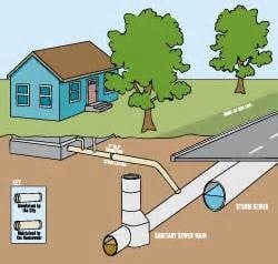
U.SGroundZero Utility Locators, LLC Family-Woman Based Business , Hablamos Espanol. We provide Professional Private Utility Locating and Water Leak Detection in both residential and commercial applications. Locating underground utilities through out the state of Arizona.
U.SGroundZero Utility Locators, LLC Family-Woman Based Business , Hablamos Espanol. We provide Professional Private Utility Locating and Water Leak Detection in both residential and commercial applications. Locating underground utilities through out the state of Arizona.
RLF Consulting
RLF Consulting
Founded in 2006 by licensed professional land surveyor, Ryan Fidler, RLF Consulting has been a groundbreaking force in the field of land surveying and civil engineering. We pioneered drone mapping, becoming indispensable partners during the emergence and evolution of 3G, 4G, and the current 5G telecommunications phases. We have established trust with numerous government agencies and private organizations by providing a broad array of services, including boundary surveying, topographic surveys, and construction staking. Our footprint extends across the Southwest USA, where we've successfully managed some of the region's most extensive projects. Our unwavering commitment to innovation, accuracy, client satisfaction, and excellence is the bedrock of our operations. As we continue to embrace technology and adapt to market dynamics, our mission remains to deliver unparalleled professional services, upholding our position as a leading surveying and civil engineering firm.
Founded in 2006 by licensed professional land surveyor, Ryan Fidler, RLF Consulting has been a groundbreaking force in the field of land surveying and civil engineering. We pioneered drone mapping, becoming indispensable partners during the emergence and evolution of 3G, 4G, and the current 5G telecommunications phases. We have established trust with numerous government agencies and private organizations by providing a broad array of services, including boundary surveying, topographic surveys, and construction staking. Our footprint extends across the Southwest USA, where we've successfully managed some of the region's most extensive projects. Our unwavering commitment to innovation, accuracy, client satisfaction, and excellence is the bedrock of our operations. As we continue to embrace technology and adapt to market dynamics, our mission remains to deliver unparalleled professional services, upholding our position as a leading surveying and civil engineering firm.
Hook Engineering, Inc.
Hook Engineering, Inc.
Hook Engineering is a Civil Engineering and Land Surveying company that has been providing professional services to private and public clients throughout Arizona since 1961. Combining specialized skills, broad-based knowledge, and management skills, the Hook staff is able to manage projects through teamwork to achieve outstanding results for our clients.
Hook Engineering is a Civil Engineering and Land Surveying company that has been providing professional services to private and public clients throughout Arizona since 1961. Combining specialized skills, broad-based knowledge, and management skills, the Hook staff is able to manage projects through teamwork to achieve outstanding results for our clients.
the CK Group, Inc.
the CK Group, Inc.
Founded in 1995, the CK Group, Inc. (CK) has grown into a highly dependable, full service engineering firm that provides innovative solutions to federal, municipal and private sector clients project needs. We are licensed to provide services in Texas, Arizona, California, Nevada, Colorado, New Mexico and Utah. We do so, through two of our strategically located engineering offices and materials testing laboratories in Dallas/Fort Worth, Texas and Phoenix, Arizona. With a current staff count of over 30 professional engineers, registered land surveyors, engineers, designers and technicians.
Founded in 1995, the CK Group, Inc. (CK) has grown into a highly dependable, full service engineering firm that provides innovative solutions to federal, municipal and private sector clients project needs. We are licensed to provide services in Texas, Arizona, California, Nevada, Colorado, New Mexico and Utah. We do so, through two of our strategically located engineering offices and materials testing laboratories in Dallas/Fort Worth, Texas and Phoenix, Arizona. With a current staff count of over 30 professional engineers, registered land surveyors, engineers, designers and technicians.
SBL Geomatics
SBL Geomatics
SBL GIS provides services classically delve into remote sensing, surveying, cartographic services, photogrammetry, CAD, image processing, geographic information systems (GIS), global positioning systems (GPS), and telemetry methods and technology for managing spatial phenomena and processes. SBL Geomatics provide complete outsourcing solutions for all your GIS related inquiries. For us, every client is unique and client satisfaction is our growth. The steady ascend of our growth graph is a hard earned reward. We are an ISO certified company; the ISO 9001:2000 Certification for Quality Management and ISO 14001:2004 Certification for Environmental Management System. Our mission-Mapping for an accessible world. For more details you can visit our website SBL GIS Services or http://www.sblgis.com/ Contact us on:http://www.sblgis.com Address : 1B, 1st Floor, Leela Infopark – Phase – II, Kakkanad, Cochin, India - 682030 Phone no:+91(0) 484 2784057 Email id:[email protected]
SBL GIS provides services classically delve into remote sensing, surveying, cartographic services, photogrammetry, CAD, image processing, geographic information systems (GIS), global positioning systems (GPS), and telemetry methods and technology for managing spatial phenomena and processes. SBL Geomatics provide complete outsourcing solutions for all your GIS related inquiries. For us, every client is unique and client satisfaction is our growth. The steady ascend of our growth graph is a hard earned reward. We are an ISO certified company; the ISO 9001:2000 Certification for Quality Management and ISO 14001:2004 Certification for Environmental Management System. Our mission-Mapping for an accessible world. For more details you can visit our website SBL GIS Services or http://www.sblgis.com/ Contact us on:http://www.sblgis.com Address : 1B, 1st Floor, Leela Infopark – Phase – II, Kakkanad, Cochin, India - 682030 Phone no:+91(0) 484 2784057 Email id:[email protected]
The Sacaton, AZ homeowners’ guide to land surveying services
From average costs to expert advice, get all the answers you need to get your job done.
 •
•Discover site preparation cost estimates, including average prices, cost factors, and tips to help homeowners budget for their next project.

A land survey can determine your property’s borders and settle property disputes. Learn how much a land survey costs and what can affect the price.

Just bought a plot of land and need to get it build-ready? Learn how much it costs to clear land to gauge your initial budget before you break ground.
 •
•Find out how much an elevation certificate costs, including average prices, cost factors, and tips to save money when hiring a surveyor for your property.

What is a property line? Find out everything you need to know about property lines, from easements to where to build a fence and how land surveys work.

Wondering whether you need a land survey or a plot plan? Learn about the differences between the two, when to do each, and what information they provide.
- Chandler Heights, AZ Land surveyors
- San Tan Valley, AZ Land surveyors
- Casa Grande, AZ Land surveyors
- Sun Lakes, AZ Land surveyors
- Queen Creek, AZ Land surveyors
- Chandler, AZ Land surveyors
- Coolidge, AZ Land surveyors
- Gilbert, AZ Land surveyors
- Higley, AZ Land surveyors
- Maricopa, AZ Land surveyors
- Stanfield, AZ Land surveyors
- Guadalupe, AZ Land surveyors
- Mesa, AZ Land surveyors
- Tempe, AZ Land surveyors
- Florence, AZ Land surveyors
- Arizona City, AZ Land surveyors
- Eloy, AZ Land surveyors
- Laveen, AZ Land surveyors
- Paradise Valley, AZ Land surveyors
- Fountain Hills, AZ Land surveyors
- Tolleson, AZ Land surveyors
- Fort Mcdowell, AZ Land surveyors
- Scottsdale, AZ Land surveyors
- Superior, AZ Land surveyors
- Avondale, AZ Land surveyors
- Red Rock, AZ Land surveyors
- Rio Verde, AZ Land surveyors
- Goodyear, AZ Land surveyors
- Litchfield Park, AZ Land surveyors
- 🌱 "Mow a small front yard"
- 🛠 "Fix a leaking pipe under the sink"
- 🏠 "Repair shingles on an asphalt roof"
