
Get matched with top land surveyors in Montgomery, AL
Enter your ZIP and get matched with up to 5 pros
Need a pro for your land surveying project in Montgomery, AL?
Select your specific project to find the pro for you.
Verified Reviews for Land Surveying pros in Montgomery, AL
*The Angi rating for Land Surveying companies in Montgomery, AL is a rating based on verified reviews from our community of homeowners who have used these pros to meet their Land Surveying needs.
*The HomeAdvisor rating for Land Surveying companies in Montgomery, AL is a rating based on verified reviews from our community of homeowners who have used these pros to meet their Land Surveying needs.
Last update on December 03, 2025
Find Land surveyors in Montgomery
C Dubb's Land Clearing
C Dubb's Land Clearing
At C Dubb's Land Clearing, we understand the importance of transforming raw land into a canvas that suits your vision. We are thrilled to introduce our comprehensive range of services, specializing in forestry mulching, land clearing, site preparation, excavation, and dirt work. Thank you for considering C Dubb's Land Clearing for your land transformation needs. We look forward to partnering with you and bringing your customer's vision to life. Best regards, C Dubb's Land Clearing Jack Farrell
At C Dubb's Land Clearing, we understand the importance of transforming raw land into a canvas that suits your vision. We are thrilled to introduce our comprehensive range of services, specializing in forestry mulching, land clearing, site preparation, excavation, and dirt work. Thank you for considering C Dubb's Land Clearing for your land transformation needs. We look forward to partnering with you and bringing your customer's vision to life. Best regards, C Dubb's Land Clearing Jack Farrell
Safe-touch Security
Safe-touch Security
We put in home and business alarms, surveillance, access control, hang TVs, and change locks. Been in business over thirteen years. Safe-touch is licensed and bond.
We put in home and business alarms, surveillance, access control, hang TVs, and change locks. Been in business over thirteen years. Safe-touch is licensed and bond.

W&A Alabama
W&A Alabama
26 years of experience
W&A Alabama is a leading provider of LiDAR, land surveying, and land planning-related services with over 25 years of industry-related experience.
W&A Alabama is a leading provider of LiDAR, land surveying, and land planning-related services with over 25 years of industry-related experience.

Abel Drone Services, LLC
Abel Drone Services, LLC
7 years of experience
Abel Drone Services, LLC is a new veteran owned and operated enthusiast license drone company based in Gadsden, Alabama that serves the U.S. Government, law enforcement agencies, residential, commercial, and industrial clients in the United States, particularly in Alabama, Georgia, Mississippi, Tennessee and Florida. We offer a wide range of services such as Aerial Area Mapping, Construction Site Progress Tracking, support all levels of Search & Rescue Operations, External & Internal Infrastructure Damage Inspections, Insurance Property Claims, Roof Inspections and, provide 4K high-quality Videos along with Photos of those memorable events in life.
Abel Drone Services, LLC is a new veteran owned and operated enthusiast license drone company based in Gadsden, Alabama that serves the U.S. Government, law enforcement agencies, residential, commercial, and industrial clients in the United States, particularly in Alabama, Georgia, Mississippi, Tennessee and Florida. We offer a wide range of services such as Aerial Area Mapping, Construction Site Progress Tracking, support all levels of Search & Rescue Operations, External & Internal Infrastructure Damage Inspections, Insurance Property Claims, Roof Inspections and, provide 4K high-quality Videos along with Photos of those memorable events in life.
SkyWorx
SkyWorx
Free onsite estimate
SkyWorx is a professional aerial imaging service that uses drone technology to help businesses maximize savings and generate profit. We specialize in Construction Management, Business Advertising, Roof Inspections / Measurements, Real Estate, Events, and more. Every day, we strive to evolve by incorporating the latest technology and data systems available. This enables us to offer a product to our customers at a competitive price that, not only saves them time, but saves them money. For SkyWorx, drones are more than a profession, its a passion. Contact SkyWorx for more information.
SkyWorx is a professional aerial imaging service that uses drone technology to help businesses maximize savings and generate profit. We specialize in Construction Management, Business Advertising, Roof Inspections / Measurements, Real Estate, Events, and more. Every day, we strive to evolve by incorporating the latest technology and data systems available. This enables us to offer a product to our customers at a competitive price that, not only saves them time, but saves them money. For SkyWorx, drones are more than a profession, its a passion. Contact SkyWorx for more information.
Alabama Land Surveyors, Inc
Alabama Land Surveyors, Inc
45 years of experience
Alabama Land Surveyors has Alabama and Mississippi state-licensed Land Survey Professionals dedicated to assisting our clients with both routine and complex land surveying projects. Alabama Land Surveyors was formed in 1973 by M.P. Hayden, and incorporated in 1980. Our office is located in Montgomery, Alabama. Our field crews employ the latest in Total Station Surveys, Global Positioning Satellite (GPS), and electronic measuring technologies. Our CADD technicians use industry-standard software to deliver accurate results in .DWG format, efficiently and expeditiously. Our personnel attend annual seminars and training on land surveying so that we may provide our clients with all aspects of surveying related to their projects.
Alabama Land Surveyors has Alabama and Mississippi state-licensed Land Survey Professionals dedicated to assisting our clients with both routine and complex land surveying projects. Alabama Land Surveyors was formed in 1973 by M.P. Hayden, and incorporated in 1980. Our office is located in Montgomery, Alabama. Our field crews employ the latest in Total Station Surveys, Global Positioning Satellite (GPS), and electronic measuring technologies. Our CADD technicians use industry-standard software to deliver accurate results in .DWG format, efficiently and expeditiously. Our personnel attend annual seminars and training on land surveying so that we may provide our clients with all aspects of surveying related to their projects.
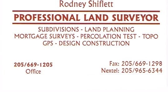
Shiflett Surveying
Shiflett Surveying
Customers say: Quick response
27 years of experience
Shiflett Surveying is a land surveying company started by Rodney Shiflett in 1998. Mr. Shiflett is involved in all aspects of every job ordered, from doing his own field work to working closely with his Autocad drafter to provide accurate and correct information.
Shiflett Surveying is a land surveying company started by Rodney Shiflett in 1998. Mr. Shiflett is involved in all aspects of every job ordered, from doing his own field work to working closely with his Autocad drafter to provide accurate and correct information.
Land Surveying questions, answered by experts
Helpful?
Helpful?
Helpful?
Helpful?
Helpful?
The Montgomery, AL homeowners’ guide to land surveying services
From average costs to expert advice, get all the answers you need to get your job done.
 •
•Discover site preparation cost estimates, including average prices, cost factors, and tips to help homeowners budget for their next project.

A land survey can determine your property’s borders and settle property disputes. Learn how much a land survey costs and what can affect the price.

Just bought a plot of land and need to get it build-ready? Learn how much it costs to clear land to gauge your initial budget before you break ground.

Not sure what kind of property survey you need? Learn about the differences between a land survey vs. a boundary survey to get started.

Wondering whether you need a land survey or a plot plan? Learn about the differences between the two, when to do each, and what information they provide.

Knowing where your property lines are can help settle a dispute with a neighbor and even prevent an ugly legal battle. This guide will help you draw the line.
- Pike Road, AL Land surveyors
- Coosada, AL Land surveyors
- Millbrook, AL Land surveyors
- Hope Hull, AL Land surveyors
- Elmore, AL Land surveyors
- Wetumpka, AL Land surveyors
- Prattville, AL Land surveyors
- Shorter, AL Land surveyors
- Ramer, AL Land surveyors
- Deatsville, AL Land surveyors
- Titus, AL Land surveyors
- Tallassee, AL Land surveyors
- Marbury, AL Land surveyors
- Eclectic, AL Land surveyors
- Hayneville, AL Land surveyors
- Mosses, AL Land surveyors
- Letohatchee, AL Land surveyors
- Autaugaville, AL Land surveyors
- Verbena, AL Land surveyors
- Highland Home, AL Land surveyors
- Equality, AL Land surveyors
- Tuskegee, AL Land surveyors
- Honoraville, AL Land surveyors
- Tyler, AL Land surveyors
- Roofing in Montgomery
- Tree Service in Montgomery
- Plumbing in Montgomery
- Electrical in Montgomery
- Lawn And Yard Work in Montgomery
- Foundation Repair in Montgomery
- Concrete Repair in Montgomery
- Handyman Service in Montgomery
- Windows in Montgomery
- Flooring in Montgomery
- Pest Control in Montgomery
- Carpet Cleaning in Montgomery
- Garage Doors in Montgomery
- Sunroom And Patio Remodeling in Montgomery
- Pressure Washing in Montgomery
- Concrete Driveways in Montgomery
- Cabinet Refinishing in Montgomery
- Exterior Painting in Montgomery
- Moving in Montgomery
- Insulation in Montgomery
- Home Inspection in Montgomery
- Ceiling Fans in Montgomery
- Garbage Collection in Montgomery
- Water And Smoke Damage in Montgomery
- Excavating in Montgomery
- Landscaping in Montgomery
- Mailbox Repair in Montgomery
- Cleaning in Montgomery
- Cabinet Makers in Montgomery
- Computer Repair in Montgomery
What do you need done? We’ll find top pros.
- 🌱 "Mow a small front yard"
- 🛠 "Fix a leaking pipe under the sink"
- 🏠 "Repair shingles on an asphalt roof"