
Get matched with top land surveyors in Lillian, AL
Enter your ZIP and get matched with up to 5 pros
Need a pro for your land surveying project in Lillian, AL?
Select your specific project to find the pro for you.
Verified Reviews for Land Surveying pros in Lillian, AL
*The Angi rating for Land Surveying companies in Lillian, AL is a rating based on verified reviews from our community of homeowners who have used these pros to meet their Land Surveying needs.
*The HomeAdvisor rating for Land Surveying companies in Lillian, AL is a rating based on verified reviews from our community of homeowners who have used these pros to meet their Land Surveying needs.
Last update on December 03, 2025

Find Land surveyors in Lillian
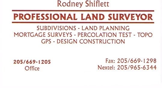
Shiflett Surveying
Shiflett Surveying
Customers say: Quick response
1998 years of experience
Shiflett Surveying is a land surveying company started by Rodney Shiflett in 1998. Mr. Shiflett is involved in all aspects of every job ordered, from doing his own field work to working closely with his Autocad drafter to provide accurate and correct information.
Shiflett Surveying is a land surveying company started by Rodney Shiflett in 1998. Mr. Shiflett is involved in all aspects of every job ordered, from doing his own field work to working closely with his Autocad drafter to provide accurate and correct information.
Polysurveying & Engineering
Polysurveying & Engineering
Customers say: Quick response
Recommended by 100% of Angi customers
Recommended by 100% of HomeAdvisor customers
Welcome to Polysurveying and Engineering, Baldwin County, AL's premier land surveyor. Our firm strives to offer fast and affordable services to satisfy our clients needs Our specialty is land surveying, but we also offer a list of services that includes land planning, consultation services; and civil engineering services such as road planning services, sub division services, and much more! Reference our website, and call with any questions or to schedule your free quote.
Welcome to Polysurveying and Engineering, Baldwin County, AL's premier land surveyor. Our firm strives to offer fast and affordable services to satisfy our clients needs Our specialty is land surveying, but we also offer a list of services that includes land planning, consultation services; and civil engineering services such as road planning services, sub division services, and much more! Reference our website, and call with any questions or to schedule your free quote.
Survey Consults, Inc.
Survey Consults, Inc.
Customers say: Quick response
Recommended by 100% of Angi customers
Recommended by 100% of HomeAdvisor customers
Land Surveying, FEMA Elevation Certificate, Mortgage Surveys, Topographic Surveys, House Staking, Construction Staking, GPS Capable
"Survey Consults are professional and their service is great! As a Realtor, my clients often need surveys for closing, I always recommend Jason Braswell at Survey Consults. Give Jason a call if you need a survey, elevation certificate or more!"
Barbara M on May 2020
RONNIE POIROUX
RONNIE POIROUX
Customers say: Quick response
Recommended by 100% of Angi customers
Recommended by 100% of HomeAdvisor customers
OWNER OPERATED. NO SUBS. CHARGES FLAT RATE. NO TRAVEL CHARGES. NO SERVICE FEE.
OWNER OPERATED. NO SUBS. CHARGES FLAT RATE. NO TRAVEL CHARGES. NO SERVICE FEE.
Driven Engineering! Inc.
Driven Engineering! Inc.
2006 years of experience
Consulting Engineers, environmental consultants, and government contractors, over 11 employees.... Unique in purpose, vision, and environment
Consulting Engineers, environmental consultants, and government contractors, over 11 employees.... Unique in purpose, vision, and environment
Butler and Associates, Inc
Butler and Associates, Inc
1983 years of experience
We provide Professional Land Surveying services to Builders and and related clients in the Homebuilding Industry. Our surveyors utilize the latest technology, including both Robotics and GPS systems.
We provide Professional Land Surveying services to Builders and and related clients in the Homebuilding Industry. Our surveyors utilize the latest technology, including both Robotics and GPS systems.
Curle W W Land Surveying
Curle W W Land Surveying
Curle WW Land Surveying. We specialize in Subdivisions and Mortgage Surveys. Our team is here to serve you with professionalism. We deliver. Located in Navarre, FL Please call today.
Curle WW Land Surveying. We specialize in Subdivisions and Mortgage Surveys. Our team is here to serve you with professionalism. We deliver. Located in Navarre, FL Please call today.
EARTHWORK OUTLAWS
EARTHWORK OUTLAWS
Emergency services offered
Let us help you improve your property value with our top of the line equipment and staff! We pride ourselves on our customer satisfaction and hospitality. We offer all earthwork, landscaping, driveway, dirt, fencing, and many more services with FREE ESTIMATES!!!
Let us help you improve your property value with our top of the line equipment and staff! We pride ourselves on our customer satisfaction and hospitality. We offer all earthwork, landscaping, driveway, dirt, fencing, and many more services with FREE ESTIMATES!!!

J. Pierce and Associates, LLC.
J. Pierce and Associates, LLC.
2009 years of experience
JPA also offers a full range of professional geomatics (surveying) services. From residential boundary surveys to complex GIS mapping projects, we know how to use the latest technology to fit your needs. JPA has also pioneered the survey-grade GIS for utilities market and will be glad to introduce you to all this amazing resource has to offer.
JPA also offers a full range of professional geomatics (surveying) services. From residential boundary surveys to complex GIS mapping projects, we know how to use the latest technology to fit your needs. JPA has also pioneered the survey-grade GIS for utilities market and will be glad to introduce you to all this amazing resource has to offer.
5 Star Drone Video and Photography services
5 Star Drone Video and Photography services
2019 years of experience
I can offer complete packages that can include Aerial photos and videos with ground photos and videos all in one price With over 4 years experience I bring something other photographers may not offer my services are all inclusive with no limit on video and photos to you
I can offer complete packages that can include Aerial photos and videos with ground photos and videos all in one price With over 4 years experience I bring something other photographers may not offer my services are all inclusive with no limit on video and photos to you
Land Surveying questions, answered by experts
The Lillian, AL homeowners’ guide to land surveying services
From average costs to expert advice, get all the answers you need to get your job done.
 •
•Discover site preparation cost estimates, including average prices, cost factors, and tips to help homeowners budget for their next project.

A land survey can determine your property’s borders and settle property disputes. Learn how much a land survey costs and what can affect the price.

Just bought a plot of land and need to get it build-ready? Learn how much it costs to clear land to gauge your initial budget before you break ground.
 •
•Find out how much an elevation certificate costs, including average prices, cost factors, and tips to save money when hiring a surveyor for your property.

What is a property line? Find out everything you need to know about property lines, from easements to where to build a fence and how land surveys work.

Real estate transactions often require a survey, but who pays for it? Learn who pays for a land survey in most cases and some exceptions to the norm.
- Elberta, AL Land surveyors
- Orange Beach, AL Land surveyors
- Seminole, AL Land surveyors
- Robertsdale, AL Land surveyors
- Pensacola, FL Land surveyors
- Foley, AL Land surveyors
- Summerdale, AL Land surveyors
- Ensley, FL Land surveyors
- Gulf Shores, AL Land surveyors
- Gonzalez, FL Land surveyors
- Cantonment, FL Land surveyors
- Magnolia Springs, AL Land surveyors
- Silverhill, AL Land surveyors
- Pensacola Beach, FL Land surveyors
- Loxley, AL Land surveyors
- Molino, FL Land surveyors
- Fairhope, AL Land surveyors
- Gulf Breeze, FL Land surveyors
- Pace, FL Land surveyors
- Milton, FL Land surveyors
- Point Clear, AL Land surveyors
- Daphne, AL Land surveyors
- Spanish Fort, AL Land surveyors
- Mcdavid, FL Land surveyors
- Navarre, FL Land surveyors
- Bay Minette, AL Land surveyors
- Dauphin Island, AL Land surveyors
- Jay, FL Land surveyors
- Century, FL Land surveyors
- Coden, AL Land surveyors
- Tree Service in Lillian
- Plumbing in Lillian
- Roofing in Lillian
- Lawn And Yard Work in Lillian
- Cleaning in Lillian
- Electrical in Lillian
- Landscaping in Lillian
- Concrete Repair in Lillian
- Epoxy Flooring in Lillian
- Computer Repair in Lillian
- Deck Maintenance in Lillian
- Garage Doors in Lillian
- Windows in Lillian
- Handyman Service in Lillian
- Stone And Gravel in Lillian
- Leaf Removal in Lillian
- Pest Control in Lillian
- Mailbox Repair in Lillian
- Painting in Lillian
- Pressure Washing in Lillian
- Mulch And Topsoil in Lillian
- Small Appliance Repair in Lillian
- Swimming Pools in Lillian
- Siding in Lillian
- Excavating in Lillian
- Dumpster Rental in Lillian
- Home Inspection in Lillian
- Lawn Irrigation in Lillian
- Insulation in Lillian
- Cabinet Makers in Lillian