
Get matched with top land surveyors in Orange Beach, AL
Enter your ZIP and get matched with up to 5 pros
Need a pro for your land surveying project in Orange Beach, AL?
Select your specific project to find the pro for you.
Verified Reviews for Land Surveying pros in Orange Beach, AL
*The Angi rating for Land Surveying companies in Orange Beach, AL is a rating based on verified reviews from our community of homeowners who have used these pros to meet their Land Surveying needs.
*The HomeAdvisor rating for Land Surveying companies in Orange Beach, AL is a rating based on verified reviews from our community of homeowners who have used these pros to meet their Land Surveying needs.
Last update on December 01, 2025
Find Land surveyors in Orange Beach
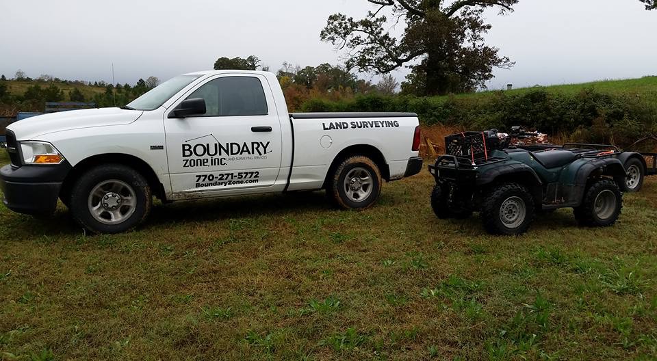
Boundary Zone - Miramar Beach
Boundary Zone - Miramar Beach
21 years of experience
We have a team of Professional Surveyors that provide residential surveying and construction staking. Our Specialties include Boundary Surveys, ALTA (American Land Title Association), Topographic and Tree Surveys, Existing Conditions, As-built, Site Maps, Plot Surveys, Construction Surveys, Drone Mapping, & Elevation Certificates. We take pride in serving our clients with accurate surveys that are orientated to customer service.
We have a team of Professional Surveyors that provide residential surveying and construction staking. Our Specialties include Boundary Surveys, ALTA (American Land Title Association), Topographic and Tree Surveys, Existing Conditions, As-built, Site Maps, Plot Surveys, Construction Surveys, Drone Mapping, & Elevation Certificates. We take pride in serving our clients with accurate surveys that are orientated to customer service.
EARTHWORK OUTLAWS
EARTHWORK OUTLAWS
Emergency services offered
Let us help you improve your property value with our top of the line equipment and staff! We pride ourselves on our customer satisfaction and hospitality. We offer all earthwork, landscaping, driveway, dirt, fencing, and many more services with FREE ESTIMATES!!!
Let us help you improve your property value with our top of the line equipment and staff! We pride ourselves on our customer satisfaction and hospitality. We offer all earthwork, landscaping, driveway, dirt, fencing, and many more services with FREE ESTIMATES!!!

Polysurveying
Polysurveying
54 years of experience
Polysurveying, founded in 1971, has provided land surveying and mapping services to a wide variety of professional industries along the Gulf Coast, for over fifty years. Our mission is to provide fast and reliable service, while maintaining, the quality of work our clients have come to expect in order to put their needs ahead of our own. We are a family owned and operated firm that has maintained a strong hold in our roots at our Corporate office in Mobile, AL. We since expanded over the years to cover the Gulf Coast Regions of Alabama, Mississippi and Florida with our field divisions to better serve our clients to ensure we provide the foundation for their future growth and expansion within both the Homebuilding and private sectors, as well as in support of our ALTA and Drone divisions.
Polysurveying, founded in 1971, has provided land surveying and mapping services to a wide variety of professional industries along the Gulf Coast, for over fifty years. Our mission is to provide fast and reliable service, while maintaining, the quality of work our clients have come to expect in order to put their needs ahead of our own. We are a family owned and operated firm that has maintained a strong hold in our roots at our Corporate office in Mobile, AL. We since expanded over the years to cover the Gulf Coast Regions of Alabama, Mississippi and Florida with our field divisions to better serve our clients to ensure we provide the foundation for their future growth and expansion within both the Homebuilding and private sectors, as well as in support of our ALTA and Drone divisions.

Geoland Surveying
Geoland Surveying
Free onsite estimate
Geoland surveying is an established land surveying firm serving South Florida for over 24 years working in the areas of Engineering Surveying, Cadastral, Topographic, Hydrographic and Project Management. ?Setting the marks one day at a time! ?️Residential & Commercial Surveying ? Serving all of Florida's surveying needs.
Geoland surveying is an established land surveying firm serving South Florida for over 24 years working in the areas of Engineering Surveying, Cadastral, Topographic, Hydrographic and Project Management. ?Setting the marks one day at a time! ?️Residential & Commercial Surveying ? Serving all of Florida's surveying needs.

J. Pierce and Associates, LLC.
J. Pierce and Associates, LLC.
16 years of experience
JPA also offers a full range of professional geomatics (surveying) services. From residential boundary surveys to complex GIS mapping projects, we know how to use the latest technology to fit your needs. JPA has also pioneered the survey-grade GIS for utilities market and will be glad to introduce you to all this amazing resource has to offer.
JPA also offers a full range of professional geomatics (surveying) services. From residential boundary surveys to complex GIS mapping projects, we know how to use the latest technology to fit your needs. JPA has also pioneered the survey-grade GIS for utilities market and will be glad to introduce you to all this amazing resource has to offer.
5 Star Drone Video and Photography services
5 Star Drone Video and Photography services
6 years of experience
I can offer complete packages that can include Aerial photos and videos with ground photos and videos all in one price With over 4 years experience I bring something other photographers may not offer my services are all inclusive with no limit on video and photos to you
I can offer complete packages that can include Aerial photos and videos with ground photos and videos all in one price With over 4 years experience I bring something other photographers may not offer my services are all inclusive with no limit on video and photos to you

Bumpers Land Surveying LLC
Bumpers Land Surveying LLC
Customers say: Quick response
Recommended by 100% of Angi customers
Recommended by 100% of HomeAdvisor customers
Bumpers Land Surveying LLC is a full service surveying firm owned and operated by Clarke County Native Wesley Bumpers, PLS, PSM. Mr. Bumpers is licensed in Alabama, Florida, and Mississippi and egger to work with you on your next project. Additional email - [email protected].
Bumpers Land Surveying LLC is a full service surveying firm owned and operated by Clarke County Native Wesley Bumpers, PLS, PSM. Mr. Bumpers is licensed in Alabama, Florida, and Mississippi and egger to work with you on your next project. Additional email - [email protected].
Outdoor Management Services LLC
Outdoor Management Services LLC
15 years of experience
We are a residential landscaping company.
We are a residential landscaping company.
Curle W W Land Surveying
Curle W W Land Surveying
Curle WW Land Surveying. We specialize in Subdivisions and Mortgage Surveys. Our team is here to serve you with professionalism. We deliver. Located in Navarre, FL Please call today.
Curle WW Land Surveying. We specialize in Subdivisions and Mortgage Surveys. Our team is here to serve you with professionalism. We deliver. Located in Navarre, FL Please call today.
Survey Consults, Inc.
Survey Consults, Inc.
Customers say: Quick response
Recommended by 100% of Angi customers
Recommended by 100% of HomeAdvisor customers
Land Surveying, FEMA Elevation Certificate, Mortgage Surveys, Topographic Surveys, House Staking, Construction Staking, GPS Capable
"Survey Consults are professional and their service is great! As a Realtor, my clients often need surveys for closing, I always recommend Jason Braswell at Survey Consults. Give Jason a call if you need a survey, elevation certificate or more!"
Barbara M on May 2020
Land Surveying questions, answered by experts
The Orange Beach, AL homeowners’ guide to land surveying services
From average costs to expert advice, get all the answers you need to get your job done.
 •
•Discover site preparation cost estimates, including average prices, cost factors, and tips to help homeowners budget for their next project.

A land survey can determine your property’s borders and settle property disputes. Learn how much a land survey costs and what can affect the price.

Just bought a plot of land and need to get it build-ready? Learn how much it costs to clear land to gauge your initial budget before you break ground.

Boundary surveys and topographic surveys provide important information about a property. Learn the differences between boundary and topographic surveys.

Real estate transactions often require a survey, but who pays for it? Learn who pays for a land survey in most cases and some exceptions to the norm.

Wondering whether you need a land survey or a plot plan? Learn about the differences between the two, when to do each, and what information they provide.
- Elberta, AL Land surveyors
- Lillian, AL Land surveyors
- Gulf Shores, AL Land surveyors
- Foley, AL Land surveyors
- Seminole, AL Land surveyors
- Magnolia Springs, AL Land surveyors
- Summerdale, AL Land surveyors
- Robertsdale, AL Land surveyors
- Pensacola, FL Land surveyors
- Silverhill, AL Land surveyors
- Fairhope, AL Land surveyors
- Ensley, FL Land surveyors
- Gonzalez, FL Land surveyors
- Loxley, AL Land surveyors
- Point Clear, AL Land surveyors
- Cantonment, FL Land surveyors
- Pensacola Beach, FL Land surveyors
- Daphne, AL Land surveyors
- Gulf Breeze, FL Land surveyors
- Molino, FL Land surveyors
- Spanish Fort, AL Land surveyors
- Dauphin Island, AL Land surveyors
- Pace, FL Land surveyors
- Milton, FL Land surveyors
- Coden, AL Land surveyors
- Mcdavid, FL Land surveyors
- Navarre, FL Land surveyors
- Theodore, AL Land surveyors
- Bay Minette, AL Land surveyors
- Bayou La Batre, AL Land surveyors
- Tree Service in Orange Beach
- Plumbing in Orange Beach
- Lawn And Yard Work in Orange Beach
- Handyman Service in Orange Beach
- Cleaning in Orange Beach
- Roofing in Orange Beach
- Swimming Pools in Orange Beach
- Exterior Painting in Orange Beach
- Concrete Repair in Orange Beach
- Flooring in Orange Beach
- Electrical in Orange Beach
- Landscaping in Orange Beach
- Painting in Orange Beach
- Deck Maintenance in Orange Beach
- Pressure Washing in Orange Beach
- Cabinet Makers in Orange Beach
- Drywall in Orange Beach
- Dock Building Repair in Orange Beach
- Mulch And Topsoil in Orange Beach
- Home Inspection in Orange Beach
- Garbage Collection in Orange Beach
- Air Duct Cleaning in Orange Beach
- Plaster Plaster Repair in Orange Beach
- Wallpapering in Orange Beach
- Epoxy Flooring in Orange Beach
- Doors in Orange Beach
- Fireplaces in Orange Beach
- Leaf Removal in Orange Beach
- Mailbox Repair in Orange Beach
- Screen Repair in Orange Beach
What do you need done? We’ll find top pros.
- 🌱 "Mow a small front yard"
- 🛠 "Fix a leaking pipe under the sink"
- 🏠 "Repair shingles on an asphalt roof"