Get matched with top land surveyors in Oregon, WI
Enter your ZIP and get matched with up to 5 pros
Need a pro for your land surveying project in Oregon, WI?
TRUSTED BY OREGON, WI HOMEOWNERS
4.7
Average homeowner rating22
Verified land surveying services reviews
Verified Reviews for Land Surveying pros in Oregon, WI
*The Angi rating for Land Surveying companies in Oregon, WI is a rating based on verified reviews from our community of homeowners who have used these pros to meet their Land Surveying needs.
*The HomeAdvisor rating for Land Surveying companies in Oregon, WI is a rating based on verified reviews from our community of homeowners who have used these pros to meet their Land Surveying needs.
Last update on December 04, 2025
Find Land surveyors in Oregon

Gaulke Drone Services
Gaulke Drone Services
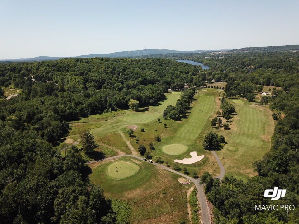
FAA licensed drone operator providing affordable, professional, and responsible aerial photography/videography for Madison area business needs. This service is well suited for roof and tower inspections, real estate ads, wedding photography/video, private property surveillance, and more. Pricing is determined by intended use, desired product, and location. Please do not hesitate to contact me to learn more about pricing, capabilities, and limitations.
FAA licensed drone operator providing affordable, professional, and responsible aerial photography/videography for Madison area business needs. This service is well suited for roof and tower inspections, real estate ads, wedding photography/video, private property surveillance, and more. Pricing is determined by intended use, desired product, and location. Please do not hesitate to contact me to learn more about pricing, capabilities, and limitations.
Badger Surveying & Mapping LLC
Badger Surveying & Mapping LLC
Badger Surveying & Mapping LLC
Badger Surveying & Mapping LLC
SiteWorks Landscape Design
SiteWorks Landscape Design
Locally owned landscape design and architecture graphic production. Garden and yard coaches ready to guide DIYers
Locally owned landscape design and architecture graphic production. Garden and yard coaches ready to guide DIYers
Walsh Geomatics, LLC Land Surveying
Walsh Geomatics, LLC Land Surveying
Full service Land Surveying & Consulting specializing in Real Estate Development, Property Boundaries, Disputed Property Boundaries and Land Division.
Full service Land Surveying & Consulting specializing in Real Estate Development, Property Boundaries, Disputed Property Boundaries and Land Division.
EC3 Environmental Consulting Group, Inc.
EC3 Environmental Consulting Group, Inc.
EC3 Environmental Consulting Group, Inc. (EC3) is located in Madison, Wisconsin, with satellite offices servicing Wisconsin, Minnesota, Illinois, and Iowa. Our work is focused on restoring natural areas and reviving deteriorating lands to preserve our lakes and streams while creating sustainable, healthy landscapes.
EC3 Environmental Consulting Group, Inc. (EC3) is located in Madison, Wisconsin, with satellite offices servicing Wisconsin, Minnesota, Illinois, and Iowa. Our work is focused on restoring natural areas and reviving deteriorating lands to preserve our lakes and streams while creating sustainable, healthy landscapes.
Earthly Landscapes
Earthly Landscapes
We are Outdoor Specialists where your yard is our Business. We take your property as seriously as our own and pay great attention to detail to ensure a professional and successful project and extremely happy customer every time.
We are Outdoor Specialists where your yard is our Business. We take your property as seriously as our own and pay great attention to detail to ensure a professional and successful project and extremely happy customer every time.
Williamson Surveying and Associates LLC
Williamson Surveying and Associates LLC
Owner operated. DBA: Williamson Surveying & Associates, LLC Of Madison, WI. Social media site: Facebook: https://www.facebook.com/pages/Williamson-Surveying-and-Associates-LLC/160111647344421. Licensed. Cash payment also accepted. Aditional email: [email protected], [email protected], [email protected], [email protected], [email protected].
Owner operated. DBA: Williamson Surveying & Associates, LLC Of Madison, WI. Social media site: Facebook: https://www.facebook.com/pages/Williamson-Surveying-and-Associates-LLC/160111647344421. Licensed. Cash payment also accepted. Aditional email: [email protected], [email protected], [email protected], [email protected], [email protected].

Isthmus Surveying
Isthmus Surveying
We provide the full spectrum of Land Surveying Services in the Greater Madison Area, Dane County and Surrounding Counties. The company is founded and run by myself, Paul Spetz, and I am fully licensed (S2525) and insured. Our prices are dependent on size of property, amount of foliage, distance from our office and scope of the project. We operate on not-to-exceed price quoting and are usually able to start and finish a project quite promptly.
We provide the full spectrum of Land Surveying Services in the Greater Madison Area, Dane County and Surrounding Counties. The company is founded and run by myself, Paul Spetz, and I am fully licensed (S2525) and insured. Our prices are dependent on size of property, amount of foliage, distance from our office and scope of the project. We operate on not-to-exceed price quoting and are usually able to start and finish a project quite promptly.

Schuster Realty Group / Re/Max Preferred
Schuster Realty Group / Re/Max Preferred
Over a decade of full time, full service real estate experience. Specializing in everything from condos to lake homes, building lots to vacant land, farms & farmettes.
Over a decade of full time, full service real estate experience. Specializing in everything from condos to lake homes, building lots to vacant land, farms & farmettes.
The Oregon, WI homeowners’ guide to land surveying services
From average costs to expert advice, get all the answers you need to get your job done.
 •
•Discover site preparation cost estimates, including average prices, cost factors, and tips to help homeowners budget for their next project.

A land survey can determine your property’s borders and settle property disputes. Learn how much a land survey costs and what can affect the price.

Just bought a plot of land and need to get it build-ready? Learn how much it costs to clear land to gauge your initial budget before you break ground.
 •
•Find out how much an elevation certificate costs, including average prices, cost factors, and tips to save money when hiring a surveyor for your property.

Boundary surveys and topographic surveys provide important information about a property. Learn the differences between boundary and topographic surveys.

Not sure what kind of property survey you need? Learn about the differences between a land survey vs. a boundary survey to get started.
- Brooklyn, WI Land surveyors
- Fitchburg, WI Land surveyors
- Mcfarland, WI Land surveyors
- Stoughton, WI Land surveyors
- Belleville, WI Land surveyors
- Monona, WI Land surveyors
- Verona, WI Land surveyors
- Shorewood Hills, WI Land surveyors
- Evansville, WI Land surveyors
- Maple Bluff, WI Land surveyors
- Cottage Grove, WI Land surveyors
- Albany, WI Land surveyors
- Middleton, WI Land surveyors
- New Glarus, WI Land surveyors
- Monticello, WI Land surveyors
- Deerfield, WI Land surveyors
- Waunakee, WI Land surveyors
- Mount Horeb, WI Land surveyors
- Cambridge, WI Land surveyors
- Cross Plains, WI Land surveyors
- Edgerton, WI Land surveyors
- Windsor, WI Land surveyors
- Sun Prairie, WI Land surveyors
- Deforest, WI Land surveyors
- De Forest, WI Land surveyors
- Dane, WI Land surveyors
- Black Earth, WI Land surveyors
- 🌱 "Mow a small front yard"
- 🛠 "Fix a leaking pipe under the sink"
- 🏠 "Repair shingles on an asphalt roof"


