Get matched with top land surveyors in Hopkins, SC
Enter your zip and get matched with up to 5 pros
Need a pro for your land surveying project in Hopkins, SC?
TRUSTED BY HOPKINS, SC HOMEOWNERS
4
Average homeowner rating12
Verified land surveying services reviews
Verified Reviews for Land Surveying pros in Hopkins, SC
*The Angi rating for Land Surveying companies in Hopkins, SC is a rating based on verified reviews from our community of homeowners who have used these pros to meet their Land Surveying needs.
*The HomeAdvisor rating for Land Surveying companies in Hopkins, SC is a rating based on verified reviews from our community of homeowners who have used these pros to meet their Land Surveying needs.
Last update on December 06, 2025
Find Land surveyors in Hopkins
Greer Surveying and Mapping, LLC
Greer Surveying and Mapping, LLC
We provide all land surveying services to include but not limited to: closing/mortgage, topographic, boundary, foundation, as-built, GPS, lake-lot/dock, design, and subdivision surveys. Also commercial ALTA/ACSM surveys, farm and timber surveys, volume/inventory surveys, etc. If you have anything from a plan to put up a fence to several houndred acres you would like to develop, we can help you. We are licensed in SC. We send a licensed surveyor to every job to ensure you get a quality survey and quality service every time. We have extremely quick turn around and are not governed by a large parent company. We are able to schedule to meet your needs if necessary.
We provide all land surveying services to include but not limited to: closing/mortgage, topographic, boundary, foundation, as-built, GPS, lake-lot/dock, design, and subdivision surveys. Also commercial ALTA/ACSM surveys, farm and timber surveys, volume/inventory surveys, etc. If you have anything from a plan to put up a fence to several houndred acres you would like to develop, we can help you. We are licensed in SC. We send a licensed surveyor to every job to ensure you get a quality survey and quality service every time. We have extremely quick turn around and are not governed by a large parent company. We are able to schedule to meet your needs if necessary.
Coastal Science & Engineering Inc
Coastal Science & Engineering Inc
We provide Specialized Services to Government, Industry & Municipal Clients. We Design Engineering Solutions That Work With Nature.
We provide Specialized Services to Government, Industry & Municipal Clients. We Design Engineering Solutions That Work With Nature.
Patriot Surveying and Infrastructure, PLLC
Patriot Surveying and Infrastructure, PLLC
We provide boundary, topographic, and construction surveys for residential, commercial, industrial and energy clients. Our clients range from homeowners, real estate agents, developers, attorneys, contractors, engineers and energy companies. AN INDEPENDENT, TRUSTED SURVEY & INFRASTRUCTURE ORGANIZATION BACKED BY DECADES OF INDUSTRY EXPERIENCE.
We provide boundary, topographic, and construction surveys for residential, commercial, industrial and energy clients. Our clients range from homeowners, real estate agents, developers, attorneys, contractors, engineers and energy companies. AN INDEPENDENT, TRUSTED SURVEY & INFRASTRUCTURE ORGANIZATION BACKED BY DECADES OF INDUSTRY EXPERIENCE.
Southeastern Land Management & Surveying
Southeastern Land Management & Surveying
Southeastern Land Management & Surveying, LLC, is a full service surveying, engineering, timber and land management company. We focus on helping our clients identify the most productive use of their property, produce a design, layout the design in the field, and finally consult them through construction and implementation.
Southeastern Land Management & Surveying, LLC, is a full service surveying, engineering, timber and land management company. We focus on helping our clients identify the most productive use of their property, produce a design, layout the design in the field, and finally consult them through construction and implementation.
Black Creek Land Management LLC
Black Creek Land Management LLC
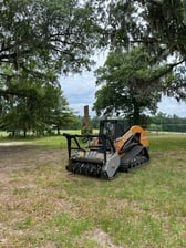
We specialize in land clearing,mulching,we also do landscaping,storm water pond maintenance and repairs,storm water BMP inspections.
We specialize in land clearing,mulching,we also do landscaping,storm water pond maintenance and repairs,storm water BMP inspections.
Carolina Surveying Services, Inc.
Carolina Surveying Services, Inc.
We are a small business located in Lexington, SC. Our office has 20+ years experience in surveying.
We are a small business located in Lexington, SC. Our office has 20+ years experience in surveying.
R. D. Platner, PLS
R. D. Platner, PLS
Being a small business enables us to customize and combine services to meet the needs of your local or nationwide projects. We provide a close client relationship with competitive pricing and project completion in a timely manner with the resources to take on any sized project. We are Security Q Clearance with projects in Fort Benning, Fort Bragg, and Fort Gordon.
Being a small business enables us to customize and combine services to meet the needs of your local or nationwide projects. We provide a close client relationship with competitive pricing and project completion in a timely manner with the resources to take on any sized project. We are Security Q Clearance with projects in Fort Benning, Fort Bragg, and Fort Gordon.
Precision Land Surveying
Precision Land Surveying
We have been surveying in Upstate South Carolina for 26 years. Allow us to help out with your next home purchase, land dispute, or even just marking the boundary for a new fence. We do it all Topographic, As-Built, ALTA/NSPS, Boundary.
We have been surveying in Upstate South Carolina for 26 years. Allow us to help out with your next home purchase, land dispute, or even just marking the boundary for a new fence. We do it all Topographic, As-Built, ALTA/NSPS, Boundary.
The Hopkins, SC homeowners’ guide to land surveying services
From average costs to expert advice, get all the answers you need to get your job done.
 •
•Discover site preparation cost estimates, including average prices, cost factors, and tips to help homeowners budget for their next project.

A land survey can determine your property’s borders and settle property disputes. Learn how much a land survey costs and what can affect the price.

Just bought a plot of land and need to get it build-ready? Learn how much it costs to clear land to gauge your initial budget before you break ground.

A land surveyor can perform a land survey and help clarify your property boundaries and features. Use this guide to find the right professional.

Boundary surveys and topographic surveys provide important information about a property. Learn the differences between boundary and topographic surveys.

If you've just been told that you need a land survey to continue your project, what time of land survey do you really need? Here are eight main options.
- Eastover, SC Land surveyors
- Gadsden, SC Land surveyors
- Arcadia Lakes, SC Land surveyors
- Forest Acres, SC Land surveyors
- Cayce, SC Land surveyors
- Columbia, SC Land surveyors
- South Congaree, SC Land surveyors
- West Columbia, SC Land surveyors
- Pine Ridge, SC Land surveyors
- Springdale, SC Land surveyors
- Elgin, SC Land surveyors
- Gaston, SC Land surveyors
- Saint Matthews, SC Land surveyors
- Blythewood, SC Land surveyors
- Wedgefield, SC Land surveyors
- Swansea, SC Land surveyors
- Shaw Air Force Base, SC Land surveyors
- Lugoff, SC Land surveyors
- Dalzell, SC Land surveyors
- Lexington, SC Land surveyors
- North, SC Land surveyors
- Irmo, SC Land surveyors
- Pelion, SC Land surveyors
- Orangeburg, SC Land surveyors
- Camden, SC Land surveyors
- Gilbert, SC Land surveyors
- Elloree, SC Land surveyors
- Chapin, SC Land surveyors


