Get matched with top land surveyors in Hernando, MS
Enter your zip and get matched with up to 5 pros
Need a pro for your land surveying project in Hernando, MS?
Verified Reviews for Land Surveying pros in Hernando, MS
*The Angi rating for Land Surveying companies in Hernando, MS is a rating based on verified reviews from our community of homeowners who have used these pros to meet their Land Surveying needs.
*The HomeAdvisor rating for Land Surveying companies in Hernando, MS is a rating based on verified reviews from our community of homeowners who have used these pros to meet their Land Surveying needs.
Last update on January 14, 2026
Find Land surveyors in Hernando

Civil Source
Civil Source
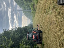
With over 38 years of experience as an Engineer and Land Surveyor, Civil Source is who you need to take care of your home. We handle everything from the initial consultation to making sure your property looks perfect every single time. We will always treat your property as we would treat our own, and you will be surprised how simple and easy our team will make the whole process seem. Give our team a call today. We're looking forward to working with you! 20% down
"Excellent work. Easy to work with & did a great job"
Tim P on December 2025

Elevista
Elevista
Provide Aerial Photography video and pictures for use in Construction Progress reporting, Real Estate ads, Agriculture / Farm analysis, evidence for Insurance claims of land or property damage, personal use, etc.
Provide Aerial Photography video and pictures for use in Construction Progress reporting, Real Estate ads, Agriculture / Farm analysis, evidence for Insurance claims of land or property damage, personal use, etc.
EARTHWORK OUTLAWS
EARTHWORK OUTLAWS
Let us help you improve your property value with our top of the line equipment and staff! We pride ourselves on our customer satisfaction and hospitality. We offer all earthwork, landscaping, driveway, dirt, fencing, and many more services with FREE ESTIMATES!!!
Let us help you improve your property value with our top of the line equipment and staff! We pride ourselves on our customer satisfaction and hospitality. We offer all earthwork, landscaping, driveway, dirt, fencing, and many more services with FREE ESTIMATES!!!
Milestone Land Surveying Inc
Milestone Land Surveying Inc
Milestone Land Surveying Inc
Milestone Land Surveying Inc
SMITH&FORSYTHE SURVEYING INC.
SMITH&FORSYTHE SURVEYING INC.
Civil Engineering and Land Surveying
Civil Engineering and Land Surveying
The Hernando, MS homeowners’ guide to land surveying services
From average costs to expert advice, get all the answers you need to get your job done.

Discover site preparation cost estimates, including average prices, cost factors, and tips to help homeowners budget for their next project.
 •
•Find out how much an elevation certificate costs, including average prices, cost factors, and tips to save money when hiring a surveyor for your property.
 •
•Just bought a plot of land and need to get it build-ready? Learn how much it costs to clear land to gauge your initial budget before you break ground.

Real estate transactions often require a survey, but who pays for it? Learn who pays for a land survey in most cases and some exceptions to the norm.

If you've just been told that you need a land survey to continue your project, what time of land survey do you really need? Here are eight main options.

Who do you hire to clear land? Most homeowners choose between a land-clearing specialist and an arborist. This guide will help you pick the right pro.
- Bridgetown, MS Land surveyors
- Coldwater, MS Land surveyors
- Horn Lake, MS Land surveyors
- Lynchburg, MS Land surveyors
- Southaven, MS Land surveyors
- Olive Branch, MS Land surveyors
- Senatobia, MS Land surveyors
- Byhalia, MS Land surveyors
- Hickory Hill, TN Land surveyors
- Robinsonville, MS Land surveyors
- Tunica Resorts, MS Land surveyors
- North Tunica, MS Land surveyors
- Tunica, MS Land surveyors
- Como, MS Land surveyors
- Crenshaw, MS Land surveyors
- Germantown, TN Land surveyors
- Collierville, TN Land surveyors
- Sardis, MS Land surveyors
- Sledge, MS Land surveyors
- Bartlett, TN Land surveyors
- Red Banks, MS Land surveyors
- 🌱 "Mow a small front yard"
- 🛠 "Fix a leaking pipe under the sink"
- 🏠 "Repair shingles on an asphalt roof"


