
Get matched with top land surveyors in Artesia, CA
Enter your ZIP and get matched with up to 5 pros
Need a pro for your land surveying project in Artesia, CA?
Select your specific project to find the pro for you.
Verified Reviews for Land Surveying pros in Artesia, CA
*The Angi rating for Land Surveying companies in Artesia, CA is a rating based on verified reviews from our community of homeowners who have used these pros to meet their Land Surveying needs.
*The HomeAdvisor rating for Land Surveying companies in Artesia, CA is a rating based on verified reviews from our community of homeowners who have used these pros to meet their Land Surveying needs.
Last update on December 07, 2025


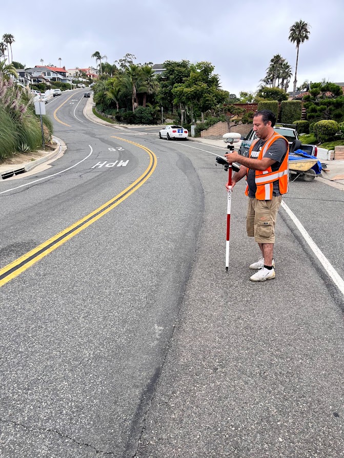
Find Land surveyors in Artesia
Standard Land Surveying, Co.
Standard Land Surveying, Co.
Customers say: Quality work
Recommended by 100% of Angi customers
Recommended by 100% of HomeAdvisor customers
37 local quotes requested
Standard Land Surveying, Co. proudly serves our customers with pride, integrity, and attention to the details that matter most to you. This is one of the many things that set us apart from the rest. We are locally owned and operated. Give us a call.
"I hired Standard Land Surveying Co. to determine our property line because my new neighbors were installing a fence between our houses and I wanted to be sure they were installing it on their property. I contacted them and spoke to Carlos who explained what they will do to determine our property line and after they were finished they explained the findings and showed me the markers that shows my property line. I was very happy with Standard Land Surveying Co. and I am glad I chose them for this project."
Sandra F on July 2023
Pin point survying
Pin point survying
My office offers a wide variety of land survying services.. Topo maps , staking properly corners, new buildings, super flat floors , as builts, multi story building staking.. Dirt Volume calculations , Rtk drone measurements, 3D scans .....
My office offers a wide variety of land survying services.. Topo maps , staking properly corners, new buildings, super flat floors , as builts, multi story building staking.. Dirt Volume calculations , Rtk drone measurements, 3D scans .....
Mission Land Surveying
Mission Land Surveying
Recommended by 100% of Angi customers
Recommended by 100% of HomeAdvisor customers
Topographical surveys Story poles Aerial targets FEMA flood certifications Roof certifications Line and grade certifications Story pole certifications and Staking Building staking Search and find monuments Final grade certifications Property corners Monitoring wells Measurements Record of survey Corner records Parcel map Lot line adjustments Construction staking ALTA/ACSM surveys Easements Monitor buildings for movement
""Exceptional experience with Mission Land Surveying. Their team demonstrated utmost professionalism, delivering accurate surveys on time. Communication was clear throughout the process, and they efficiently addressed all inquiries. Highly recommend for their expertise, adherence to deadlines, and comprehensive understanding of local regulations."
Mory K on May 2024

LaserTech 3D Scanning
LaserTech 3D Scanning
Free onsite estimate
Experience the future of surveying with LaserTech! No more waiting for weeks or months to get your survey maps. We take pride in our lightning-fast turnaround time, get your maps in just days, not weeks! Precision meets speed at LaserTech, where cutting-edge technology ensures accuracy without the long wait. Elevate your projects with the quickest and most efficient surveying services. Your timelines matter to us, and at LaserTech, we're redefining speed in the surveying industry. Contact us today for swift, accurate, and hassle-free survey maps!
Experience the future of surveying with LaserTech! No more waiting for weeks or months to get your survey maps. We take pride in our lightning-fast turnaround time, get your maps in just days, not weeks! Precision meets speed at LaserTech, where cutting-edge technology ensures accuracy without the long wait. Elevate your projects with the quickest and most efficient surveying services. Your timelines matter to us, and at LaserTech, we're redefining speed in the surveying industry. Contact us today for swift, accurate, and hassle-free survey maps!

Expedite Building & Remodeling
Expedite Building & Remodeling
10 years of experience
General Contracting, specializing in Residential And Commercial Remodeling
General Contracting, specializing in Residential And Commercial Remodeling
Olague Landscaping
Olague Landscaping
Olague Landscaping & Tree Service has been specialized in complete landscaping services for more than 10 years. We offer free quotes, price guarantees, 24 hour service including holidays. Please contact us for work in our domain.
Olague Landscaping & Tree Service has been specialized in complete landscaping services for more than 10 years. We offer free quotes, price guarantees, 24 hour service including holidays. Please contact us for work in our domain.
LiDAR America inc
LiDAR America inc
Lidar America Inc, is a company specialized in Aircraft and Drone mapping, providing Lidar and photogrammetry services in aircrafts and UAS (drone). Manned (aircraft) and unmanned (Drone UAV) aerial survey with LiDAR (Light Detection and Ranging) to produce topographic Lidar products and photogrammetry images. We perform, Topographic Lidar, Lidar Aerial, Lidar Survey, Aerial Mapping, Aerial Lidar, Topographic survey, Drone Survey, UAV Survey, Drone Lidar Mapping, Aerial Drone Services, Drone Inspection and drone services in California, South Nevada and West Arizona.
Lidar America Inc, is a company specialized in Aircraft and Drone mapping, providing Lidar and photogrammetry services in aircrafts and UAS (drone). Manned (aircraft) and unmanned (Drone UAV) aerial survey with LiDAR (Light Detection and Ranging) to produce topographic Lidar products and photogrammetry images. We perform, Topographic Lidar, Lidar Aerial, Lidar Survey, Aerial Mapping, Aerial Lidar, Topographic survey, Drone Survey, UAV Survey, Drone Lidar Mapping, Aerial Drone Services, Drone Inspection and drone services in California, South Nevada and West Arizona.
Valdezbroslandscaping
Valdezbroslandscaping
Emergency services offered
Valdezbroslandscaping 7609778360
Valdezbroslandscaping 7609778360

Engineering Capital
Engineering Capital
We can Design, Engineer, and Build depending on your needs. -New or Remodel of Single Family Dwelling, Apartments, and Other -Accessory Dwelling Units (ADU) -Junior Accessory Dwelling Units (JADU) -Title 24 -Architecture -Surveying -Retrofit
We can Design, Engineer, and Build depending on your needs. -New or Remodel of Single Family Dwelling, Apartments, and Other -Accessory Dwelling Units (ADU) -Junior Accessory Dwelling Units (JADU) -Title 24 -Architecture -Surveying -Retrofit

DIMENSIONS
DIMENSIONS
We are an as-built company that provides on-site measuring, drafting, and BIM modeling services. Our goal is to become an extension of your business, allowing you to leverage the most advanced technologies and practices in the industry. We are a local owner-operated business that services Los Angeles and Orange County. Let's get started on your next project!
We are an as-built company that provides on-site measuring, drafting, and BIM modeling services. Our goal is to become an extension of your business, allowing you to leverage the most advanced technologies and practices in the industry. We are a local owner-operated business that services Los Angeles and Orange County. Let's get started on your next project!
Land Surveying questions, answered by experts
The Artesia, CA homeowners’ guide to land surveying services
From average costs to expert advice, get all the answers you need to get your job done.
 •
•Discover site preparation cost estimates, including average prices, cost factors, and tips to help homeowners budget for their next project.

A land survey can determine your property’s borders and settle property disputes. Learn how much a land survey costs and what can affect the price.

Just bought a plot of land and need to get it build-ready? Learn how much it costs to clear land to gauge your initial budget before you break ground.
 •
•Find out how much an elevation certificate costs, including average prices, cost factors, and tips to save money when hiring a surveyor for your property.

Real estate transactions often require a survey, but who pays for it? Learn who pays for a land survey in most cases and some exceptions to the norm.

Knowing where your property lines are can help settle a dispute with a neighbor and even prevent an ugly legal battle. This guide will help you draw the line.
- Cerritos, CA Land surveyors
- La Palma, CA Land surveyors
- Buena Park, CA Land surveyors
- Norwalk, CA Land surveyors
- Bellflower, CA Land surveyors
- Cypress, CA Land surveyors
- Lakewood, CA Land surveyors
- Hawaiian Gardens, CA Land surveyors
- La Mirada, CA Land surveyors
- Los Alamitos, CA Land surveyors
- Santa Fe Springs, CA Land surveyors
- Rossmoor, CA Land surveyors
- Paramount, CA Land surveyors
- Stanton, CA Land surveyors
- Downey, CA Land surveyors
- Signal Hill, CA Land surveyors
- Seal Beach, CA Land surveyors
- Whittier, CA Land surveyors
- La Habra, CA Land surveyors
- Garden Grove, CA Land surveyors
- Fullerton, CA Land surveyors
- La Habra Heights, CA Land surveyors
- Pico Rivera, CA Land surveyors
- Commerce, CA Land surveyors
- Westminster, CA Land surveyors
- Lynwood, CA Land surveyors
- South Gate, CA Land surveyors
- Bell Gardens, CA Land surveyors
- City Of Commerce, CA Land surveyors
- Electrical in Artesia
- Plumbing in Artesia
- Lawn And Yard Work in Artesia
- Garage Doors in Artesia
- Moving in Artesia
- Doors in Artesia
- Garbage Collection in Artesia
- Swimming Pools in Artesia
- Pest Control in Artesia
- Handyman Service in Artesia
- Tree Service in Artesia
- Landscaping in Artesia
- Dumpster Rental in Artesia
- Siding in Artesia
- Kitchen And Bath Remodeling in Artesia
- Cleaning in Artesia
- Pressure Washing in Artesia
- Locksmiths in Artesia
- Mailbox Repair in Artesia
- Insulation in Artesia
- Windows in Artesia
- Window Cleaning in Artesia
- Welding in Artesia
- Glass And Mirrors in Artesia
- Drywall in Artesia
- Upholstering in Artesia
- Central Vacuum Cleaners in Artesia
- Small Appliance Repair in Artesia
- Roofing in Artesia
- Painting in Artesia
What do you need done? We’ll find top pros.
- 🌱 "Mow a small front yard"
- 🛠 "Fix a leaking pipe under the sink"
- 🏠 "Repair shingles on an asphalt roof"