
Get matched with top land surveyors in Cordes Lakes, AZ
Enter your zip and get matched with up to 5 pros
Need a pro for your land surveying project in Cordes Lakes, AZ?
Select your specific project to find the pro for you.
Verified Reviews for Land Surveying pros in Cordes Lakes, AZ
*The Angi rating for Land Surveying companies in Cordes Lakes, AZ is a rating based on verified reviews from our community of homeowners who have used these pros to meet their Land Surveying needs.
*The HomeAdvisor rating for Land Surveying companies in Cordes Lakes, AZ is a rating based on verified reviews from our community of homeowners who have used these pros to meet their Land Surveying needs.
Last update on December 03, 2025


Find Land surveyors in Cordes Lakes
Meridian Geomatics, LLC
Meridian Geomatics, LLC
Customers say: Terrific value
Recommended by 100% of Angi customers
Recommended by 100% of HomeAdvisor customers
197 local quotes requested
Meridian Geomatics offers land surveying services to the public. If you need your lot corners staked, your property mapped or split into smaller parcels or you are a contractor looking for construction staking services we have got you covered. We have over thirty years of surveying experience. No job too big or too small.
"They responded quickly to our inquiry, were available the same week, and the crew was courteous and professional."
Angie W on April 2023
BoundaryHunters LLC
BoundaryHunters LLC
Customers say: Quick response
Recommended by 100% of Angi customers
Recommended by 100% of HomeAdvisor customers
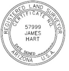
BoundaryHunters LLC provides a full array of land surveying services with specialization in boundary matters. James M (Mike) Hart has over 45 years of surveying experience and is licensed to practice surveying in 12 states. Services include land corner and boundary identification, ALTA/NSPS Land Title Surveys, expert witness testimony, and high order horizontal and vertical control.
"Not in our favor but was done fairly."
Sue S on June 2021
Contract Surveying, Inc
Contract Surveying, Inc
36 years of experience
Welcome to Contract Surveying, Inc.! We are a privately-owned and -operated land surveying company that has been in operation since 1989. We offer a variety of services including construction staking and construction layouts, topographic surveys, land surveys, and lot splits. So whether you are buying or selling a property and need a land survey completed or are in the process of building your dream home and need a topography map, we can help. While we consider ourselves experts on the residential side of the business, we do have experience with commercial properties as well. Customer satisfaction is our number one priority and we will not stop working until the job is done right. Rod Blank is a Registered Land Surveyor with years of experience in the industry and a true passion for the job. We truly have our clients' best interest at heart; if we feel that another surveying company would be a better fit for a particular job, we will definitely let you know. Call Contract Surveying, Inc. today!
Welcome to Contract Surveying, Inc.! We are a privately-owned and -operated land surveying company that has been in operation since 1989. We offer a variety of services including construction staking and construction layouts, topographic surveys, land surveys, and lot splits. So whether you are buying or selling a property and need a land survey completed or are in the process of building your dream home and need a topography map, we can help. While we consider ourselves experts on the residential side of the business, we do have experience with commercial properties as well. Customer satisfaction is our number one priority and we will not stop working until the job is done right. Rod Blank is a Registered Land Surveyor with years of experience in the industry and a true passion for the job. We truly have our clients' best interest at heart; if we feel that another surveying company would be a better fit for a particular job, we will definitely let you know. Call Contract Surveying, Inc. today!
GEOMETRIX LLC Land Surveying Services Jody A
GEOMETRIX LLC Land Surveying Services Jody A
GEOMETRIX LLC Land Surveying Services works with clients throughout the entire state of Arizona. We provide professional land surveying services to residential, commercial and industrial clients. Our professional approach ensures you will receive accurate results. Our clients deserve the best and this will be evident from start to finish. When you need to establish property boundaries or conduct an ALTA Land Title survey for property transfer, we can help. With over 25 years of experience, our services are also extended to developers and construction firms for services such as construction staking, subdivision layout and aerial mapping. Services we offer include: ALTA / ASCM Land Title Surveys Ground control for aerial mapping Property line dispute resolution Elevation certificates Construction staking Topographic surveys Mining Claims We use computerized mapping tools including G.I.S. data (Geographic Information Systems). When surveys are complete we can print maps up to 42 inches wide with a color plotter printer. PDF's are also provided for quick and easy display from your computer without having to find the maps you stored away. At GEOMETRIX LLC, your satisfaction is priority. Call today for more information. We look forward to serving you.
GEOMETRIX LLC Land Surveying Services works with clients throughout the entire state of Arizona. We provide professional land surveying services to residential, commercial and industrial clients. Our professional approach ensures you will receive accurate results. Our clients deserve the best and this will be evident from start to finish. When you need to establish property boundaries or conduct an ALTA Land Title survey for property transfer, we can help. With over 25 years of experience, our services are also extended to developers and construction firms for services such as construction staking, subdivision layout and aerial mapping. Services we offer include: ALTA / ASCM Land Title Surveys Ground control for aerial mapping Property line dispute resolution Elevation certificates Construction staking Topographic surveys Mining Claims We use computerized mapping tools including G.I.S. data (Geographic Information Systems). When surveys are complete we can print maps up to 42 inches wide with a color plotter printer. PDF's are also provided for quick and easy display from your computer without having to find the maps you stored away. At GEOMETRIX LLC, your satisfaction is priority. Call today for more information. We look forward to serving you.

Dava & Associates
Dava & Associates
44 years of experience
Professional Engineering, Surveying in central Arizona since 1981
Professional Engineering, Surveying in central Arizona since 1981
RLF Consulting
RLF Consulting
19 years of experience
Founded in 2006 by licensed professional land surveyor, Ryan Fidler, RLF Consulting has been a groundbreaking force in the field of land surveying and civil engineering. We pioneered drone mapping, becoming indispensable partners during the emergence and evolution of 3G, 4G, and the current 5G telecommunications phases. We have established trust with numerous government agencies and private organizations by providing a broad array of services, including boundary surveying, topographic surveys, and construction staking. Our footprint extends across the Southwest USA, where we've successfully managed some of the region's most extensive projects. Our unwavering commitment to innovation, accuracy, client satisfaction, and excellence is the bedrock of our operations. As we continue to embrace technology and adapt to market dynamics, our mission remains to deliver unparalleled professional services, upholding our position as a leading surveying and civil engineering firm.
Founded in 2006 by licensed professional land surveyor, Ryan Fidler, RLF Consulting has been a groundbreaking force in the field of land surveying and civil engineering. We pioneered drone mapping, becoming indispensable partners during the emergence and evolution of 3G, 4G, and the current 5G telecommunications phases. We have established trust with numerous government agencies and private organizations by providing a broad array of services, including boundary surveying, topographic surveys, and construction staking. Our footprint extends across the Southwest USA, where we've successfully managed some of the region's most extensive projects. Our unwavering commitment to innovation, accuracy, client satisfaction, and excellence is the bedrock of our operations. As we continue to embrace technology and adapt to market dynamics, our mission remains to deliver unparalleled professional services, upholding our position as a leading surveying and civil engineering firm.
All American Handyman & Plumber
All American Handyman & Plumber
35 years of experience
I can do any kind of home repairs and am a licensed plumber i have 6 years of schooling and 25 yrs of experience under my belt,I am not doing this to get rich I am an honest working family man looking to support my family. no job too small, I am a clean worker I always get the job done right the first time and on time. I take allot of pride in the work that I do my company motto is " you get A+ quality work for a C+ quality price" I can always work within a budget and no price is set in stone.I will work with anyone within any budget
I can do any kind of home repairs and am a licensed plumber i have 6 years of schooling and 25 yrs of experience under my belt,I am not doing this to get rich I am an honest working family man looking to support my family. no job too small, I am a clean worker I always get the job done right the first time and on time. I take allot of pride in the work that I do my company motto is " you get A+ quality work for a C+ quality price" I can always work within a budget and no price is set in stone.I will work with anyone within any budget
Miller Land Surveying
Miller Land Surveying
Customers say: Quick response
Recommended by 100% of Angi customers
Recommended by 100% of HomeAdvisor customers
Miller Land Surveying has the expertise and experience to provide accurate and reliable field work and produce detailed high quality maps. Professional Land Surveying Services throughout the State of Arizona. 22 years in Business. - Visit MillerLS.com
Miller Land Surveying has the expertise and experience to provide accurate and reliable field work and produce detailed high quality maps. Professional Land Surveying Services throughout the State of Arizona. 22 years in Business. - Visit MillerLS.com
Land Surveying questions, answered by experts
The Cordes Lakes, AZ homeowners’ guide to land surveying services
From average costs to expert advice, get all the answers you need to get your job done.
 •
•Discover site preparation cost estimates, including average prices, cost factors, and tips to help homeowners budget for their next project.

A land survey can determine your property’s borders and settle property disputes. Learn how much a land survey costs and what can affect the price.

Just bought a plot of land and need to get it build-ready? Learn how much it costs to clear land to gauge your initial budget before you break ground.

Not sure what kind of property survey you need? Learn about the differences between a land survey vs. a boundary survey to get started.

What is a property line? Find out everything you need to know about property lines, from easements to where to build a fence and how land surveys work.

Land surveys provide an accurate record of your property. Learn how long a land survey is good for and when you should have your property resurveyed.
- Mayer, AZ Land surveyors
- Spring Valley, AZ Land surveyors
- Humboldt, AZ Land surveyors
- Black Canyon City, AZ Land surveyors
- Dewey, AZ Land surveyors
- Camp Verde, AZ Land surveyors
- Prescott Valley, AZ Land surveyors
- Prescott, AZ Land surveyors
- Kirkland, AZ Land surveyors
- Cottonwood, AZ Land surveyors
- Lake Montezuma, AZ Land surveyors
- Rimrock, AZ Land surveyors
- Jerome, AZ Land surveyors
- Cornville, AZ Land surveyors
- Clarkdale, AZ Land surveyors
- New River, AZ Land surveyors
- Anthem, AZ Land surveyors
- Desert Hills, AZ Land surveyors
- Cave Creek, AZ Land surveyors
- Carefree, AZ Land surveyors
- Yarnell, AZ Land surveyors
- Chino Valley, AZ Land surveyors
- Skull Valley, AZ Land surveyors
- Pine, AZ Land surveyors
- Strawberry, AZ Land surveyors
- Sedona, AZ Land surveyors
- Wickenburg, AZ Land surveyors
- Congress, AZ Land surveyors
- Happy Jack, AZ Land surveyors
- Paulden, AZ Land surveyors