
Get matched with top land surveyors in Whiteriver, AZ
Enter your ZIP and get matched with up to 5 pros
Need a pro for your land surveying project in Whiteriver, AZ?
Select your specific project to find the pro for you.
Find Land surveyors in Whiteriver

National Property Inspections
National Property Inspections
Customers say: Quick response
2006 years of experience
2012 Maricopa Business of the Year. Arizona's premier home inspection company. Thermal imaging certified, no extra charges for pools. Statewide service. We schedule termite Inspections as part of our Inspections. A Rated BBB. 6 month warranty included with every inspection. 7 day per week service. www.arizonainspections.com Office 520-208-2590
2012 Maricopa Business of the Year. Arizona's premier home inspection company. Thermal imaging certified, no extra charges for pools. Statewide service. We schedule termite Inspections as part of our Inspections. A Rated BBB. 6 month warranty included with every inspection. 7 day per week service. www.arizonainspections.com Office 520-208-2590
Superior Surveying Services Inc
Superior Surveying Services Inc
Customers say: Quick response
Recommended by 100% of Angi customers
Recommended by 100% of HomeAdvisor customers
Since 1988 Superior Surveying Services, Inc. has been professionally land surveying across the Southwest. Additional DBA - Superior Surveying SVC Inc.
Since 1988 Superior Surveying Services, Inc. has been professionally land surveying across the Southwest. Additional DBA - Superior Surveying SVC Inc.
BoundaryHunters LLC
BoundaryHunters LLC
Customers say: Quick response
Recommended by 100% of Angi customers
Recommended by 100% of HomeAdvisor customers
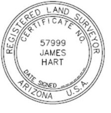
BoundaryHunters LLC provides a full array of land surveying services with specialization in boundary matters. James M (Mike) Hart has over 45 years of surveying experience and is licensed to practice surveying in 12 states. Services include land corner and boundary identification, ALTA/NSPS Land Title Surveys, expert witness testimony, and high order horizontal and vertical control.
"Not in our favor but was done fairly."
Sue S on June 2021
Ideal Building Solutions, LLC
Ideal Building Solutions, LLC
Customers say: Quick response
Recommended by 100% of Angi customers
Recommended by 100% of HomeAdvisor customers
We provide General Contracting Services for commercial and residential building. We self perform many construction trades including Rough Carpentry, Concrete and Drywall, just to name a few.
We provide General Contracting Services for commercial and residential building. We self perform many construction trades including Rough Carpentry, Concrete and Drywall, just to name a few.

RLF Consulting
RLF Consulting
2006 years of experience
Founded in 2006 by licensed professional land surveyor, Ryan Fidler, RLF Consulting has been a groundbreaking force in the field of land surveying and civil engineering. We pioneered drone mapping, becoming indispensable partners during the emergence and evolution of 3G, 4G, and the current 5G telecommunications phases. We have established trust with numerous government agencies and private organizations by providing a broad array of services, including boundary surveying, topographic surveys, and construction staking. Our footprint extends across the Southwest USA, where we've successfully managed some of the region's most extensive projects. Our unwavering commitment to innovation, accuracy, client satisfaction, and excellence is the bedrock of our operations. As we continue to embrace technology and adapt to market dynamics, our mission remains to deliver unparalleled professional services, upholding our position as a leading surveying and civil engineering firm.
Founded in 2006 by licensed professional land surveyor, Ryan Fidler, RLF Consulting has been a groundbreaking force in the field of land surveying and civil engineering. We pioneered drone mapping, becoming indispensable partners during the emergence and evolution of 3G, 4G, and the current 5G telecommunications phases. We have established trust with numerous government agencies and private organizations by providing a broad array of services, including boundary surveying, topographic surveys, and construction staking. Our footprint extends across the Southwest USA, where we've successfully managed some of the region's most extensive projects. Our unwavering commitment to innovation, accuracy, client satisfaction, and excellence is the bedrock of our operations. As we continue to embrace technology and adapt to market dynamics, our mission remains to deliver unparalleled professional services, upholding our position as a leading surveying and civil engineering firm.
Arizona Surveying, Inc.
Arizona Surveying, Inc.
2009 years of experience
Arizona Surveying, Inc. is a full service land surveying company with Northern Arizona as the primary service area.
Arizona Surveying, Inc. is a full service land surveying company with Northern Arizona as the primary service area.
Land Surveying questions, answered by experts
The Whiteriver, AZ homeowners’ guide to land surveying services
From average costs to expert advice, get all the answers you need to get your job done.
 •
•Discover site preparation cost estimates, including average prices, cost factors, and tips to help homeowners budget for their next project.

A land survey can determine your property’s borders and settle property disputes. Learn how much a land survey costs and what can affect the price.

Just bought a plot of land and need to get it build-ready? Learn how much it costs to clear land to gauge your initial budget before you break ground.
 •
•Find out how much an elevation certificate costs, including average prices, cost factors, and tips to save money when hiring a surveyor for your property.

Boundary surveys and topographic surveys provide important information about a property. Learn the differences between boundary and topographic surveys.

Wondering whether you need a land survey or a plot plan? Learn about the differences between the two, when to do each, and what information they provide.
- Mcnary, AZ Land surveyors
- Lakeside, AZ Land surveyors
- Pinetop, AZ Land surveyors
- Show Low, AZ Land surveyors
- Cibecue, AZ Land surveyors
- White Mountain Lake, AZ Land surveyors
- San Carlos, AZ Land surveyors
- Peridot, AZ Land surveyors
- Taylor, AZ Land surveyors
- Eagar, AZ Land surveyors
- Springerville, AZ Land surveyors
- Bylas, AZ Land surveyors
- Overgaard, AZ Land surveyors
- Globe, AZ Land surveyors
- Claypool, AZ Land surveyors
- Miami, AZ Land surveyors
- Snowflake, AZ Land surveyors
- Saint Johns, AZ Land surveyors
- Pima, AZ Land surveyors
- Morenci, AZ Land surveyors
- Clifton, AZ Land surveyors
- Thatcher, AZ Land surveyors
- Heber, AZ Land surveyors
- Young, AZ Land surveyors
- Tonto Basin, AZ Land surveyors
- Hayden, AZ Land surveyors
- Safford, AZ Land surveyors
- Kearny, AZ Land surveyors
- Superior, AZ Land surveyors
- Dudleyville, AZ Land surveyors
- Roofing in Whiteriver
- Kitchen And Bath Remodeling in Whiteriver
- Electrical in Whiteriver
- Plumbing in Whiteriver
- Driveways in Whiteriver
- Siding in Whiteriver
- Landscaping in Whiteriver
- Windows in Whiteriver
- Water And Smoke Damage in Whiteriver
- Pest Control in Whiteriver
- Concrete Driveways in Whiteriver
- Deck Maintenance in Whiteriver
- Computer Repair in Whiteriver
- Plumbing in Whiteriver
- Roofing in Whiteriver
- Kitchen And Bath Remodeling in Whiteriver
- Electrical in Whiteriver
- Landscaping in Whiteriver
- Tree Service in Whiteriver
- Pest Control in Whiteriver
- Swimming Pools in Whiteriver
- Moving in Whiteriver
- Garage Doors in Whiteriver
- Lawn And Yard Work in Whiteriver
- Exterior Painting in Whiteriver
- Flooring in Whiteriver
- Handyman Service in Whiteriver
- Garbage Collection in Whiteriver
- Concrete Repair in Whiteriver
- Windows in Whiteriver
What do you need done? We’ll find top pros.
- 🌱 "Mow a small front yard"
- 🛠 "Fix a leaking pipe under the sink"
- 🏠 "Repair shingles on an asphalt roof"