



Top-rated land clearing pros.

Best land clearing pros near Decatur, MS

Enter your zip and get matched with up to 5 pros

Need a pro for your land clearing project in Decatur, MS?

Select your specific project to find the pro for you.

Top-Rated Land clearing pros in Decatur - Updated Nov 2026

Avatar for Thigpen Septic Tank Service
Thigpen Septic Tank Service
4.7(
55
)
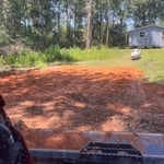
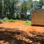
Building Site - Preparation and ClearingBuilding Site - Preparation and Clearing - For Business

Serving Decatur, MS and surrounding areas

Credit card accepted

"Very professional service. Price was as quoted and less than local competitors. Showed up a little late but contacted us to let us know he was running behind first. Took about an hour to complete the work. Would definitely use them again."
Truck
Truck & Jerrys
Truck door & Jerrys
Truck
Additional Photos

+5

Recommended by96%of homeowners
Avatar for Arc Electrical, LLC
Arc Electrical, LLC
5.0(
4
)
Building Site - Preparation and Clearing

Serving Decatur, MS and surrounding areas

In business since 2020

Free estimates

Emergency services offered

"It was a late night emergency call I lost power I called him and he came out that night and had my power back on that same night. Nathen and his crew are awesome an super professional. Had them do serval more job at my other properties."
Outside parking
Inside
Outside
Light pole
Light pole

+7

Response time5 hrs
Showing 1-10 of 30
Land Clearing Services FAQs, answered by experts

Measure from zero on a measuring tape by placing the metal hook right up against the edge of what you need to measure. You can also latch the hook onto an open edge—of, say, a table—to accurately measure as well. If you begin at the 1-inch mark, you'll need to subtract an inch from your total.

The small lines on the tape measure either indicate inches, fractions of an inch, or centimeters and millimeters. On the imperial unit side (aka the inches side), the longest lines indicate inches, followed by the next shortest lines that indicate a half-inch, and then the quarter, eighth, and sixteenth-inch. On the metric side, the lines break down meters, centimeters, and millimeters.
Depending on the type of land survey, the report will mark the boundaries of your property, the topographical changes of the landscape, as well as major natural and added structures to the plot. A more detailed survey, like an as-built survey, will note the measurements of the structures and landscape following major construction. A topographic survey will also help your contractor determine the cost of land development projects.

A land survey provides precise property boundaries, reveals legal encroachments, and identifies rights-of-way, minimizing disputes. Understanding the exact dimensions and features of the property aids in informed decision-making and safeguards the buyer's investment.

There are a couple of ways you can determine the depth of your well. One method is to use a device called a well sounder. This tool has a long measuring tape containing a sensor to alert you once the end reaches the water. 

Or you can DIY it by using a long tape measure with a half-filled bottle of water attached to it. Lower the tape measure into your well. Once you feel tension on the tape, you’ll know the bottle has reached your static water level. This will give you an approximate idea of your well’s depth.

The Decatur, MS homeowners’ guide to land clearing services

From average costs to expert advice, get all the answers you need to get your job done.