




Top-rated land surveyors.

Best land surveyors near Sunset, LA

Enter your zip and get matched with up to 5 pros

Need a pro for your land surveying project in Sunset, LA?

Select your specific project to find the pro for you.

Top-Rated Land surveyors in Sunset - Updated Nov 2026

Avatar for Normand Land Surveying, LLC
Normand Land Surveying, LLC
4.9(
37
)
Land Surveyor

Serving Sunset, LA and surrounding areas

In business since 2016

Free estimates

Small jobs welcome

"He was to the point. He knew what needed to be researched and perform his duty as a surveyor. I will contact him in the future to handle all my survey needs for my company."
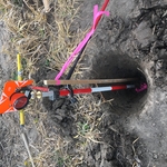
Fnd 2-1/4" IR
CP Tree
NGS Monument
Survey Photos
Survey Photos

+27

Response time12 hrs
Response rate96%
Recommended by90%of homeowners

Land Surveying FAQs, answered by experts

A land survey defines and records the physical aspects of a property, including its boundaries, dimensions, easements, features, and sometimes topographical information. In contrast, a land appraisal determines the property's monetary value. While an appraiser will often consult a land survey to understand the property's physical specifications, the survey itself does not determine the land's value.

Soil testers and licensed excavators are often the professionals you hire if you need a perc test. In some cases, structural engineers will also be able to conduct the test for you. In many municipalities, you’ll need your professional on-site to dig and fill the holes with water, as well as a representative from your local building department or health department. That representative is the individual who will determine whether your test passes or fails.

If you’re planning to dig on your property, you’ll need to check for underground utility lines. Call the national call-before-you-dig 811 number. Once connected to an operator, you can schedule a site visit to mark underground lines. This way, you won’t accidentally dig into pipes and can cause major (read: costly) issues.

Before property transactions or major improvements to ensure accuracy.

A land survey includes the layout of a single property, including precise measurements and to-scale drawings of boundary lines, land improvements, and sometimes other features, like topography and drainage information. A plat map includes the layouts and boundary lines of several adjacent plots and basic structure measurements. Surveys are normally more valuable for homeowners and buyers, and plat maps are for governmental use.

The Sunset, LA homeowners’ guide to land surveying services

From average costs to expert advice, get all the answers you need to get your job done.