Get matched with top land surveyors in Hoschton, GA
Enter your ZIP and get matched with up to 5 pros
Need a pro for your land surveying project in Hoschton, GA?
TRUSTED BY HOSCHTON, GA HOMEOWNERS
4.4
Average homeowner rating30
Verified land surveying services reviews
Verified Reviews for Land Surveying pros in Hoschton, GA
*The Angi rating for Land Surveying companies in Hoschton, GA is a rating based on verified reviews from our community of homeowners who have used these pros to meet their Land Surveying needs.
*The HomeAdvisor rating for Land Surveying companies in Hoschton, GA is a rating based on verified reviews from our community of homeowners who have used these pros to meet their Land Surveying needs.
Last update on November 29, 2025
Find Land surveyors in Hoschton

Ringo/Abernathy & Associates
Ringo/Abernathy & Associates
We offer a vast selection of Surveying needs from standard boundary pin setting to intricate residential site plans and large land design plans. We can provide Boundary Surveys, Topography Surveys, as well as Site Plans for county Environmental Health Department, Residential Drainage Plans, Erosion Control Plans, House Location Plans, all As-builts, FEMA Certifications, and all required staking. With nearly 40 years of experience in the Metro Atlanta area, we can assist you with any sort of house or land plan you may need.
"Great Customer service and high quality care. Integrity driven and it was a pleasure to have them come out. Even after care was awesome"
Kevin T on May 2025
A.E.L Land Clearing and Trash Removal
A.E.L Land Clearing and Trash Removal
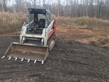
We provide land clearing services with a forestry mulcher. (this machine clears thick brush, small trees and stumps that a lawnmower cant) we also provide other skid steer services as well (land leveling, grading, post driving etc). In addition we provide trash/ debris removal with dump trailer rentals. We aim to expand our business through referrals so honesty and integrity is our creed and our main purpose is to leave our customers happy and satisfied so they will be willing to recommend us to their friends and family. Our operators have between 10-15 years of experience operating the machines and we are also licensed and insured.
We provide land clearing services with a forestry mulcher. (this machine clears thick brush, small trees and stumps that a lawnmower cant) we also provide other skid steer services as well (land leveling, grading, post driving etc). In addition we provide trash/ debris removal with dump trailer rentals. We aim to expand our business through referrals so honesty and integrity is our creed and our main purpose is to leave our customers happy and satisfied so they will be willing to recommend us to their friends and family. Our operators have between 10-15 years of experience operating the machines and we are also licensed and insured.

SitRep Services
SitRep Services
Private Utility Locating Services to help you dig safely! If you are concerned about hitting anything in the ground during your next project. Give us a call. We locate your utilities and subsurface targets to ensure your project can be completed safely. Using ground penetrating radar and radio detection tools, we can find and mark anything that may be in the way of your next project. We locate utilities for customers installing, repairing or remodeling any area including: fences, pools, gas lines, sheds, driveways, landscaping, irrigation, septic, leech fields, well water lines, lighting, communication lines and more. If you are concerned about hitting anything in the ground during your next project. Give us a call. Our locators are highly experienced and use top-of-the-line locating equipment to keep you safe during your project. Our techs are based in Atlanta and cover much of Georgia and the surrounding areas. 811 notifies local public utilities that they need to mark their services from the meter on your property to the main. They do not mark any private items past the meter, or things like septic, well, irrigation, lighting etc. 811 also requires a few days to complete the request. We recommend you call 811 first and then call us to find what they don't. Want to keep a record for future projects? We can map out all of your utilities including GPS paths on satellite imagery and give you a copy to use in the future.
Private Utility Locating Services to help you dig safely! If you are concerned about hitting anything in the ground during your next project. Give us a call. We locate your utilities and subsurface targets to ensure your project can be completed safely. Using ground penetrating radar and radio detection tools, we can find and mark anything that may be in the way of your next project. We locate utilities for customers installing, repairing or remodeling any area including: fences, pools, gas lines, sheds, driveways, landscaping, irrigation, septic, leech fields, well water lines, lighting, communication lines and more. If you are concerned about hitting anything in the ground during your next project. Give us a call. Our locators are highly experienced and use top-of-the-line locating equipment to keep you safe during your project. Our techs are based in Atlanta and cover much of Georgia and the surrounding areas. 811 notifies local public utilities that they need to mark their services from the meter on your property to the main. They do not mark any private items past the meter, or things like septic, well, irrigation, lighting etc. 811 also requires a few days to complete the request. We recommend you call 811 first and then call us to find what they don't. Want to keep a record for future projects? We can map out all of your utilities including GPS paths on satellite imagery and give you a copy to use in the future.
Smith Land Care Solutions
Smith Land Care Solutions
We specialize in Tree / Brush removal and lot or land clearing. We can help you removal unsightly overgrowth or neusance trees. Our owner operated team has 10+ years of experience. We stand out because our machinery allows us to clear trees faster and at a better cost than traditional tree removal companies.
We specialize in Tree / Brush removal and lot or land clearing. We can help you removal unsightly overgrowth or neusance trees. Our owner operated team has 10+ years of experience. We stand out because our machinery allows us to clear trees faster and at a better cost than traditional tree removal companies.

Atlanta Drone Imagery
Atlanta Drone Imagery
We provide drone photography services in Atlanta and the surrounding areas to professionals in real estate, construction, inspections, events planning, film and TV productions. Call us at 818.495.8812 or visit our website at www.AtlantaDroneImagery.com.
We provide drone photography services in Atlanta and the surrounding areas to professionals in real estate, construction, inspections, events planning, film and TV productions. Call us at 818.495.8812 or visit our website at www.AtlantaDroneImagery.com.

United Land Surveying
United Land Surveying
UNITED LAND SURVEYING provides an essential service to Homeowners, Attorneys, Builders, Developers, Architects, Landscapers, Home Inspectors, and Engineers. The strength of our business is giving each of our clients a personalized and custom experience to meet your specific needs. We take the time to ask you about your reasons for a survey so we can deliver the quality that you expect. We are available year-round, providing a variety of survey options from the most common Boundary Survey to the complex Topographic Survey, and EVERYTHING beyond and between. Our services are available to individuals and professionals and cover the Metro-Atlanta and all surrounding counties.
UNITED LAND SURVEYING provides an essential service to Homeowners, Attorneys, Builders, Developers, Architects, Landscapers, Home Inspectors, and Engineers. The strength of our business is giving each of our clients a personalized and custom experience to meet your specific needs. We take the time to ask you about your reasons for a survey so we can deliver the quality that you expect. We are available year-round, providing a variety of survey options from the most common Boundary Survey to the complex Topographic Survey, and EVERYTHING beyond and between. Our services are available to individuals and professionals and cover the Metro-Atlanta and all surrounding counties.
Genuine Mapping and Design, LLC
Genuine Mapping and Design, LLC
Genuine Mapping & Design is a small surveying, mapping, GIS, land planning and civil design firm operated out of Jackson County, GA. We work directly for homeowners on property surveys, flood certifications, site plans and other products and services. We also work with real estate professionals, developers and utility contractors to prepare pre-design drawings, conceptual plans, subdivision and construction drawings for land transactions and development projects. In addition we offer larger scale mapping services and Geographic Information System products for resource managers, agriculture and other clients looking to ask questions of spatial data and make decisions based on the answers.
Genuine Mapping & Design is a small surveying, mapping, GIS, land planning and civil design firm operated out of Jackson County, GA. We work directly for homeowners on property surveys, flood certifications, site plans and other products and services. We also work with real estate professionals, developers and utility contractors to prepare pre-design drawings, conceptual plans, subdivision and construction drawings for land transactions and development projects. In addition we offer larger scale mapping services and Geographic Information System products for resource managers, agriculture and other clients looking to ask questions of spatial data and make decisions based on the answers.
Land & Lake Surveying
Land & Lake Surveying
The average person needs a land survey just a few times in their life. The process is always changing and we will be glad to assist you every step of the way.
The average person needs a land survey just a few times in their life. The process is always changing and we will be glad to assist you every step of the way.
Alex Construction All Phases of Home Improvement
Alex Construction All Phases of Home Improvement
Need Something Fixed, Painted, Stained, Sealed, Replaced, Installed, Built or Maintained? Alex Construction Provides The Finest Home Remodeling and Renovation Services For Residential, Rental & Commercial Properties At Very Reasonable Rates! A Solid Reputation Built on 15+ Years of Experience, Quality, Integrity, Responsibility & Reliability at an Affordable Price! Call Today For Your Free Estimate!
Need Something Fixed, Painted, Stained, Sealed, Replaced, Installed, Built or Maintained? Alex Construction Provides The Finest Home Remodeling and Renovation Services For Residential, Rental & Commercial Properties At Very Reasonable Rates! A Solid Reputation Built on 15+ Years of Experience, Quality, Integrity, Responsibility & Reliability at an Affordable Price! Call Today For Your Free Estimate!

Williams & Associates
Williams & Associates
Williams & Associates began in October of 1999 with the idea of establishing an all-encompassing design firm in the northeast Georgia area to serve the growing communities. Since its inception, the firm has grown from a one-person operation into a diverse company of talented civil and traffic engineers, surveyors, landscape architects, planners and support staff. This diversity has enabled us to realize our original goal while providing our clients with a superior level of service. The dedication to quality service and client satisfaction is the cornerstone of Williams & Associates.
Williams & Associates began in October of 1999 with the idea of establishing an all-encompassing design firm in the northeast Georgia area to serve the growing communities. Since its inception, the firm has grown from a one-person operation into a diverse company of talented civil and traffic engineers, surveyors, landscape architects, planners and support staff. This diversity has enabled us to realize our original goal while providing our clients with a superior level of service. The dedication to quality service and client satisfaction is the cornerstone of Williams & Associates.
The Hoschton, GA homeowners’ guide to land surveying services
From average costs to expert advice, get all the answers you need to get your job done.
 •
•Discover site preparation cost estimates, including average prices, cost factors, and tips to help homeowners budget for their next project.

A land survey can determine your property’s borders and settle property disputes. Learn how much a land survey costs and what can affect the price.

Just bought a plot of land and need to get it build-ready? Learn how much it costs to clear land to gauge your initial budget before you break ground.

Wondering whether you need a land survey or a plot plan? Learn about the differences between the two, when to do each, and what information they provide.

Land surveys provide an accurate record of your property. Learn how long a land survey is good for and when you should have your property resurveyed.

Knowing where your property lines are can help settle a dispute with a neighbor and even prevent an ugly legal battle. This guide will help you draw the line.
- Auburn, GA Land surveyors
- Dacula, GA Land surveyors
- Braselton, GA Land surveyors
- Buford, GA Land surveyors
- Flowery Branch, GA Land surveyors
- Winder, GA Land surveyors
- Oakwood, GA Land surveyors
- Sugar Hill, GA Land surveyors
- Lawrenceville, GA Land surveyors
- Pendergrass, GA Land surveyors
- Suwanee, GA Land surveyors
- Bethlehem, GA Land surveyors
- Grayson, GA Land surveyors
- Duluth, GA Land surveyors
- Jefferson, GA Land surveyors
- Arcade, GA Land surveyors
- Gainesville, GA Land surveyors
- Statham, GA Land surveyors
- Berkeley Lake, GA Land surveyors
- Walnut Grove, GA Land surveyors
- Loganville, GA Land surveyors
- Snellville, GA Land surveyors
- Cumming, GA Land surveyors
- Lilburn, GA Land surveyors
- Gillsville, GA Land surveyors
- Monroe, GA Land surveyors
- Peachtree Corners, GA Land surveyors
- Johns Creek, GA Land surveyors
- Alpharetta, GA Land surveyors
- Norcross, GA Land surveyors
- Plumbing in Hoschton
- Lawn And Yard Work in Hoschton
- Tree Service in Hoschton
- Landscaping in Hoschton
- Electrical in Hoschton
- Deck Maintenance in Hoschton
- Moving in Hoschton
- Pest Control in Hoschton
- Flooring in Hoschton
- Roofing in Hoschton
- Pressure Washing in Hoschton
- Sunroom And Patio Remodeling in Hoschton
- Kitchen And Bath Remodeling in Hoschton
- Mailbox Repair in Hoschton
- Lawn Irrigation in Hoschton
- Concrete Repair in Hoschton
- Cabinet Makers in Hoschton
- Lawn Fertilization And Treatment in Hoschton
- Septic Tank in Hoschton
- Swimming Pools in Hoschton
- Garbage Collection in Hoschton
- Stone And Gravel in Hoschton
- Landscaping Hardscaping And Pavers in Hoschton
- Small Appliance Repair in Hoschton
- Computer Repair in Hoschton
- Foundation Repair in Hoschton
- Handyman Service in Hoschton
- Carpet Cleaning in Hoschton
- Garage Doors in Hoschton
- Air Duct Cleaning in Hoschton
- 🌱 "Mow a small front yard"
- 🛠 "Fix a leaking pipe under the sink"
- 🏠 "Repair shingles on an asphalt roof"
