
Get matched with top land surveyors in Apache Junction, AZ
Enter your zip and get matched with up to 5 pros
Need a pro for your land surveying project in Apache Junction, AZ?
Select your specific project to find the pro for you.
Verified Reviews for Land Surveying pros in Apache Junction, AZ
*The Angi rating for Land Surveying companies in Apache Junction, AZ is a rating based on verified reviews from our community of homeowners who have used these pros to meet their Land Surveying needs.
*The HomeAdvisor rating for Land Surveying companies in Apache Junction, AZ is a rating based on verified reviews from our community of homeowners who have used these pros to meet their Land Surveying needs.
Last update on January 09, 2026


Find Land surveyors in Apache Junction
Evans Professional Land Surveys, LLC
Evans Professional Land Surveys, LLC
Customers say: Quality work
13 years of experience
Free onsite estimate
We are a locally owned and operated company with over 5 years of industry experience. We specialize in land surveying. We pride ourselves on the quality of our work as well as our commitment to outstanding results. We look forward to building lasting relationships and guarantee your satisfaction!
"Great experience."
Muggs H on February 2022

National Property Inspections
National Property Inspections
Customers say: Quick response
20 years of experience
2012 Maricopa Business of the Year. Arizona's premier home inspection company. Thermal imaging certified, no extra charges for pools. Statewide service. We schedule termite Inspections as part of our Inspections. A Rated BBB. 6 month warranty included with every inspection. 7 day per week service. www.arizonainspections.com Office 520-208-2590
2012 Maricopa Business of the Year. Arizona's premier home inspection company. Thermal imaging certified, no extra charges for pools. Statewide service. We schedule termite Inspections as part of our Inspections. A Rated BBB. 6 month warranty included with every inspection. 7 day per week service. www.arizonainspections.com Office 520-208-2590
TREELAND NURSERY INC
TREELAND NURSERY INC
Customers say: Quick response
Recommended by 100% of Angi customers
Recommended by 100% of HomeAdvisor customers
Treeland Nurseries found its start as a hobby in the backyard of its founders, Ed and Dorothy Waltemeyer. In the late 1950’s, Ed and Dorothy turned their interest of growing trees from seed into the thriving family-owned and operated business that it is today. Since opening their first retail location on Southern just off of Country Club in 1969, Treeland has moved their primary location to Country Club Drive just off of Guadalupe Road and has expanded to service the wholesale nursery market with the addition of over 100 acres of growing facilities in the Chandler and Gilbert area. Each of their three locations can be easily identified by the iconic “W” palm trees, created in recognition of the Waltemeyer name. Now run by Ed and Dorothy’s four children with the third generation working there as well, Treeland Nurseries has grown to be one of Arizona's largest wholesale and retail nursery operations.
Treeland Nurseries found its start as a hobby in the backyard of its founders, Ed and Dorothy Waltemeyer. In the late 1950’s, Ed and Dorothy turned their interest of growing trees from seed into the thriving family-owned and operated business that it is today. Since opening their first retail location on Southern just off of Country Club in 1969, Treeland has moved their primary location to Country Club Drive just off of Guadalupe Road and has expanded to service the wholesale nursery market with the addition of over 100 acres of growing facilities in the Chandler and Gilbert area. Each of their three locations can be easily identified by the iconic “W” palm trees, created in recognition of the Waltemeyer name. Now run by Ed and Dorothy’s four children with the third generation working there as well, Treeland Nurseries has grown to be one of Arizona's largest wholesale and retail nursery operations.
Superior Surveying Services Inc
Superior Surveying Services Inc
Customers say: Quick response
Recommended by 100% of Angi customers
Recommended by 100% of HomeAdvisor customers
Since 1988 Superior Surveying Services, Inc. has been professionally land surveying across the Southwest. Additional DBA - Superior Surveying SVC Inc.
Since 1988 Superior Surveying Services, Inc. has been professionally land surveying across the Southwest. Additional DBA - Superior Surveying SVC Inc.
Miller Land Surveying
Miller Land Surveying
Customers say: Quick response
Recommended by 100% of Angi customers
Recommended by 100% of HomeAdvisor customers
Miller Land Surveying has the expertise and experience to provide accurate and reliable field work and produce detailed high quality maps. Professional Land Surveying Services throughout the State of Arizona. 22 years in Business. - Visit MillerLS.com
Miller Land Surveying has the expertise and experience to provide accurate and reliable field work and produce detailed high quality maps. Professional Land Surveying Services throughout the State of Arizona. 22 years in Business. - Visit MillerLS.com
BoundaryHunters LLC
BoundaryHunters LLC
Customers say: Quick response
Recommended by 100% of Angi customers
Recommended by 100% of HomeAdvisor customers
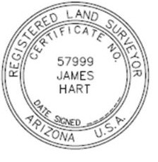
BoundaryHunters LLC provides a full array of land surveying services with specialization in boundary matters. James M (Mike) Hart has over 45 years of surveying experience and is licensed to practice surveying in 12 states. Services include land corner and boundary identification, ALTA/NSPS Land Title Surveys, expert witness testimony, and high order horizontal and vertical control.
"Not in our favor but was done fairly."
Sue S on June 2021
Logan Simpson Design Inc.
Logan Simpson Design Inc.
Customers say: Quick response
Recommended by 100% of Angi customers
Recommended by 100% of HomeAdvisor customers
Logan Simpson is a landscape architecture design firm that specializes in environmental planning - from conservation to recreational projects. While our headquarters are in Tempe, AZ we have offices throughout the West including Utah, Nevada, Colorado, Oregon, and Tucson, AZ. For more information, please visit our website: http://www.logansimpson.com/
Logan Simpson is a landscape architecture design firm that specializes in environmental planning - from conservation to recreational projects. While our headquarters are in Tempe, AZ we have offices throughout the West including Utah, Nevada, Colorado, Oregon, and Tucson, AZ. For more information, please visit our website: http://www.logansimpson.com/
Don E Petersen R L S
Don E Petersen R L S
17 years of experience
Service oriented land surveying to determine your boundary lines.
Service oriented land surveying to determine your boundary lines.

U.SGroundZero Utility Locators, LLC
U.SGroundZero Utility Locators, LLC
12 years of experience
U.SGroundZero Utility Locators, LLC Family-Woman Based Business , Hablamos Espanol. We provide Professional Private Utility Locating and Water Leak Detection in both residential and commercial applications. Locating underground utilities through out the state of Arizona.
U.SGroundZero Utility Locators, LLC Family-Woman Based Business , Hablamos Espanol. We provide Professional Private Utility Locating and Water Leak Detection in both residential and commercial applications. Locating underground utilities through out the state of Arizona.
Drone Solutions & Photography
Drone Solutions & Photography
We are FAA LICENSED DRONE PILOTS. The real deal. 12 + years of flight experience over 5,000 drone flights. Drone photography, video for marketing your business/company. Drone mapping for technical services such as survey, orthomosaics, plant health, tree health, turf health. Measurement calculations, volumetrics, tree counting, property documentation for insurance/asset protection. We also provide professional ground Photography as well.
We are FAA LICENSED DRONE PILOTS. The real deal. 12 + years of flight experience over 5,000 drone flights. Drone photography, video for marketing your business/company. Drone mapping for technical services such as survey, orthomosaics, plant health, tree health, turf health. Measurement calculations, volumetrics, tree counting, property documentation for insurance/asset protection. We also provide professional ground Photography as well.
Land Surveying questions, answered by experts
The Apache Junction, AZ homeowners’ guide to land surveying services
From average costs to expert advice, get all the answers you need to get your job done.

Leveling your yard can help with drainage and prevent damage to your home. Learn the cost to level a yard in Phoenix, AZ and what factors can affect the price.

A land survey can determine your property’s borders and settle property disputes. Learn how much a land survey costs and what can affect the price.
 •
•Find out how much an elevation certificate costs, including average prices, cost factors, and tips to save money when hiring a surveyor for your property.

Is having your land surveyed important? A professional surveyor can help you avoid a legal and logistical headache. Learn the average cost and benefits.

If you're selling or remodeling a home, land surveys are more common than you think. But, what is a land survey? Here's what to know about the process.

Land surveys provide an accurate record of your property. Learn how long a land survey is good for and when you should have your property resurveyed.
What do you need done? We’ll find top pros.
- 🌱 "Mow a small front yard"
- 🛠 "Fix a leaking pipe under the sink"
- 🏠 "Repair shingles on an asphalt roof"