
Get matched with top land surveyors in Pine Level, AL
Enter your zip and get matched with up to 5 pros
Need a pro for your land surveying project in Pine Level, AL?
Select your specific project to find the pro for you.
Verified Reviews for Land Surveying pros in Pine Level, AL
*The Angi rating for Land Surveying companies in Pine Level, AL is a rating based on verified reviews from our community of homeowners who have used these pros to meet their Land Surveying needs.
*The HomeAdvisor rating for Land Surveying companies in Pine Level, AL is a rating based on verified reviews from our community of homeowners who have used these pros to meet their Land Surveying needs.
Last update on November 20, 2025
Find Land surveyors in Pine Level
Alabama Land Surveyors, Inc
Alabama Land Surveyors, Inc
45 years of experience
Alabama Land Surveyors has Alabama and Mississippi state-licensed Land Survey Professionals dedicated to assisting our clients with both routine and complex land surveying projects. Alabama Land Surveyors was formed in 1973 by M.P. Hayden, and incorporated in 1980. Our office is located in Montgomery, Alabama. Our field crews employ the latest in Total Station Surveys, Global Positioning Satellite (GPS), and electronic measuring technologies. Our CADD technicians use industry-standard software to deliver accurate results in .DWG format, efficiently and expeditiously. Our personnel attend annual seminars and training on land surveying so that we may provide our clients with all aspects of surveying related to their projects.
Alabama Land Surveyors has Alabama and Mississippi state-licensed Land Survey Professionals dedicated to assisting our clients with both routine and complex land surveying projects. Alabama Land Surveyors was formed in 1973 by M.P. Hayden, and incorporated in 1980. Our office is located in Montgomery, Alabama. Our field crews employ the latest in Total Station Surveys, Global Positioning Satellite (GPS), and electronic measuring technologies. Our CADD technicians use industry-standard software to deliver accurate results in .DWG format, efficiently and expeditiously. Our personnel attend annual seminars and training on land surveying so that we may provide our clients with all aspects of surveying related to their projects.
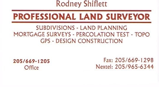
Shiflett Surveying
Shiflett Surveying
Customers say: Quick response
27 years of experience
Shiflett Surveying is a land surveying company started by Rodney Shiflett in 1998. Mr. Shiflett is involved in all aspects of every job ordered, from doing his own field work to working closely with his Autocad drafter to provide accurate and correct information.
Shiflett Surveying is a land surveying company started by Rodney Shiflett in 1998. Mr. Shiflett is involved in all aspects of every job ordered, from doing his own field work to working closely with his Autocad drafter to provide accurate and correct information.
Land Surveying questions, answered by experts
The Pine Level, AL homeowners’ guide to land surveying services
From average costs to expert advice, get all the answers you need to get your job done.
 •
•Discover site preparation cost estimates, including average prices, cost factors, and tips to help homeowners budget for their next project.

A land survey can determine your property’s borders and settle property disputes. Learn how much a land survey costs and what can affect the price.

Just bought a plot of land and need to get it build-ready? Learn how much it costs to clear land to gauge your initial budget before you break ground.
 •
•Find out how much an elevation certificate costs, including average prices, cost factors, and tips to save money when hiring a surveyor for your property.

What is a property line? Find out everything you need to know about property lines, from easements to where to build a fence and how land surveys work.

Real estate transactions often require a survey, but who pays for it? Learn who pays for a land survey in most cases and some exceptions to the norm.
- Ramer, AL Land surveyors
- Highland Home, AL Land surveyors
- Pike Road, AL Land surveyors
- Hope Hull, AL Land surveyors
- Troy, AL Land surveyors
- Montgomery, AL Land surveyors
- Shorter, AL Land surveyors
- Honoraville, AL Land surveyors
- Luverne, AL Land surveyors
- Letohatchee, AL Land surveyors
- Tuskegee, AL Land surveyors
- Wetumpka, AL Land surveyors
- Tallassee, AL Land surveyors
- Coosada, AL Land surveyors
- Clio, AL Land surveyors
- Millbrook, AL Land surveyors
- Elmore, AL Land surveyors
- Brantley, AL Land surveyors
- Mosses, AL Land surveyors
- Hayneville, AL Land surveyors
- Greenville, AL Land surveyors
- Prattville, AL Land surveyors
- Clayton, AL Land surveyors