





Land Clearing Services questions, answered by experts
The small lines on the tape measure either indicate inches, fractions of an inch, or centimeters and millimeters. On the imperial unit side (aka the inches side), the longest lines indicate inches, followed by the next shortest lines that indicate a half-inch, and then the quarter, eighth, and sixteenth-inch. On the metric side, the lines break down meters, centimeters, and millimeters.
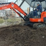
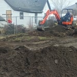
Building a road on a slope requires careful planning and will normally require a drainage system underneath to prevent flooding and damage to the road over time. Your professional may lengthen your road to create switchbacks if the slope directly to your home is too steep, as there are regulations for maximum road slope. The drainage system will help prevent runoff from the higher side of the slope from damaging the asphalt or concrete. Keep in mind that building a road on a slope isn’t a good DIY project, as a lot can go wrong.
To prepare for a land survey, you must thoroughly check your land surveyor’s qualifications, reviews, and fees to align with your expectations. When it is time for the survey to be conducted, ensure that you have all your documents organized and available, know and mark your property lines, and inform your neighbors that the survey is happening.
If you or your mortgage lender think your land survey needs to be more accurate, double-check the survey report and get at least a second opinion from the original surveyor and an inspector, if possible. Although it’s unlikely, even reputable surveying companies can make mistakes. An inaccurate survey can cause problems down the road in the case of any property line disputes, so it’s best to resolve any inaccuracies as quickly as possible.
A land survey includes the layout of a single property, including precise measurements and to-scale drawings of boundary lines, land improvements, and sometimes other features, like topography and drainage information. A plat map includes the layouts and boundary lines of several adjacent plots and basic structure measurements. Surveys are normally more valuable for homeowners and buyers, and plat maps are for governmental use.
The Eagle Mountain, UT homeowners’ guide to land clearing services
From average costs to expert advice, get all the answers you need to get your job done.