
Get matched with top land surveyors in Santa Clara, NM
Enter your zip and get matched with up to 5 pros
Need a pro for your land surveying project in Santa Clara, NM?
Select your specific project to find the pro for you.
Verified Reviews for Land Surveying pros in Santa Clara, NM
*The Angi rating for Land Surveying companies in Santa Clara, NM is a rating based on verified reviews from our community of homeowners who have used these pros to meet their Land Surveying needs.
*The HomeAdvisor rating for Land Surveying companies in Santa Clara, NM is a rating based on verified reviews from our community of homeowners who have used these pros to meet their Land Surveying needs.
Last update on December 07, 2025

Find Land surveyors in Santa Clara
BoundaryHunters LLC
BoundaryHunters LLC
Customers say: Quick response
Recommended by 100% of Angi customers
Recommended by 100% of HomeAdvisor customers
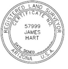
BoundaryHunters LLC provides a full array of land surveying services with specialization in boundary matters. James M (Mike) Hart has over 45 years of surveying experience and is licensed to practice surveying in 12 states. Services include land corner and boundary identification, ALTA/NSPS Land Title Surveys, expert witness testimony, and high order horizontal and vertical control.
"Not in our favor but was done fairly."
Sue S on June 2021
William J. Miller Engineers, Inc.
William J. Miller Engineers, Inc.
28 years of experience
We provide Professional Engineering Services to water users in the areas of surface and groundwater hydrology, hydraulic analysis and design, hydrologic modeling, water resource planning and development, and water right administration.
We provide Professional Engineering Services to water users in the areas of surface and groundwater hydrology, hydraulic analysis and design, hydrologic modeling, water resource planning and development, and water right administration.
Elliott Land Surveying
Elliott Land Surveying
21 years of experience
Owner operated. No subs. Cost is determined by job. Travel charges apply. Ask about Angie's List discount.
Owner operated. No subs. Cost is determined by job. Travel charges apply. Ask about Angie's List discount.
Land Surveying questions, answered by experts
The Santa Clara, NM homeowners’ guide to land surveying services
From average costs to expert advice, get all the answers you need to get your job done.
 •
•Discover site preparation cost estimates, including average prices, cost factors, and tips to help homeowners budget for their next project.

A land survey can determine your property’s borders and settle property disputes. Learn how much a land survey costs and what can affect the price.

Just bought a plot of land and need to get it build-ready? Learn how much it costs to clear land to gauge your initial budget before you break ground.
 •
•Find out how much an elevation certificate costs, including average prices, cost factors, and tips to save money when hiring a surveyor for your property.

Boundary surveys and topographic surveys provide important information about a property. Learn the differences between boundary and topographic surveys.

Wondering whether you need a land survey or a plot plan? Learn about the differences between the two, when to do each, and what information they provide.