
Get matched with top land surveyors in Murdock, FL
Enter your zip and get matched with up to 5 pros
Need a pro for your land surveying project in Murdock, FL?
Select your specific project to find the pro for you.
TRUSTED BY MURDOCK, FL HOMEOWNERS
 4.3 Average homeowner rating
 20 Verified land surveying services reviews
Verified Reviews for Land Surveying pros in Murdock, FL
*The Angi rating for Land Surveying companies in Murdock, FL is a rating based on verified reviews from our community of homeowners who have used these pros to meet their Land Surveying needs.
*The HomeAdvisor rating for Land Surveying companies in Murdock, FL is a rating based on verified reviews from our community of homeowners who have used these pros to meet their Land Surveying needs.
Last update on November 25, 2025

Find Land surveyors in Murdock
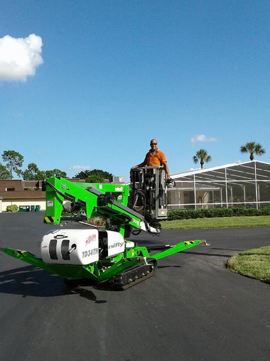
John Ibarra & Associates, Inc
John Ibarra & Associates, Inc
Customers say: Quality work
Recommended by 100% of Angi customers
Recommended by 100% of HomeAdvisor customers
108 local quotes requested
John Ibarra and Associates, Inc. is an established land surveying firm serving South Florida for over 35 years. John Ibarra and Associates, Inc specializes in the rapid and accurate production of residential boundary surveys for the land title, mortgage banking, and real estate industries, as well as Surveys for construction purposes. All of our Surveys come with original signed and sealed color copies. We cover areas from Homestead through Tampa, FL (including Miami, Broward, Palm Beach, Lee, Collier, Brevard, St. Lucie, Charlotte & Sarasota county) and our standard Surveys (up to 7,500 Sq. Ft. +/-) including elevation certificate (if in a flood zone) would be $375.00 with a standard time-frame of 5-7 business days
"It went well. Had the field surveryor on property within 2 days of my payment. There was a delay of almost 2 weeks to get the survey, and I went in person to pick it up because my architect wanted some originals to look at. Other than that, the staff was nice and professional, and they delivered on a job well done."
Danielle P on May 2025

Protek Land Clearing
Protek Land Clearing
50 years of experience
Land clearing, forestry mulching, tree removal, underbrush clearing services provided with 15 years of hands-on experience. Services cover Southwest Florida. Lee, Collier, Hendry, Charlotte Counties. We're a full service land clearing company, with forestry mulching and tree removal in Lee, Charlotte, Collier, and Hendry Counties.
Land clearing, forestry mulching, tree removal, underbrush clearing services provided with 15 years of hands-on experience. Services cover Southwest Florida. Lee, Collier, Hendry, Charlotte Counties. We're a full service land clearing company, with forestry mulching and tree removal in Lee, Charlotte, Collier, and Hendry Counties.
DimTec 3D, LLC
DimTec 3D, LLC
11 years of experience
DimTec 3D offers hardware and software rental solutions in the field of 3D Laser Scanning. Our FARO Focus 3D Laser Scanner is annually calibrated to assure optimal accuracy.
DimTec 3D offers hardware and software rental solutions in the field of 3D Laser Scanning. Our FARO Focus 3D Laser Scanner is annually calibrated to assure optimal accuracy.
Bean Whitaker Lutz & Kareh Inc
Bean Whitaker Lutz & Kareh Inc
Customers say: Quick response
Recommended by 100% of Angi customers
Recommended by 100% of HomeAdvisor customers
We strive to produce high quality professional work in a timely manner to meet our clients' needs. Bean, Whitaker, Lutz and Kareh, Inc. has been providing surveying, planning, permitting and engineering services to Southwest Florida since 1963, along with our predecessor, Howell F. Davis & Associates, Inc. Our document and drawing files are one of the largest private sources of property in Southwest Florida. Our planning services include: • Development feasibility reports • Preliminary site plans • Applications for public hearing Our engineering services include design of: • Roads • Sewer • Water • Drainage systems • Landscaping and irrigation systems Surveys and mapping services include: • Elevation certificates • Boundary surveys • Surveys for land development • Lot fit studies • Plot plans See our website for more information.
"We were referred to this company by a friend who, months prior, had their own property surveyed. They were so impressed with the quality, responsiveness, and timely execution of the project that they made sure we checked them out. We are incredibly happy that we did! The detail of their work and their drawings are perfect and very easy to follow! They were very professional to deal with, very punctual and responsive. I was given an estimated time of about 2 weeks to get four (4) .25 acre lots surveyed, but instead they were out surveying the lots within the first half of the week after talking to the representative - FAST. When I was watching the survey crew, it looked like they were using some pretty high tech equipment, and the guys were very nice. There was a hiccup in communication, and that could have been our fault as well as we were not diligent in following-up with our representative when we had questions. But, overall the finished product was a fair value and we will certainly use them again, as well as highly recommend them to others."
Patrick M on June 2018
Efficient Builders, LLC
Efficient Builders, LLC
21 years of experience
General Contractor with a primary focus on Design/Build
General Contractor with a primary focus on Design/Build
AllState Surveying
AllState Surveying
Free onsite estimate
Florida Land Surveyors & Mappers. We Specialize in every aspect of Land Surveying and Mapping; Boundary Surveys, Topographies, Building Layout and additions, New Fence, Construction Surveys, Property Line Dispute Surveys, FEMA Flood Certificates for Flood Insurance and that's just to name a few. Click here for a Complete List of our Services. We Service every County in Florida and utilize the Latest Equipment and Software available in the Field of Surveying and Mapping. We provide: Computer Drafted Survey in Full Color A Flattering Photo of your Property on the Front All Property Corners Clearly Marked Digitally Sealed Surveys available via Email Fastest Turnaround time in the Business Statewide Coverage area Give us a Call at (888) 569-0480 to discuss what Survey is right for your situation. We are happy to answer any questions you may have.
Florida Land Surveyors & Mappers. We Specialize in every aspect of Land Surveying and Mapping; Boundary Surveys, Topographies, Building Layout and additions, New Fence, Construction Surveys, Property Line Dispute Surveys, FEMA Flood Certificates for Flood Insurance and that's just to name a few. Click here for a Complete List of our Services. We Service every County in Florida and utilize the Latest Equipment and Software available in the Field of Surveying and Mapping. We provide: Computer Drafted Survey in Full Color A Flattering Photo of your Property on the Front All Property Corners Clearly Marked Digitally Sealed Surveys available via Email Fastest Turnaround time in the Business Statewide Coverage area Give us a Call at (888) 569-0480 to discuss what Survey is right for your situation. We are happy to answer any questions you may have.
Fema Certs, Inc.
Fema Certs, Inc.
19 years of experience
We provide "Elevation Certificates" for clients applying for flood insurance.
We provide "Elevation Certificates" for clients applying for flood insurance.
Miller Surveying, Inc.
Miller Surveying, Inc.
23 years of experience
Miller Surveying established in 2002. 4 employees, cost for surveying services are determined on case by case basis.
Miller Surveying established in 2002. 4 employees, cost for surveying services are determined on case by case basis.
Surveying and Mapping, Inc.
Surveying and Mapping, Inc.
22 years of experience
Surveying and Mapping, Inc. Surveying and Mapping, Inc. is a multi-disciplined firm. We offer a wide variety of Professional Surveying Services for strictly Surveying projects or to compliment Engineers, Architects, Planners and other Design Professionals. Surveying and Mapping, Inc. specializes in Commercial and Residential Construction projects of all sizes. Our experience in these fields keeps all of our projects moving efficiently in all phases, through to completion. We work closely with our Clients and their Engineer, Legal Counsel and Contractors; so we can save our clients time and complete their projects on schedule. As well as Private Projects, Surveying and Mapping, Inc.’s experience encompasses Government and Public Projects. Services that we offer are as follows: Surveys: Boundary, Topographic, Development Order, Mean High Water, Submerged Land Lease, Condominium, Alta/Ascm, Mortgage, Right-of-Way, Pool, Utility, Route, As-Built, Environmental, Hydrographic, Bathymetric and Specific Purpose. FEMA Elevation Certificates amd E-Loma's. Site Geometry: Site layout and geometry, including coordination of building and site infrastructure. Platting: Complete Platting services; from the preliminary plat through the compilation of all required submittal items, to the execution and recording of the final plat. Mapping: Full Color Sales Maps, Preliminary Plats, Subdivision Maps, Condominium Exhibits and Specialty Mapping. Legal Services: Title Report and Encumbrance reviews, Deed review and plotting, Easement and Boundary Legal Descriptions. Construction: Complete Layout, Staking and As-Built of Site Infrastructure and Buildings. Condominium: Surveys and Exhibits for Declaration of Condominium Filings.
Surveying and Mapping, Inc. Surveying and Mapping, Inc. is a multi-disciplined firm. We offer a wide variety of Professional Surveying Services for strictly Surveying projects or to compliment Engineers, Architects, Planners and other Design Professionals. Surveying and Mapping, Inc. specializes in Commercial and Residential Construction projects of all sizes. Our experience in these fields keeps all of our projects moving efficiently in all phases, through to completion. We work closely with our Clients and their Engineer, Legal Counsel and Contractors; so we can save our clients time and complete their projects on schedule. As well as Private Projects, Surveying and Mapping, Inc.’s experience encompasses Government and Public Projects. Services that we offer are as follows: Surveys: Boundary, Topographic, Development Order, Mean High Water, Submerged Land Lease, Condominium, Alta/Ascm, Mortgage, Right-of-Way, Pool, Utility, Route, As-Built, Environmental, Hydrographic, Bathymetric and Specific Purpose. FEMA Elevation Certificates amd E-Loma's. Site Geometry: Site layout and geometry, including coordination of building and site infrastructure. Platting: Complete Platting services; from the preliminary plat through the compilation of all required submittal items, to the execution and recording of the final plat. Mapping: Full Color Sales Maps, Preliminary Plats, Subdivision Maps, Condominium Exhibits and Specialty Mapping. Legal Services: Title Report and Encumbrance reviews, Deed review and plotting, Easement and Boundary Legal Descriptions. Construction: Complete Layout, Staking and As-Built of Site Infrastructure and Buildings. Condominium: Surveys and Exhibits for Declaration of Condominium Filings.
Land Surveying questions, answered by experts
The Murdock, FL homeowners’ guide to land surveying services
From average costs to expert advice, get all the answers you need to get your job done.
 •
•Discover site preparation cost estimates, including average prices, cost factors, and tips to help homeowners budget for their next project.

A land survey can determine your property’s borders and settle property disputes. Learn how much a land survey costs and what can affect the price.

Just bought a plot of land and need to get it build-ready? Learn how much it costs to clear land to gauge your initial budget before you break ground.

Boundary surveys and topographic surveys provide important information about a property. Learn the differences between boundary and topographic surveys.

What is a property line? Find out everything you need to know about property lines, from easements to where to build a fence and how land surveys work.

Not sure what kind of property survey you need? Learn about the differences between a land survey vs. a boundary survey to get started.
- Port Charlotte, FL Land surveyors
- North Port, FL Land surveyors
- Venice, FL Land surveyors
- Englewood, FL Land surveyors
- Punta Gorda, FL Land surveyors
- Rotonda West, FL Land surveyors
- Placida, FL Land surveyors
- Boca Grande, FL Land surveyors
- Laurel, FL Land surveyors
- North Venice, FL Land surveyors
- Nokomis, FL Land surveyors
- Myakka City, FL Land surveyors
- Osprey, FL Land surveyors
- Arcadia, FL Land surveyors
- Bokeelia, FL Land surveyors
- Sarasota, FL Land surveyors
- North Fort Myers, FL Land surveyors
- Cape Coral, FL Land surveyors
- Fruitville, FL Land surveyors
- Siesta Key, FL Land surveyors
- Tice, FL Land surveyors
- University Park, FL Land surveyors
- Saint James City, FL Land surveyors
- Fort Myers, FL Land surveyors
- Captiva, FL Land surveyors
- Tallevast, FL Land surveyors
- Lakewood Ranch, FL Land surveyors
- Bradenton, FL Land surveyors
- Oneco, FL Land surveyors
- Alva, FL Land surveyors