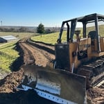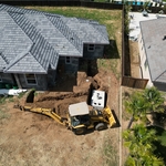



Top-rated land clearing pros.

Get matched with top land clearing pros in Lathrop, CA

Enter your zip and get matched with up to 5 pros

Need a pro for your land clearing project in Lathrop, CA?

Select your specific project to find the pro for you.

TRUSTED BY LATHROP, CA HOMEOWNERS

  • Average homeowner rating star icon4.5
    Average homeowner rating
  • Verified reviews icon261
    Verified land clearing services reviews

Find Land clearing pros in Lathrop

Elite Rooter
4.0(
2
)
Building Site - Preparation and ClearingBuilding Site - Preparation and Clearing - For Business

Serving Lathrop, CA and surrounding areas

Credit card accepted

"I hired Elite to look at my sewer line. I was having multiple back ups and was concerned my line was plugged up. The technician came out and asked me a series of questions that helped narrow down the issue. He ran a camera down the line and whatever he been plugging the line up had finally gone threw. He was very professional, knowledgeable and polite. I would definitely hire them again. Kudos to Elite!!!’"
Recommended by100%of homeowners

Showing 1-10 of 17
Land Clearing Services questions, answered by experts

A boundary survey measures the boundary lines of the property, only the length of each property line and their locations. A land survey includes a more in-depth measurement of the property, including the heights and depths of the terrain measured by a topographic survey. A boundary survey is typically the most cost-effective method for marking and measuring property lines.

The small lines on the tape measure either indicate inches, fractions of an inch, or centimeters and millimeters. On the imperial unit side (aka the inches side), the longest lines indicate inches, followed by the next shortest lines that indicate a half-inch, and then the quarter, eighth, and sixteenth-inch. On the metric side, the lines break down meters, centimeters, and millimeters.

There are a couple of ways you can determine the depth of your well. One method is to use a device called a well sounder. This tool has a long measuring tape containing a sensor to alert you once the end reaches the water. 

Or you can DIY it by using a long tape measure with a half-filled bottle of water attached to it. Lower the tape measure into your well. Once you feel tension on the tape, you’ll know the bottle has reached your static water level. This will give you an approximate idea of your well’s depth.

It is almost always necessary to hire a land surveyor near you to ensure your fence sits on the right side of the property line. Mistaking the shape of your property can lead to fines and costly changes if you have to move or adjust the privacy fence—not to mention some surly looks from your neighbor. We recommend jumpstarting your fence planning in the spring to ensure there is plenty of time to map out your plan before construction season.

Professional well contractors may use electromagnetic mapping to look for places with a high likelihood of water. Water access can vary significantly, even on the same property, so it can be difficult to know where to drill if you don’t have specialized tools to look for water.

The Lathrop, CA homeowners’ guide to land clearing services

From average costs to expert advice, get all the answers you need to get your job done.