



Top-rated land clearing pros.

Get matched with top land clearing pros in Stanton, TX

Enter your zip and get matched with up to 5 pros

Need a pro for your land clearing project in Stanton, TX?

Select your specific project to find the pro for you.

Find Land clearing pros in Stanton

Avatar for DIamond G Land Services LLC
DIamond G Land Services LLC
4.8(
23
)
Building Site - Preparation and ClearingBuilding Site - Preparation and Clearing - For Business

Serving Stanton, TX and surrounding areas

Approved

In business since 2021

Free estimates

Warranties offered

"Curtis cleaned out my pond, dug it deeper and lined it with clay..He was there when he said he would be, and did a great job..His price seemed fair for what he had to do, and overall, Curtis was a great guy to work with!..If I had to have more excavation work, I would certainly give Curtis a call!"
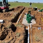
Our Work
Our Work
Our Work
Our Work
Our Work

+5

Response time1 day
Response rate88%
Recommended by85%of homeowners
Triple G Containers & Services
5.0(
6
)
Building Site - Preparation and ClearingBuilding Site - Preparation and Clearing - For Business

Serving Stanton, TX and surrounding areas

In business since 2020

Free estimates

Emergency services offered

"Great customer service, on time with delivery and pickup, very professional and dedicated to serving our community. Very affordable and they go over and above to help. Weâ ve used Triple G for dirt work, rentals, demo and land clearing! Highly recommend. Give them a call donâ t hesitate!"
Recommended by100%of homeowners
Showing 1-10 of 45
Land Clearing Services questions, answered by experts

A boundary survey measures the boundary lines of the property, only the length of each property line and their locations. A land survey includes a more in-depth measurement of the property, including the heights and depths of the terrain measured by a topographic survey. A boundary survey is typically the most cost-effective method for marking and measuring property lines.

Professional well contractors may use electromagnetic mapping to look for places with a high likelihood of water. Water access can vary significantly, even on the same property, so it can be difficult to know where to drill if you don’t have specialized tools to look for water.

A land survey includes the layout of a single property, including precise measurements and to-scale drawings of boundary lines, land improvements, and sometimes other features, like topography and drainage information. A plat map includes the layouts and boundary lines of several adjacent plots and basic structure measurements. Surveys are normally more valuable for homeowners and buyers, and plat maps are for governmental use.

When planning for land survey costs, you should consider the following elements as major contributors to the overall cost:

  • Size of your property in terms of acres or square feet

  • Complexity of the terrain in terms of hills, elevation changes, rocks, water, and other features

  • Type of survey you need (boundary survey, topographic survey, or a combination of survey types)

  • Distance traveled for the professional surveyor

Depending on property size and complexity, usually 1-3 weeks.

The Stanton, TX homeowners’ guide to land clearing services

From average costs to expert advice, get all the answers you need to get your job done.