Get matched with top land surveyors in Guyton, GA
Enter your ZIP and get matched with up to 5 pros
Need a pro for your land surveying project in Guyton, GA?
Verified Reviews for Land Surveying pros in Guyton, GA
*The Angi rating for Land Surveying companies in Guyton, GA is a rating based on verified reviews from our community of homeowners who have used these pros to meet their Land Surveying needs.
*The HomeAdvisor rating for Land Surveying companies in Guyton, GA is a rating based on verified reviews from our community of homeowners who have used these pros to meet their Land Surveying needs.
Last update on December 05, 2025
Find Land surveyors in Guyton
D&L Land Services
D&L Land Services
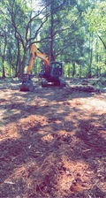
D&L is a small local business owned by two brothers. D&L offers a wide variety of land management which may include driveways, drainage issues, tree services, excavation, grading, pasture installations, pond construction, and much more.
D&L is a small local business owned by two brothers. D&L offers a wide variety of land management which may include driveways, drainage issues, tree services, excavation, grading, pasture installations, pond construction, and much more.
Surveying Consultants
Surveying Consultants
Surveying Consultants is a local and regional corporation dedicated to providing quality professional land information services since 1983. Our firm is headquartered in Bluffton, SC, with a field staging office in Rincon, GA. It was founded in 1983 by Terry Hatchell, PLS. The firm has been in continuous operation since its conception under his direction. We provide professional services in SC and GA, and provide support surveying in NY, VA, MI, PA, FL and many other states. Our dedicated professional and technical staff includes registered land surveyors, party chiefs, certified survey technicians, CAD mapping technicians and office support personnel. Surveying Consultant’s continuing goal is to provide responsive high quality professional services on time and at a fair fee in order to meet complex challenges in an ever changing economy. The firm has specialized expertise and extensive experience in geodetic control, photogrammetric control, boundary, right of way, topographic, construction stakeout, landfills, borrow and dike construction, bridge construction, elevation certificates, asbuilts, ALTA/ACSM land title, hydrographic and coastal critical and wetland lines mapping, predesign and post design surveys. Surveying Consultants analyzes each project from its conception and designs a unique approach which will assure quality, timely delivery and on budget.
Surveying Consultants is a local and regional corporation dedicated to providing quality professional land information services since 1983. Our firm is headquartered in Bluffton, SC, with a field staging office in Rincon, GA. It was founded in 1983 by Terry Hatchell, PLS. The firm has been in continuous operation since its conception under his direction. We provide professional services in SC and GA, and provide support surveying in NY, VA, MI, PA, FL and many other states. Our dedicated professional and technical staff includes registered land surveyors, party chiefs, certified survey technicians, CAD mapping technicians and office support personnel. Surveying Consultant’s continuing goal is to provide responsive high quality professional services on time and at a fair fee in order to meet complex challenges in an ever changing economy. The firm has specialized expertise and extensive experience in geodetic control, photogrammetric control, boundary, right of way, topographic, construction stakeout, landfills, borrow and dike construction, bridge construction, elevation certificates, asbuilts, ALTA/ACSM land title, hydrographic and coastal critical and wetland lines mapping, predesign and post design surveys. Surveying Consultants analyzes each project from its conception and designs a unique approach which will assure quality, timely delivery and on budget.
Custom Craftsmen
Custom Craftsmen
General Contractor
General Contractor

Brewer Land Surveying
Brewer Land Surveying
Brewer Land Surveying is a full-service, fully automated Land Surveying firm licensed for operation in Georgia and South Carolina. Some of the services we offer are: •FEMA Flood Elevation Certificates •Boundary Surveys •Topographical Surveys •Foundation Surveys •As-built Surveys •ALTA/ACSM Land Title Surveys •Subdivision Plats •Construction Layout •GPS Control Points •Route Surveys •Mapping for GIS infrastructure projects •Aerial Photography Control Targeting Please contact us today to discuss your needs. There is no charge for estimates. We welcome the opportunity to earn your trust and to provide you with the best service in the industry.
Brewer Land Surveying is a full-service, fully automated Land Surveying firm licensed for operation in Georgia and South Carolina. Some of the services we offer are: •FEMA Flood Elevation Certificates •Boundary Surveys •Topographical Surveys •Foundation Surveys •As-built Surveys •ALTA/ACSM Land Title Surveys •Subdivision Plats •Construction Layout •GPS Control Points •Route Surveys •Mapping for GIS infrastructure projects •Aerial Photography Control Targeting Please contact us today to discuss your needs. There is no charge for estimates. We welcome the opportunity to earn your trust and to provide you with the best service in the industry.
The Guyton, GA homeowners’ guide to land surveying services
From average costs to expert advice, get all the answers you need to get your job done.
 •
•Discover site preparation cost estimates, including average prices, cost factors, and tips to help homeowners budget for their next project.

A land survey can determine your property’s borders and settle property disputes. Learn how much a land survey costs and what can affect the price.

Just bought a plot of land and need to get it build-ready? Learn how much it costs to clear land to gauge your initial budget before you break ground.

Not sure what kind of property survey you need? Learn about the differences between a land survey vs. a boundary survey to get started.

If you've just been told that you need a land survey to continue your project, what time of land survey do you really need? Here are eight main options.

Knowing where your property lines are can help settle a dispute with a neighbor and even prevent an ugly legal battle. This guide will help you draw the line.
- Rincon, GA Land surveyors
- Ellabell, GA Land surveyors
- Brooklet, GA Land surveyors
- Port Wentworth, GA Land surveyors
- Pembroke, GA Land surveyors
- Hardeeville, SC Land surveyors
- Garden City, GA Land surveyors
- Pineland, SC Land surveyors
- Savannah, GA Land surveyors
- Statesboro, GA Land surveyors
- Ridgeland, SC Land surveyors
- Coosawhatchie, SC Land surveyors
- Register, GA Land surveyors
- Thunderbolt, GA Land surveyors
- Bluffton, SC Land surveyors
- Skidaway Island, GA Land surveyors
- Okatie, SC Land surveyors
- Claxton, GA Land surveyors
- Fort Stewart, GA Land surveyors
- Sylvania, GA Land surveyors
- Hagan, GA Land surveyors
- Portal, GA Land surveyors
- Roofing in Guyton
- Plumbing in Guyton
- Tree Service in Guyton
- Cleaning in Guyton
- Landscaping in Guyton
- Lawn And Yard Work in Guyton
- Septic Tank in Guyton
- Swimming Pools in Guyton
- Electrical in Guyton
- Concrete Repair in Guyton
- Flooring in Guyton
- Mailbox Repair in Guyton
- Siding in Guyton
- Carpet Cleaning in Guyton
- Pest Control in Guyton
- Pressure Washing in Guyton
- Moving in Guyton
- Garage Builders in Guyton
- Windows in Guyton
- Excavating in Guyton
- Handyman Service in Guyton
- Small Appliance Repair in Guyton
- Mold Testing And Remediation in Guyton
- Solar Panels in Guyton
- Insulation in Guyton
- Stone And Gravel in Guyton
- Garbage Collection in Guyton
- Painting in Guyton
- Doors in Guyton
- Dryer Vent Cleaning in Guyton
- 🌱 "Mow a small front yard"
- 🛠 "Fix a leaking pipe under the sink"
- 🏠 "Repair shingles on an asphalt roof"


