
Get matched with top land surveyors in Mobile, AL
Enter your zip and get matched with up to 5 pros
Need a pro for your land surveying project in Mobile, AL?
Select your specific project to find the pro for you.
Verified Reviews for Land Surveying pros in Mobile, AL
*The Angi rating for Land Surveying companies in Mobile, AL is a rating based on verified reviews from our community of homeowners who have used these pros to meet their Land Surveying needs.
*The HomeAdvisor rating for Land Surveying companies in Mobile, AL is a rating based on verified reviews from our community of homeowners who have used these pros to meet their Land Surveying needs.
Last update on December 04, 2025
Find Land surveyors in Mobile
C Dubb's Land Clearing
C Dubb's Land Clearing
At C Dubb's Land Clearing, we understand the importance of transforming raw land into a canvas that suits your vision. We are thrilled to introduce our comprehensive range of services, specializing in forestry mulching, land clearing, site preparation, excavation, and dirt work. Thank you for considering C Dubb's Land Clearing for your land transformation needs. We look forward to partnering with you and bringing your customer's vision to life. Best regards, C Dubb's Land Clearing Jack Farrell
At C Dubb's Land Clearing, we understand the importance of transforming raw land into a canvas that suits your vision. We are thrilled to introduce our comprehensive range of services, specializing in forestry mulching, land clearing, site preparation, excavation, and dirt work. Thank you for considering C Dubb's Land Clearing for your land transformation needs. We look forward to partnering with you and bringing your customer's vision to life. Best regards, C Dubb's Land Clearing Jack Farrell
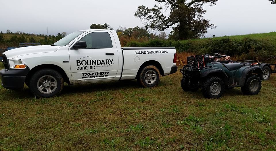
Boundary Zone - Miramar Beach
Boundary Zone - Miramar Beach
21 years of experience
We have a team of Professional Surveyors that provide residential surveying and construction staking. Our Specialties include Boundary Surveys, ALTA (American Land Title Association), Topographic and Tree Surveys, Existing Conditions, As-built, Site Maps, Plot Surveys, Construction Surveys, Drone Mapping, & Elevation Certificates. We take pride in serving our clients with accurate surveys that are orientated to customer service.
We have a team of Professional Surveyors that provide residential surveying and construction staking. Our Specialties include Boundary Surveys, ALTA (American Land Title Association), Topographic and Tree Surveys, Existing Conditions, As-built, Site Maps, Plot Surveys, Construction Surveys, Drone Mapping, & Elevation Certificates. We take pride in serving our clients with accurate surveys that are orientated to customer service.
EARTHWORK OUTLAWS
EARTHWORK OUTLAWS
Emergency services offered
Let us help you improve your property value with our top of the line equipment and staff! We pride ourselves on our customer satisfaction and hospitality. We offer all earthwork, landscaping, driveway, dirt, fencing, and many more services with FREE ESTIMATES!!!
Let us help you improve your property value with our top of the line equipment and staff! We pride ourselves on our customer satisfaction and hospitality. We offer all earthwork, landscaping, driveway, dirt, fencing, and many more services with FREE ESTIMATES!!!
G&N Construction
G&N Construction
Construction, maintenance, land clearing
Construction, maintenance, land clearing
Erik Ford DBA
Erik Ford DBA
Licensed drone operator that can provide your aerial needs. Been flying drones for over 5 years. I have a passion for flying drones and its a neat perspective so far above the ground. Willing to travel. We can provide you with aerial photography as well as aerial cinematography. Can take pictures of properties for you marketing and insurance purposes. Can also perform roof inspections of your house/business. Also have the capacity to map land of your chosing. I use Dronelink, Dronedeploy, Verifly, and Air Control. We do adhere to all FAA and TSA regulations.
Licensed drone operator that can provide your aerial needs. Been flying drones for over 5 years. I have a passion for flying drones and its a neat perspective so far above the ground. Willing to travel. We can provide you with aerial photography as well as aerial cinematography. Can take pictures of properties for you marketing and insurance purposes. Can also perform roof inspections of your house/business. Also have the capacity to map land of your chosing. I use Dronelink, Dronedeploy, Verifly, and Air Control. We do adhere to all FAA and TSA regulations.

Polysurveying
Polysurveying
54 years of experience
Polysurveying, founded in 1971, has provided land surveying and mapping services to a wide variety of professional industries along the Gulf Coast, for over fifty years. Our mission is to provide fast and reliable service, while maintaining, the quality of work our clients have come to expect in order to put their needs ahead of our own. We are a family owned and operated firm that has maintained a strong hold in our roots at our Corporate office in Mobile, AL. We since expanded over the years to cover the Gulf Coast Regions of Alabama, Mississippi and Florida with our field divisions to better serve our clients to ensure we provide the foundation for their future growth and expansion within both the Homebuilding and private sectors, as well as in support of our ALTA and Drone divisions.
Polysurveying, founded in 1971, has provided land surveying and mapping services to a wide variety of professional industries along the Gulf Coast, for over fifty years. Our mission is to provide fast and reliable service, while maintaining, the quality of work our clients have come to expect in order to put their needs ahead of our own. We are a family owned and operated firm that has maintained a strong hold in our roots at our Corporate office in Mobile, AL. We since expanded over the years to cover the Gulf Coast Regions of Alabama, Mississippi and Florida with our field divisions to better serve our clients to ensure we provide the foundation for their future growth and expansion within both the Homebuilding and private sectors, as well as in support of our ALTA and Drone divisions.

J. Pierce and Associates, LLC.
J. Pierce and Associates, LLC.
16 years of experience
JPA also offers a full range of professional geomatics (surveying) services. From residential boundary surveys to complex GIS mapping projects, we know how to use the latest technology to fit your needs. JPA has also pioneered the survey-grade GIS for utilities market and will be glad to introduce you to all this amazing resource has to offer.
JPA also offers a full range of professional geomatics (surveying) services. From residential boundary surveys to complex GIS mapping projects, we know how to use the latest technology to fit your needs. JPA has also pioneered the survey-grade GIS for utilities market and will be glad to introduce you to all this amazing resource has to offer.
5 Star Drone Video and Photography services
5 Star Drone Video and Photography services
6 years of experience
I can offer complete packages that can include Aerial photos and videos with ground photos and videos all in one price With over 4 years experience I bring something other photographers may not offer my services are all inclusive with no limit on video and photos to you
I can offer complete packages that can include Aerial photos and videos with ground photos and videos all in one price With over 4 years experience I bring something other photographers may not offer my services are all inclusive with no limit on video and photos to you
Daphne Land Surveying
Daphne Land Surveying
Daphne Land Surveying offers all types of land surveying services in Daphne and the surrounding areas. We complete ALTA Surveys, boundary, property or ranch surveys, topographic surveys, construction surveys, pipeline surveys, and communication tower surveys. Call us today for an estimate.
Daphne Land Surveying offers all types of land surveying services in Daphne and the surrounding areas. We complete ALTA Surveys, boundary, property or ranch surveys, topographic surveys, construction surveys, pipeline surveys, and communication tower surveys. Call us today for an estimate.

Bumpers Land Surveying LLC
Bumpers Land Surveying LLC
Customers say: Quick response
Recommended by 100% of Angi customers
Recommended by 100% of HomeAdvisor customers
Bumpers Land Surveying LLC is a full service surveying firm owned and operated by Clarke County Native Wesley Bumpers, PLS, PSM. Mr. Bumpers is licensed in Alabama, Florida, and Mississippi and egger to work with you on your next project. Additional email - [email protected].
Bumpers Land Surveying LLC is a full service surveying firm owned and operated by Clarke County Native Wesley Bumpers, PLS, PSM. Mr. Bumpers is licensed in Alabama, Florida, and Mississippi and egger to work with you on your next project. Additional email - [email protected].
Land Surveying questions, answered by experts
Helpful?
Helpful?
Helpful?
Helpful?
Helpful?
The Mobile, AL homeowners’ guide to land surveying services
From average costs to expert advice, get all the answers you need to get your job done.
 •
•Discover site preparation cost estimates, including average prices, cost factors, and tips to help homeowners budget for their next project.

A land survey can determine your property’s borders and settle property disputes. Learn how much a land survey costs and what can affect the price.

Just bought a plot of land and need to get it build-ready? Learn how much it costs to clear land to gauge your initial budget before you break ground.

A land surveyor can perform a land survey and help clarify your property boundaries and features. Use this guide to find the right professional.
 •
•Find out how much an elevation certificate costs, including average prices, cost factors, and tips to save money when hiring a surveyor for your property.

Not sure what kind of property survey you need? Learn about the differences between a land survey vs. a boundary survey to get started.
- Chickasaw, AL Land surveyors
- Prichard, AL Land surveyors
- Semmes, AL Land surveyors
- Calvert, AL Land surveyors
- Saraland, AL Land surveyors
- Theodore, AL Land surveyors
- Satsuma, AL Land surveyors
- Wilmer, AL Land surveyors
- Georgetown, AL Land surveyors
- Creola, AL Land surveyors
- Axis, AL Land surveyors
- Irvington, AL Land surveyors
- Spanish Fort, AL Land surveyors
- Daphne, AL Land surveyors
- Grand Bay, AL Land surveyors
- Hurley, MS Land surveyors
- Lucedale, MS Land surveyors
- Bayou La Batre, AL Land surveyors
- Point Clear, AL Land surveyors
- Coden, AL Land surveyors
- Fairhope, AL Land surveyors
- Citronelle, AL Land surveyors
- Mount Vernon, AL Land surveyors
- Loxley, AL Land surveyors
- Bay Minette, AL Land surveyors
- Bucks, AL Land surveyors
- Silverhill, AL Land surveyors
- Moss Point, MS Land surveyors
- Big Point, MS Land surveyors
- Helena, MS Land surveyors