

Top-rated land clearing pros.

Best land clearing pros near Copake Falls, NY

Enter your zip and get matched with up to 5 pros

Need a pro for your land clearing project in Copake Falls, NY?

Select your specific project to find the pro for you.

TRUSTED BY COPAKE FALLS, NY HOMEOWNERS

  • Average homeowner rating star icon4.4
    Average homeowner rating
  • Verified reviews icon107
    Verified land clearing services reviews

Top-Rated Land clearing pros in Copake Falls - Updated Nov 2026

Avatar for C2G Environmental Consultants LLC
C2G Environmental Consultants LLC
5.0(
20
)
Building Site - Preparation and ClearingBuilding Site - Preparation and Clearing - For Business

Serving Copake Falls, NY and surrounding areas

Approved

In business since 2004

Free estimates

Emergency services offered

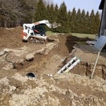
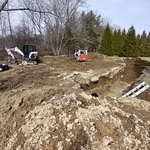
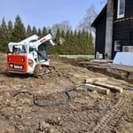
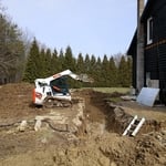
"Two man crew. On-time. Assessed area, brought in back hoe, very organized, dug hole, and removed tank. Removed all hose lines in the house where connections were. Filled in holes, cleared area, very professional and through. We purchased top soil and reseeded lawn after C2G left."
Recommended by100%of homeowners
Hudson Valley Hauling and Junk Removal, LLC
5.0(
7
)
Building Site - Preparation and Clearing - For Business

Serving Copake Falls, NY and surrounding areas

In business since 2020

Free estimates

Emergency services offered

"After the pandemic my entire backyard looked like a junkyard..and I had continued to amass more junk as I failed to deal with it. Finally, I had enough and called HVH to take care of it. They did an incredible, timely, cleanup job! Now I can finally have friends over for backyard BBQs again!"
My jobs
My jobs
My jobs
My jobs
My jobs

+41

Response time11 hrs
Recommended by83%of homeowners
Showing 1-10 of 39
Land Clearing Services FAQs, answered by experts

A land survey includes the layout of a single property, including precise measurements and to-scale drawings of boundary lines, land improvements, and sometimes other features, like topography and drainage information. A plat map includes the layouts and boundary lines of several adjacent plots and basic structure measurements. Surveys are normally more valuable for homeowners and buyers, and plat maps are for governmental use.
This is fairly rare, but sometimes the local government or a group like a historical society will label a tree as a landmark, or historical item. These designations almost always come with a small, on-site plaque for identification, but you should also be able to look up protected trees in your area on a city website or similar list. If the tree in question is a landmark, call your local government and ask how to proceed before making any plans.

Before property transactions or major improvements to ensure accuracy.

There are a couple of ways you can determine the depth of your well. One method is to use a device called a well sounder. This tool has a long measuring tape containing a sensor to alert you once the end reaches the water. 

Or you can DIY it by using a long tape measure with a half-filled bottle of water attached to it. Lower the tape measure into your well. Once you feel tension on the tape, you’ll know the bottle has reached your static water level. This will give you an approximate idea of your well’s depth.

A land survey defines and records the physical aspects of a property, including its boundaries, dimensions, easements, features, and sometimes topographical information. In contrast, a land appraisal determines the property's monetary value. While an appraiser will often consult a land survey to understand the property's physical specifications, the survey itself does not determine the land's value.

The Copake Falls, NY homeowners’ guide to land clearing services

From average costs to expert advice, get all the answers you need to get your job done.