




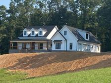

Top-rated land clearing pros.

Get matched with top land clearing pros in Redkey, IN

Enter your zip and get matched with up to 5 pros

Need a pro for your land clearing project in Redkey, IN?

Select your specific project to find the pro for you.

TRUSTED BY REDKEY, IN HOMEOWNERS

  • Average homeowner rating star icon4.5
    Average homeowner rating
  • Verified reviews icon38
    Verified land clearing services reviews

Find Land clearing pros in Redkey

Avatar for Bales Construction
Bales Construction
5.0(
5
)
Building Site - Preparation and Clearing

Serving Redkey, IN and surrounding areas

In business since 2016

Free estimates

Credit card accepted

"Bales Construction did an amazing job with our home renovation. We live in an old farmhouse that needed major renovation through the entire home. Even with the challenges of an old home, they did a great job on everything. Our contractor, Jake and his team, transformed our house into a home. They added a bathroom upstairs and reconfigured the entire floor, remodeled the dining room, kitchen, half bath, mudroom/laundry room, and master suite shower, added a pantry, and relocated our back door to make better use of our space. I recommend them for any project you have on your wish list!"
Response time10 mins
Showing 1-10 of 38
Land Clearing Services questions, answered by experts

A few different types of land surveys can help determine certain features and boundaries of your property. These include:

  • Boundary surveys describe the actual borders of a property. These are generally required when trying to get construction permits issued. 

  • Location surveys provide much of the same information as a boundary survey but also include in-depth information about any improvements made to your property. 

  • Mortgage location surveys are usually required by lenders and title companies before financing or offering an insurance policy. 

  • Site-planning surveys are done before applying for building permits and can be issued before any major home improvements. 

  • Topographic surveys provide a formal map of land elevations. It can also describe the location and size of natural features and any land improvements.

A land survey can take anywhere from a few hours to a month or more, depending on the size of the property, the type of survey, the property’s accessibility and topography, and the availability of historical property records. A simple boundary survey to determine a fence line can be completed in a day while surveying 50 acres of undeveloped woodlands may take weeks or longer.

Professional well contractors may use electromagnetic mapping to look for places with a high likelihood of water. Water access can vary significantly, even on the same property, so it can be difficult to know where to drill if you don’t have specialized tools to look for water.

Depending on the type of land survey, the report will mark the boundaries of your property, the topographical changes of the landscape, as well as major natural and added structures to the plot. A more detailed survey, like an as-built survey, will note the measurements of the structures and landscape following major construction. A topographic survey will also help your contractor determine the cost of land development projects.

Pros will assess your soil type, property geography, and rain patterns for optimal slope.

The Redkey, IN homeowners’ guide to land clearing services

From average costs to expert advice, get all the answers you need to get your job done.