
Get matched with top land surveyors in Lake Havasu City, AZ
Enter your ZIP and get matched with up to 5 pros
Need a pro for your land surveying project in Lake Havasu City, AZ?
Select your specific project to find the pro for you.
Find Land surveyors in Lake Havasu City
Hess & Co LLC
Hess & Co LLC
Super Service Award
38 local quotes requested
Free onsite estimate
We pride our company on reliability, great communication, integrity, and quality work. Our top priority is customer satisfaction and will go the extra mile. We are experts in our trade and will work with you from conception to competition. We strive in making all clients, repeat clients. We are licensed in Arizona and California. We have over 50 combined years of experience. Call us today @ 928 275-9793 be relieved you did. Thank you
"Friendly, Knowledgeable, Professional and Courteous."
Margaret H on June 2025
Stovall Land Surveying
Stovall Land Surveying
Land Sruveying survices, in Arizona, Nevada, Utah and Californi. Boundary Surveys, lot surveys, topographic surveys
Land Sruveying survices, in Arizona, Nevada, Utah and Californi. Boundary Surveys, lot surveys, topographic surveys
LiDAR America inc
LiDAR America inc
Lidar America Inc, is a company specialized in Aircraft and Drone mapping, providing Lidar and photogrammetry services in aircrafts and UAS (drone). Manned (aircraft) and unmanned (Drone UAV) aerial survey with LiDAR (Light Detection and Ranging) to produce topographic Lidar products and photogrammetry images. We perform, Topographic Lidar, Lidar Aerial, Lidar Survey, Aerial Mapping, Aerial Lidar, Topographic survey, Drone Survey, UAV Survey, Drone Lidar Mapping, Aerial Drone Services, Drone Inspection and drone services in California, South Nevada and West Arizona.
Lidar America Inc, is a company specialized in Aircraft and Drone mapping, providing Lidar and photogrammetry services in aircrafts and UAS (drone). Manned (aircraft) and unmanned (Drone UAV) aerial survey with LiDAR (Light Detection and Ranging) to produce topographic Lidar products and photogrammetry images. We perform, Topographic Lidar, Lidar Aerial, Lidar Survey, Aerial Mapping, Aerial Lidar, Topographic survey, Drone Survey, UAV Survey, Drone Lidar Mapping, Aerial Drone Services, Drone Inspection and drone services in California, South Nevada and West Arizona.
BoundaryHunters LLC
BoundaryHunters LLC
Customers say: Quick response
Recommended by 100% of Angi customers
Recommended by 100% of HomeAdvisor customers
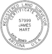
BoundaryHunters LLC provides a full array of land surveying services with specialization in boundary matters. James M (Mike) Hart has over 45 years of surveying experience and is licensed to practice surveying in 12 states. Services include land corner and boundary identification, ALTA/NSPS Land Title Surveys, expert witness testimony, and high order horizontal and vertical control.
"Not in our favor but was done fairly."
Sue S on June 2021
K&B Construction, Inc.
K&B Construction, Inc.
10 years of experience
With over 40 Years of construction experience the dedicated Pros of K&B are ready to go to work for you. At K&B providing quality service, and a quality product whether a new custom home, new commercial office space or an RV Garage addition. K&B knows that quality service means providing the best pricing on the best product and that the best product means understanding that living in and with that new home or remodel must be both a pleasure and must be affordable. K&B incorporates the newest methods, materials, and construction techniques to insure you, our clients, the highest quality construction at the lowest possible price.
With over 40 Years of construction experience the dedicated Pros of K&B are ready to go to work for you. At K&B providing quality service, and a quality product whether a new custom home, new commercial office space or an RV Garage addition. K&B knows that quality service means providing the best pricing on the best product and that the best product means understanding that living in and with that new home or remodel must be both a pleasure and must be affordable. K&B incorporates the newest methods, materials, and construction techniques to insure you, our clients, the highest quality construction at the lowest possible price.
RLF Consulting
RLF Consulting
19 years of experience
Founded in 2006 by licensed professional land surveyor, Ryan Fidler, RLF Consulting has been a groundbreaking force in the field of land surveying and civil engineering. We pioneered drone mapping, becoming indispensable partners during the emergence and evolution of 3G, 4G, and the current 5G telecommunications phases. We have established trust with numerous government agencies and private organizations by providing a broad array of services, including boundary surveying, topographic surveys, and construction staking. Our footprint extends across the Southwest USA, where we've successfully managed some of the region's most extensive projects. Our unwavering commitment to innovation, accuracy, client satisfaction, and excellence is the bedrock of our operations. As we continue to embrace technology and adapt to market dynamics, our mission remains to deliver unparalleled professional services, upholding our position as a leading surveying and civil engineering firm.
Founded in 2006 by licensed professional land surveyor, Ryan Fidler, RLF Consulting has been a groundbreaking force in the field of land surveying and civil engineering. We pioneered drone mapping, becoming indispensable partners during the emergence and evolution of 3G, 4G, and the current 5G telecommunications phases. We have established trust with numerous government agencies and private organizations by providing a broad array of services, including boundary surveying, topographic surveys, and construction staking. Our footprint extends across the Southwest USA, where we've successfully managed some of the region's most extensive projects. Our unwavering commitment to innovation, accuracy, client satisfaction, and excellence is the bedrock of our operations. As we continue to embrace technology and adapt to market dynamics, our mission remains to deliver unparalleled professional services, upholding our position as a leading surveying and civil engineering firm.
Land Surveying questions, answered by experts
The Lake Havasu City, AZ homeowners’ guide to land surveying services
From average costs to expert advice, get all the answers you need to get your job done.
 •
•Discover site preparation cost estimates, including average prices, cost factors, and tips to help homeowners budget for their next project.

A land survey can determine your property’s borders and settle property disputes. Learn how much a land survey costs and what can affect the price.

Just bought a plot of land and need to get it build-ready? Learn how much it costs to clear land to gauge your initial budget before you break ground.
 •
•Find out how much an elevation certificate costs, including average prices, cost factors, and tips to save money when hiring a surveyor for your property.

Not sure what kind of property survey you need? Learn about the differences between a land survey vs. a boundary survey to get started.

Knowing where your property lines are can help settle a dispute with a neighbor and even prevent an ugly legal battle. This guide will help you draw the line.
- Bouse, AZ Land surveyors
- Quartzsite, AZ Land surveyors
- Salome, AZ Land surveyors
- Ehrenberg, AZ Land surveyors
- Blythe, CA Land surveyors
- Wenden, AZ Land surveyors
- Bagdad, AZ Land surveyors
- Kingman, AZ Land surveyors
- Dolan Springs, AZ Land surveyors
- Searchlight, NV Land surveyors
- Aguila, AZ Land surveyors
- Congress, AZ Land surveyors
- Peach Springs, AZ Land surveyors
- Yarnell, AZ Land surveyors
- Skull Valley, AZ Land surveyors
- Meadview, AZ Land surveyors
- Wickenburg, AZ Land surveyors
- Kirkland, AZ Land surveyors
- Plumbing in Lake Havasu City
- Roofing in Lake Havasu City
- Tree Service in Lake Havasu City
- Garage Doors in Lake Havasu City
- Electrical in Lake Havasu City
- Kitchen And Bath Remodeling in Lake Havasu City
- Flooring in Lake Havasu City
- Landscaping in Lake Havasu City
- Lawn And Yard Work in Lake Havasu City
- Moving in Lake Havasu City
- Garage Builders in Lake Havasu City
- Handyman Service in Lake Havasu City
- Carpet Cleaning in Lake Havasu City
- Swimming Pools in Lake Havasu City
- Mailbox Repair in Lake Havasu City
- Dumpster Rental in Lake Havasu City
- Concrete Repair in Lake Havasu City
- Landscaping Hardscaping And Pavers in Lake Havasu City
- Contractor in Lake Havasu City
- Deck Maintenance in Lake Havasu City
- Insulation in Lake Havasu City
- Garbage Collection in Lake Havasu City
- Mold Testing And Remediation in Lake Havasu City
- Drywall in Lake Havasu City
- Screen Repair in Lake Havasu City
- Pressure Washing in Lake Havasu City
- Countertops in Lake Havasu City
- Sunroom And Patio Remodeling in Lake Havasu City
- Air Duct Cleaning in Lake Havasu City
- Cabinet Makers in Lake Havasu City
What do you need done? We’ll find top pros.
- 🌱 "Mow a small front yard"
- 🛠 "Fix a leaking pipe under the sink"
- 🏠 "Repair shingles on an asphalt roof"