
Get matched with top land surveyors in Samantha, AL
Enter your ZIP and get matched with up to 5 pros
Need a pro for your land surveying project in Samantha, AL?
Select your specific project to find the pro for you.
Find Land surveyors in Samantha
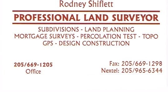
Shiflett Surveying
Shiflett Surveying
Customers say: Quick response
27 years of experience
Shiflett Surveying is a land surveying company started by Rodney Shiflett in 1998. Mr. Shiflett is involved in all aspects of every job ordered, from doing his own field work to working closely with his Autocad drafter to provide accurate and correct information.
Shiflett Surveying is a land surveying company started by Rodney Shiflett in 1998. Mr. Shiflett is involved in all aspects of every job ordered, from doing his own field work to working closely with his Autocad drafter to provide accurate and correct information.
Land Surveying questions, answered by experts
The Samantha, AL homeowners’ guide to land surveying services
From average costs to expert advice, get all the answers you need to get your job done.
 •
•Discover site preparation cost estimates, including average prices, cost factors, and tips to help homeowners budget for their next project.

A land survey can determine your property’s borders and settle property disputes. Learn how much a land survey costs and what can affect the price.

Just bought a plot of land and need to get it build-ready? Learn how much it costs to clear land to gauge your initial budget before you break ground.

Boundary surveys and topographic surveys provide important information about a property. Learn the differences between boundary and topographic surveys.

Not sure what kind of property survey you need? Learn about the differences between a land survey vs. a boundary survey to get started.

Knowing where your property lines are can help settle a dispute with a neighbor and even prevent an ugly legal battle. This guide will help you draw the line.
- Berry, AL Land surveyors
- Coker, AL Land surveyors
- Buhl, AL Land surveyors
- Gordo, AL Land surveyors
- Northport, AL Land surveyors
- Fayette, AL Land surveyors
- Tuscaloosa, AL Land surveyors
- Reform, AL Land surveyors
- Skyland, AL Land surveyors
- Oakman, AL Land surveyors
- Fosters, AL Land surveyors
- Cottondale, AL Land surveyors
- Coaling, AL Land surveyors
- Adger, AL Land surveyors
- Duncanville, AL Land surveyors
- Carrollton, AL Land surveyors
- Pickensville, AL Land surveyors
- Ralph, AL Land surveyors
- Townley, AL Land surveyors
- Parrish, AL Land surveyors
- Quinton, AL Land surveyors
- Millport, AL Land surveyors
- Moundville, AL Land surveyors
- Vance, AL Land surveyors
- Carbon Hill, AL Land surveyors
- Brookwood, AL Land surveyors
- Plumbing in Samantha
- Roofing in Samantha
- Plumbing in Samantha
- Tree Service in Samantha
- Electrical in Samantha
- Kitchen And Bath Remodeling in Samantha
- Lawn And Yard Work in Samantha
- Foundation Repair in Samantha
- Swimming Pools in Samantha
- Landscaping in Samantha
- Pest Control in Samantha
- Garage Doors in Samantha
- Flooring in Samantha
- Septic Tank in Samantha
- Windows in Samantha
- Concrete Repair in Samantha
- Cleaning in Samantha
- Pressure Washing in Samantha
- Exterior Painting in Samantha
- Siding in Samantha
- Garbage Collection in Samantha
- Handyman Service in Samantha
- Excavating in Samantha
- Moving in Samantha
- Insulation in Samantha
- Driveways in Samantha
- Concrete Driveways in Samantha
- Sunroom And Patio Remodeling in Samantha
- Water And Smoke Damage in Samantha
- Gutter Cleaning in Samantha