
Get matched with top land surveyors in Buhl, AL
Enter your ZIP and get matched with up to 5 pros
Need a pro for your land surveying project in Buhl, AL?
Select your specific project to find the pro for you.
Find Land surveyors in Buhl
EARTHWORK OUTLAWS
EARTHWORK OUTLAWS
Emergency services offered
Let us help you improve your property value with our top of the line equipment and staff! We pride ourselves on our customer satisfaction and hospitality. We offer all earthwork, landscaping, driveway, dirt, fencing, and many more services with FREE ESTIMATES!!!
Let us help you improve your property value with our top of the line equipment and staff! We pride ourselves on our customer satisfaction and hospitality. We offer all earthwork, landscaping, driveway, dirt, fencing, and many more services with FREE ESTIMATES!!!

W&A Alabama
W&A Alabama
26 years of experience
W&A Alabama is a leading provider of LiDAR, land surveying, and land planning-related services with over 25 years of industry-related experience.
W&A Alabama is a leading provider of LiDAR, land surveying, and land planning-related services with over 25 years of industry-related experience.

Abel Drone Services, LLC
Abel Drone Services, LLC
7 years of experience
Abel Drone Services, LLC is a new veteran owned and operated enthusiast license drone company based in Gadsden, Alabama that serves the U.S. Government, law enforcement agencies, residential, commercial, and industrial clients in the United States, particularly in Alabama, Georgia, Mississippi, Tennessee and Florida. We offer a wide range of services such as Aerial Area Mapping, Construction Site Progress Tracking, support all levels of Search & Rescue Operations, External & Internal Infrastructure Damage Inspections, Insurance Property Claims, Roof Inspections and, provide 4K high-quality Videos along with Photos of those memorable events in life.
Abel Drone Services, LLC is a new veteran owned and operated enthusiast license drone company based in Gadsden, Alabama that serves the U.S. Government, law enforcement agencies, residential, commercial, and industrial clients in the United States, particularly in Alabama, Georgia, Mississippi, Tennessee and Florida. We offer a wide range of services such as Aerial Area Mapping, Construction Site Progress Tracking, support all levels of Search & Rescue Operations, External & Internal Infrastructure Damage Inspections, Insurance Property Claims, Roof Inspections and, provide 4K high-quality Videos along with Photos of those memorable events in life.
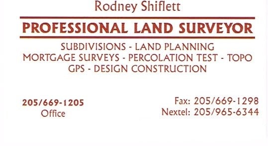
Shiflett Surveying
Shiflett Surveying
Customers say: Quick response
27 years of experience
Shiflett Surveying is a land surveying company started by Rodney Shiflett in 1998. Mr. Shiflett is involved in all aspects of every job ordered, from doing his own field work to working closely with his Autocad drafter to provide accurate and correct information.
Shiflett Surveying is a land surveying company started by Rodney Shiflett in 1998. Mr. Shiflett is involved in all aspects of every job ordered, from doing his own field work to working closely with his Autocad drafter to provide accurate and correct information.
Land Surveying questions, answered by experts
The Buhl, AL homeowners’ guide to land surveying services
From average costs to expert advice, get all the answers you need to get your job done.
 •
•Discover site preparation cost estimates, including average prices, cost factors, and tips to help homeowners budget for their next project.

A land survey can determine your property’s borders and settle property disputes. Learn how much a land survey costs and what can affect the price.

Just bought a plot of land and need to get it build-ready? Learn how much it costs to clear land to gauge your initial budget before you break ground.

Not sure what kind of property survey you need? Learn about the differences between a land survey vs. a boundary survey to get started.

Wondering whether you need a land survey or a plot plan? Learn about the differences between the two, when to do each, and what information they provide.

Land surveys provide an accurate record of your property. Learn how long a land survey is good for and when you should have your property resurveyed.
- Coker, AL Land surveyors
- Northport, AL Land surveyors
- Fosters, AL Land surveyors
- Tuscaloosa, AL Land surveyors
- Gordo, AL Land surveyors
- Skyland, AL Land surveyors
- Ralph, AL Land surveyors
- Berry, AL Land surveyors
- Reform, AL Land surveyors
- Moundville, AL Land surveyors
- Cottondale, AL Land surveyors
- Pickensville, AL Land surveyors
- Carrollton, AL Land surveyors
- Duncanville, AL Land surveyors
- Coaling, AL Land surveyors
- Aliceville, AL Land surveyors
- Fayette, AL Land surveyors
- Eutaw, AL Land surveyors
- Adger, AL Land surveyors
- Millport, AL Land surveyors
- Vance, AL Land surveyors
- Mccalla, AL Land surveyors
- Lake View, AL Land surveyors
- Oakman, AL Land surveyors
- Plumbing in Buhl
- Septic Tank in Buhl
- Tree Service in Buhl
- Handyman Service in Buhl
- Cleaning in Buhl
- Exterior Painting in Buhl
- Moving in Buhl
- Electrical in Buhl
- Mailbox Repair in Buhl
- Foundation Repair in Buhl
- Small Appliance Repair in Buhl
- Roofing in Buhl
- Landscaping in Buhl
- Kitchen And Bath Remodeling in Buhl
- Window Cleaning in Buhl
- Deck Maintenance in Buhl
- Epoxy Flooring in Buhl
- Lawn And Yard Work in Buhl
- Plaster Plaster Repair in Buhl
- Siding in Buhl
- Swimming Pools in Buhl
- Pressure Washing in Buhl
- Roofing in Buhl
- Plumbing in Buhl
- Tree Service in Buhl
- Electrical in Buhl
- Kitchen And Bath Remodeling in Buhl
- Lawn And Yard Work in Buhl
- Foundation Repair in Buhl
- Swimming Pools in Buhl