
Get matched with top land surveyors in Mcalester, OK
Enter your zip and get matched with up to 5 pros
Need a pro for your land surveying project in Mcalester, OK?
Select your specific project to find the pro for you.
Find Land surveyors in Mcalester
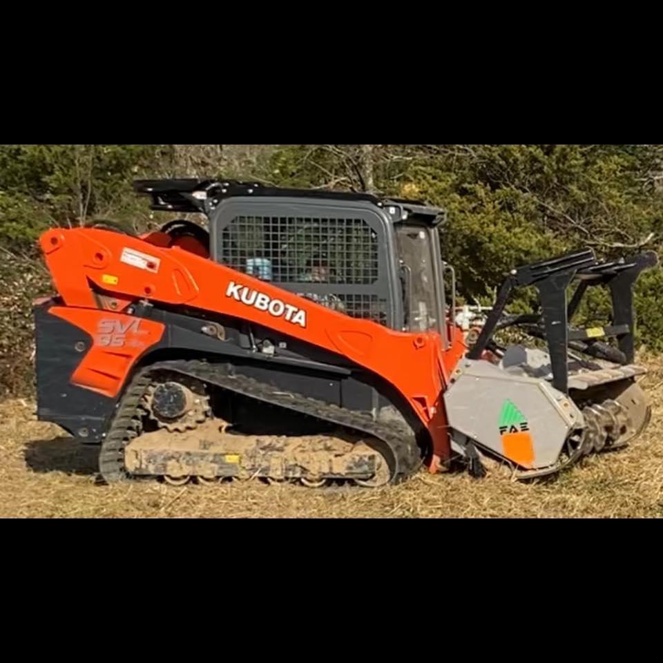
B5 Land Clearing
B5 Land Clearing
The most eco-friendly way to get rid of any trees or brush off of your property! If you need a pond dam, fence row, grazing area or trails cut please give us a call or feel free to message us!
The most eco-friendly way to get rid of any trees or brush off of your property! If you need a pond dam, fence row, grazing area or trails cut please give us a call or feel free to message us!

Foresight Land Surveying
Foresight Land Surveying
Customers say: Quick response
Recommended by 100% of Angi customers
Recommended by 100% of HomeAdvisor customers
Professional Land Surveying company serving eastern Oklahoma with the services they expect from a large company, but with the feel of a family-owned business.
Professional Land Surveying company serving eastern Oklahoma with the services they expect from a large company, but with the feel of a family-owned business.
JM Russell Land Surveying
JM Russell Land Surveying
46 years of experience
JM Russell Land Surveyors are experienced and licensed to practice land surveying for boundary, platting. topographic and A.L.T.A. surveys in Denton, Cooke and Dallas counties, north Texas and southern Oklahoma. We offer a 10% discount honoring our military as well as a 10% discount for senior citizens.
JM Russell Land Surveyors are experienced and licensed to practice land surveying for boundary, platting. topographic and A.L.T.A. surveys in Denton, Cooke and Dallas counties, north Texas and southern Oklahoma. We offer a 10% discount honoring our military as well as a 10% discount for senior citizens.
Aaron L Morris RPLS
Aaron L Morris RPLS
Free onsite estimate
Aaron L Morris RPLS
Aaron L Morris RPLS
Oklahoma Survey Co
Oklahoma Survey Co
Customers say: Super punctual
20 years of experience
Our business was established in 2005. We provide surveying services across the state. We use top of the line GPS and total station surveying equipment. Our customers enjoy the fact that the person answering the phone is the same person that is on site and performing the survey in the field. Additional address - 3121 E. Sorghum Mill Rd. Edmond, OK 73034
Our business was established in 2005. We provide surveying services across the state. We use top of the line GPS and total station surveying equipment. Our customers enjoy the fact that the person answering the phone is the same person that is on site and performing the survey in the field. Additional address - 3121 E. Sorghum Mill Rd. Edmond, OK 73034
Land Surveying questions, answered by experts
The Mcalester, OK homeowners’ guide to land surveying services
From average costs to expert advice, get all the answers you need to get your job done.
 •
•Discover site preparation cost estimates, including average prices, cost factors, and tips to help homeowners budget for their next project.

A land survey can determine your property’s borders and settle property disputes. Learn how much a land survey costs and what can affect the price.

Just bought a plot of land and need to get it build-ready? Learn how much it costs to clear land to gauge your initial budget before you break ground.

Not sure what kind of property survey you need? Learn about the differences between a land survey vs. a boundary survey to get started.

Wondering whether you need a land survey or a plot plan? Learn about the differences between the two, when to do each, and what information they provide.

Knowing where your property lines are can help settle a dispute with a neighbor and even prevent an ugly legal battle. This guide will help you draw the line.