
Get matched with top land surveyors in Calcutta, OH
Enter your zip and get matched with up to 5 pros
Need a pro for your land surveying project in Calcutta, OH?
Select your specific project to find the pro for you.
Verified Reviews for Land Surveying pros in Calcutta, OH
*The Angi rating for Land Surveying companies in Calcutta, OH is a rating based on verified reviews from our community of homeowners who have used these pros to meet their Land Surveying needs.
*The HomeAdvisor rating for Land Surveying companies in Calcutta, OH is a rating based on verified reviews from our community of homeowners who have used these pros to meet their Land Surveying needs.
Last update on December 02, 2025
Find Land surveyors in Calcutta
ECS Surveying, LLC
ECS Surveying, LLC
2 years of experience
ECS is equipped to handle any residential or commercial surveying project, no matter how large or small. ECS is a full service surveying firm, offering a wide array of survey services across the Greater Cleveland and Columbus regions. We understand that every project is an important project and we focus on accuracy and communication from start to finish to ensure a complete process. Using our expertise, ECS is able to tailor one of our multiple services to handle our clients overall objective in an accurate and cost-efficient way.
ECS is equipped to handle any residential or commercial surveying project, no matter how large or small. ECS is a full service surveying firm, offering a wide array of survey services across the Greater Cleveland and Columbus regions. We understand that every project is an important project and we focus on accuracy and communication from start to finish to ensure a complete process. Using our expertise, ECS is able to tailor one of our multiple services to handle our clients overall objective in an accurate and cost-efficient way.

Above It Contracting
Above It Contracting
Welcome to Above It Contracting! Serving Allegheny County and surrounding areas with expert home remodel needs, moving and delivery services, and many other general contracting purposes.
Welcome to Above It Contracting! Serving Allegheny County and surrounding areas with expert home remodel needs, moving and delivery services, and many other general contracting purposes.
Leaseazr Services, LLC
Leaseazr Services, LLC
Free onsite estimate
Property management real estate rental services marketing services
Property management real estate rental services marketing services
AAA ECO CARE
AAA ECO CARE
17 years of experience
WE ARE A FULL SERVICE LANDSCAPING/MAINTENANCE COMPANY THAT CAN HANDLE ANY SIZE JOB
WE ARE A FULL SERVICE LANDSCAPING/MAINTENANCE COMPANY THAT CAN HANDLE ANY SIZE JOB

E.C. Metzger & Associates, Inc.
E.C. Metzger & Associates, Inc.
32 years of experience
We are a family owned business offering Professional Land Surveying Services in the State of Ohio (preferred area is Stark and surrounding Counties). A Professional Surveyor is always on site, taking the measurements, and determining the outcome of the survey. We strive to offer individualized service at a fair price.
We are a family owned business offering Professional Land Surveying Services in the State of Ohio (preferred area is Stark and surrounding Counties). A Professional Surveyor is always on site, taking the measurements, and determining the outcome of the survey. We strive to offer individualized service at a fair price.
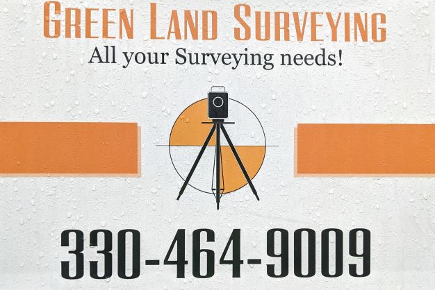
Green Land Surveying Co. LLC
Green Land Surveying Co. LLC
Customers say: Terrific value
31 years of experience
Privately Owned and operated since 1994. One Employee (me) Fully Robotic and GPS enabled Equipment All Work performed by Licensed Professional Surveyor Member of The Professional Land Surveyors of Ohio $750.00 Minimum Fee (Effective 2022/01/01) 2 to 3 Week turnaround time for Survey Report
Privately Owned and operated since 1994. One Employee (me) Fully Robotic and GPS enabled Equipment All Work performed by Licensed Professional Surveyor Member of The Professional Land Surveyors of Ohio $750.00 Minimum Fee (Effective 2022/01/01) 2 to 3 Week turnaround time for Survey Report
Land Surveying questions, answered by experts
The Calcutta, OH homeowners’ guide to land surveying services
From average costs to expert advice, get all the answers you need to get your job done.
 •
•Discover site preparation cost estimates, including average prices, cost factors, and tips to help homeowners budget for their next project.

A land survey can determine your property’s borders and settle property disputes. Learn how much a land survey costs and what can affect the price.

Just bought a plot of land and need to get it build-ready? Learn how much it costs to clear land to gauge your initial budget before you break ground.

Not sure what kind of property survey you need? Learn about the differences between a land survey vs. a boundary survey to get started.

If you've just been told that you need a land survey to continue your project, what time of land survey do you really need? Here are eight main options.

Wondering whether you need a land survey or a plot plan? Learn about the differences between the two, when to do each, and what information they provide.
- East Liverpool, OH Land surveyors
- Chester, WV Land surveyors
- Newell, WV Land surveyors
- Wellsville, OH Land surveyors
- Midland, PA Land surveyors
- Rogers, OH Land surveyors
- Industry, PA Land surveyors
- Ohioville, PA Land surveyors
- Lisbon, OH Land surveyors
- East Palestine, OH Land surveyors
- Beaver, PA Land surveyors
- Vanport, PA Land surveyors
- New Cumberland, WV Land surveyors
- New Waterford, OH Land surveyors
- Salineville, OH Land surveyors
- Patterson Heights, PA Land surveyors
- West Mayfield, PA Land surveyors
- Beaver Falls, PA Land surveyors
- Toronto, OH Land surveyors
- Big Beaver, PA Land surveyors
- Columbiana, OH Land surveyors
- Monaca, PA Land surveyors
- Leetonia, OH Land surveyors
- New Brighton, PA Land surveyors
- Clinton, PA Land surveyors
- Aliquippa, PA Land surveyors
- Rochester, PA Land surveyors
- Petersburg, OH Land surveyors
- North Braddock, PA Land surveyors
- New Beaver, PA Land surveyors