
Get matched with top land surveyors in Arapahoe, WY
Enter your ZIP and get matched with up to 5 pros
Need a pro for your land surveying project in Arapahoe, WY?
Select your specific project to find the pro for you.
Find Land surveyors in Arapahoe
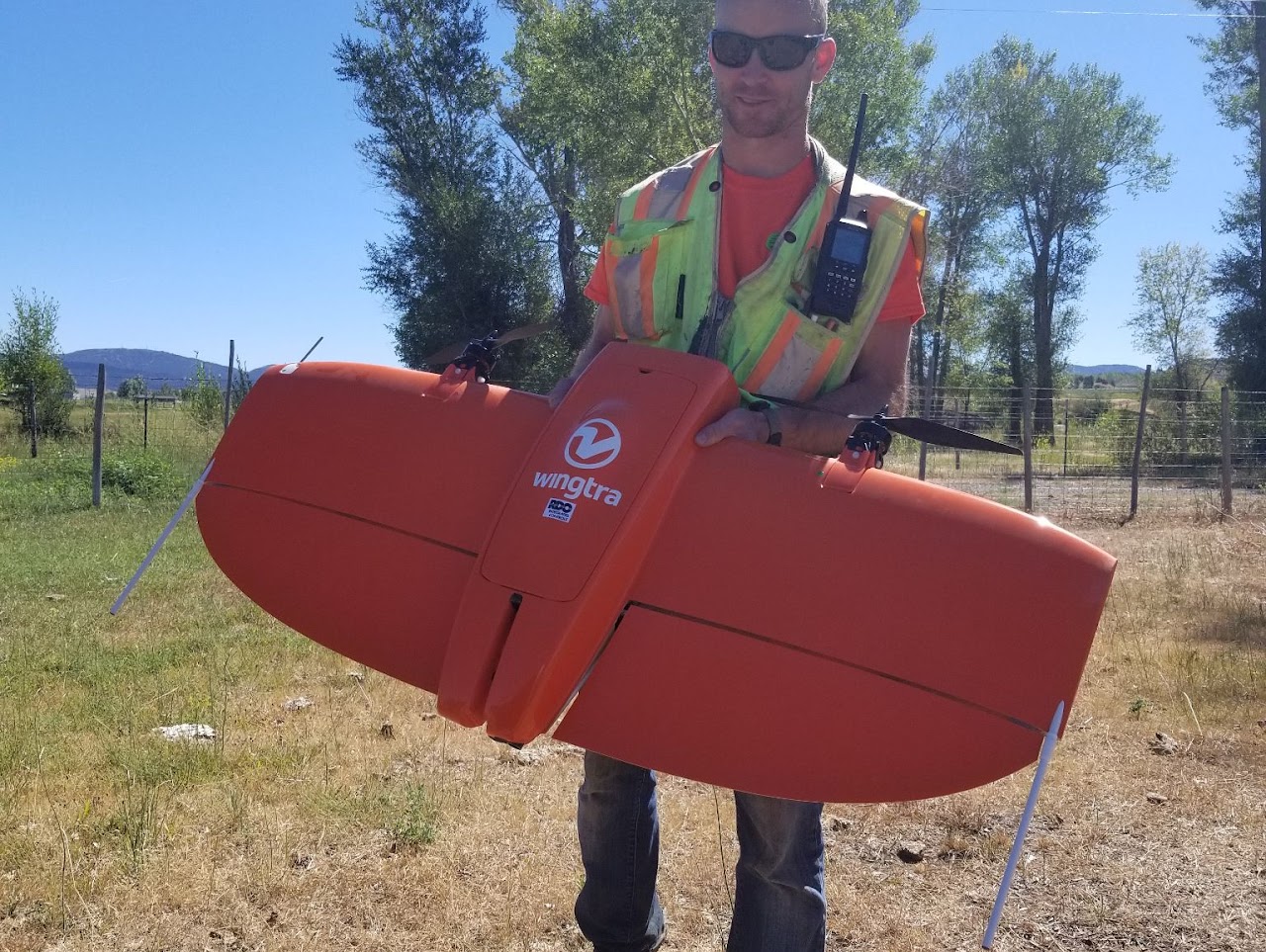
Wyoming Land to Air Surveying
Wyoming Land to Air Surveying
4 years of experience
WYLAS is reliable and hard working. We are using current and leading edge technology to ensure jobs get done on budget and and on time. Brandon has been surveying since 2010 and can provide construction staking, road design, CAD drafting, drone imagery, remotely sensed data, GIS, and top notch land surveying services now that he is licensed in Wyoming. Brandon has been focused on energy projects and has helped survey multiple transmission line and wind farm projects that range from 100-350 miles in length. Thanks to his degree in geography/remote sensing, Brandon is able to aid large companies with Standard operating procedures and workflows to deal with datum transformations, grid to ground scaling, and GIS integration for multi-state projects as they cross state and coordinate zone boundaries. Brandon specializes in lidar scanning, processing, and drone mapping for electrical substations, and can provide same day services for scanning and drone mapping projects under 10 acres. With Brandon's military background he can get through the most challenging projects and still have a smile to show at the end of the day. Brandon ensures his signature is on every project he touches which is not just limited to his stamp.
WYLAS is reliable and hard working. We are using current and leading edge technology to ensure jobs get done on budget and and on time. Brandon has been surveying since 2010 and can provide construction staking, road design, CAD drafting, drone imagery, remotely sensed data, GIS, and top notch land surveying services now that he is licensed in Wyoming. Brandon has been focused on energy projects and has helped survey multiple transmission line and wind farm projects that range from 100-350 miles in length. Thanks to his degree in geography/remote sensing, Brandon is able to aid large companies with Standard operating procedures and workflows to deal with datum transformations, grid to ground scaling, and GIS integration for multi-state projects as they cross state and coordinate zone boundaries. Brandon specializes in lidar scanning, processing, and drone mapping for electrical substations, and can provide same day services for scanning and drone mapping projects under 10 acres. With Brandon's military background he can get through the most challenging projects and still have a smile to show at the end of the day. Brandon ensures his signature is on every project he touches which is not just limited to his stamp.
WLC Engineering Surveying
WLC Engineering Surveying
19 years of experience
As a civil engineering, land surveying, GIS, grants writing and materials testing firm, WLC Engineering, Surveying, and Planning provides unparalleled customer service for quality-driven projects to public and private sector clients in Wyoming and Rocky Mountain West region. But, to really know about us, you need to know what we value most: integrity, relationships, and viability. Our success since 1948 has been largely based on our integrity. WLC believes in being fair, honest, and ethical in all of our internal and external dealings. We also believe providing high-quality technical work and services to our clients is a key component of our integrity. We understand choosing the right thing isn’t always the easy thing. WLC’s believes our integrity is a large part of our strong, statewide reputation and why our client return rate is greater than 80%. Integrity naturally breeds positive relationships. We know we prefer working with people we trust and respect. We know that you do also. WLC views our relationships with clients, employees, vendors, and partners as one of our greatest assets. Lastly, WLC continues to invest in creating a viable company each and every day. We are proud that we are the longest-standing engineering and surveying firm in Wyoming. We also know there is a reason for this: because the viability of our company is at the forefront of our decisions. To be valuable to our clients and employees, we must exist and maintain a healthy company.
As a civil engineering, land surveying, GIS, grants writing and materials testing firm, WLC Engineering, Surveying, and Planning provides unparalleled customer service for quality-driven projects to public and private sector clients in Wyoming and Rocky Mountain West region. But, to really know about us, you need to know what we value most: integrity, relationships, and viability. Our success since 1948 has been largely based on our integrity. WLC believes in being fair, honest, and ethical in all of our internal and external dealings. We also believe providing high-quality technical work and services to our clients is a key component of our integrity. We understand choosing the right thing isn’t always the easy thing. WLC’s believes our integrity is a large part of our strong, statewide reputation and why our client return rate is greater than 80%. Integrity naturally breeds positive relationships. We know we prefer working with people we trust and respect. We know that you do also. WLC views our relationships with clients, employees, vendors, and partners as one of our greatest assets. Lastly, WLC continues to invest in creating a viable company each and every day. We are proud that we are the longest-standing engineering and surveying firm in Wyoming. We also know there is a reason for this: because the viability of our company is at the forefront of our decisions. To be valuable to our clients and employees, we must exist and maintain a healthy company.
Cannon Consulting
Cannon Consulting
Cannon Consulting serves the Land Development Industry with the highest level of professionalism, honesty and integrity and welcomes the opportunity to serve your specific needs. We provide a wide variety of land surveying and mapping services for residential, commercial and oil and gas. Our mission is to ensure accuracy and the best quality while always remembering "Time is of the Essence".
Cannon Consulting serves the Land Development Industry with the highest level of professionalism, honesty and integrity and welcomes the opportunity to serve your specific needs. We provide a wide variety of land surveying and mapping services for residential, commercial and oil and gas. Our mission is to ensure accuracy and the best quality while always remembering "Time is of the Essence".
GDA Engineers
GDA Engineers
GDA Engineers located in Cody, Wyoming. We specialize in civil engineering, surveying, and planning solutions for our valued clients in Wyoming, North Dakota and across the Rocky Mountain Region. We offer the following services and more: • Engineering Design • Construction Administration • Aviation Planning • Transportation Engineering and Surveying • Land Development Engineering and Surveying • Site Design • Permitting • Environmental Assessments • Municipal Engineering Services • Private and Public Land Surveys • Construction Surveys • Aviation Surveys • Water Rights GDA Engineers is celebrating over 60 years of successful projects across Wyoming, Montana, Idaho, Iowa, Utah, and Colorado. Our hometown is Cody, Wyoming, but our backyard is the Mountain West. Call us for more information on the different types of engineering services we provide. We build strong relationships to meet client expectations with consistent, responsive actions providing the best possible value. Visit our website for more information or call today!
GDA Engineers located in Cody, Wyoming. We specialize in civil engineering, surveying, and planning solutions for our valued clients in Wyoming, North Dakota and across the Rocky Mountain Region. We offer the following services and more: • Engineering Design • Construction Administration • Aviation Planning • Transportation Engineering and Surveying • Land Development Engineering and Surveying • Site Design • Permitting • Environmental Assessments • Municipal Engineering Services • Private and Public Land Surveys • Construction Surveys • Aviation Surveys • Water Rights GDA Engineers is celebrating over 60 years of successful projects across Wyoming, Montana, Idaho, Iowa, Utah, and Colorado. Our hometown is Cody, Wyoming, but our backyard is the Mountain West. Call us for more information on the different types of engineering services we provide. We build strong relationships to meet client expectations with consistent, responsive actions providing the best possible value. Visit our website for more information or call today!
Land Surveying questions, answered by experts
The Arapahoe, WY homeowners’ guide to land surveying services
From average costs to expert advice, get all the answers you need to get your job done.
 •
•Discover site preparation cost estimates, including average prices, cost factors, and tips to help homeowners budget for their next project.

A land survey can determine your property’s borders and settle property disputes. Learn how much a land survey costs and what can affect the price.

Just bought a plot of land and need to get it build-ready? Learn how much it costs to clear land to gauge your initial budget before you break ground.
 •
•Find out how much an elevation certificate costs, including average prices, cost factors, and tips to save money when hiring a surveyor for your property.

Wondering whether you need a land survey or a plot plan? Learn about the differences between the two, when to do each, and what information they provide.

Knowing where your property lines are can help settle a dispute with a neighbor and even prevent an ugly legal battle. This guide will help you draw the line.
- Kitchen And Bath Remodeling in Arapahoe
- Plumbing in Arapahoe
- Tree Service in Arapahoe
- Contractor in Arapahoe
- Foundation Repair in Arapahoe
- Roofing in Arapahoe
- Plumbing in Arapahoe
- Tree Service in Arapahoe
- Kitchen And Bath Remodeling in Arapahoe
- Siding in Arapahoe
- Foundation Repair in Arapahoe
- Concrete Repair in Arapahoe
- Landscaping in Arapahoe
- Electrical in Arapahoe
- Windows in Arapahoe
- Exterior Painting in Arapahoe
- Garage Doors in Arapahoe
- Flooring in Arapahoe
- Lawn And Yard Work in Arapahoe
- Doors in Arapahoe
- Septic Tank in Arapahoe
- Excavating in Arapahoe
- Driveways in Arapahoe
- Concrete Driveways in Arapahoe
- Contractor in Arapahoe
- Insulation in Arapahoe
- Deck Maintenance in Arapahoe
- Handyman Service in Arapahoe
- Drywall in Arapahoe
- Garage Builders in Arapahoe
What do you need done? We’ll find top pros.
- 🌱 "Mow a small front yard"
- 🛠 "Fix a leaking pipe under the sink"
- 🏠 "Repair shingles on an asphalt roof"