Get matched with top land surveyors in Foxworth, MS
Enter your zip and get matched with up to 5 pros
Need a pro for your land surveying project in Foxworth, MS?
Verified Reviews for Land Surveying pros in Foxworth, MS
*The Angi rating for Land Surveying companies in Foxworth, MS is a rating based on verified reviews from our community of homeowners who have used these pros to meet their Land Surveying needs.
*The HomeAdvisor rating for Land Surveying companies in Foxworth, MS is a rating based on verified reviews from our community of homeowners who have used these pros to meet their Land Surveying needs.
Last update on December 24, 2025
Find Land surveyors in Foxworth
North Mississippi Surveying, LLC
North Mississippi Surveying, LLC
Land, Construction, Topographic Surveying, and Mapping
Land, Construction, Topographic Surveying, and Mapping
Professional Land Services, Inc.
Professional Land Services, Inc.
Since 1986, Professional Land Services, Inc. has remained as Northern Mississippi's premier land surveying firm. We're dual licensed to provide work in Tennessee, and strive to offer top quality, professional, courteous service as promptly and reasonable priced as possible. At Professional Land Services, Inc. we strive to keep pace with the most modern technology available in the surveying industry. Our field equipment includes RTK GPS equipment, static GPS equipment, and electronic robotic total stations with data collectors. We can currently equip two field crews. Our office is equipped with four computer workstations running Carlson, AutoCad, and MicroStation software for survey computations and drafting. Our services are available for walk-ins or lending agencies alike. Reference our website and contact us for your consultation, you'll be glad that you did!
Since 1986, Professional Land Services, Inc. has remained as Northern Mississippi's premier land surveying firm. We're dual licensed to provide work in Tennessee, and strive to offer top quality, professional, courteous service as promptly and reasonable priced as possible. At Professional Land Services, Inc. we strive to keep pace with the most modern technology available in the surveying industry. Our field equipment includes RTK GPS equipment, static GPS equipment, and electronic robotic total stations with data collectors. We can currently equip two field crews. Our office is equipped with four computer workstations running Carlson, AutoCad, and MicroStation software for survey computations and drafting. Our services are available for walk-ins or lending agencies alike. Reference our website and contact us for your consultation, you'll be glad that you did!
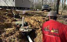
EARTHWORK OUTLAWS
EARTHWORK OUTLAWS
Let us help you improve your property value with our top of the line equipment and staff! We pride ourselves on our customer satisfaction and hospitality. We offer all earthwork, landscaping, driveway, dirt, fencing, and many more services with FREE ESTIMATES!!!
Let us help you improve your property value with our top of the line equipment and staff! We pride ourselves on our customer satisfaction and hospitality. We offer all earthwork, landscaping, driveway, dirt, fencing, and many more services with FREE ESTIMATES!!!
5 Star Drone Video and Photography services
5 Star Drone Video and Photography services
I can offer complete packages that can include Aerial photos and videos with ground photos and videos all in one price With over 4 years experience I bring something other photographers may not offer my services are all inclusive with no limit on video and photos to you
I can offer complete packages that can include Aerial photos and videos with ground photos and videos all in one price With over 4 years experience I bring something other photographers may not offer my services are all inclusive with no limit on video and photos to you
Witness Tree Forestry and Surveying, LLC
Witness Tree Forestry and Surveying, LLC
Full service land surveying company.
Full service land surveying company.
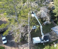
Timber Liquidators
Timber Liquidators
Forestry Consultant
Forestry Consultant
The Foxworth, MS homeowners’ guide to land surveying services
From average costs to expert advice, get all the answers you need to get your job done.
 •
•Just bought a plot of land and need to get it build-ready? Learn how much it costs to clear land to gauge your initial budget before you break ground.

Discover site preparation cost estimates, including average prices, cost factors, and tips to help homeowners budget for their next project.

A land survey can determine your property’s borders and settle property disputes. Learn how much a land survey costs and what can affect the price.

A land surveyor can perform a land survey and help clarify your property boundaries and features. Use this guide to find the right professional.

Land surveys provide an accurate record of your property. Learn how long a land survey is good for and when you should have your property resurveyed.

Boundary surveys and topographic surveys provide important information about a property. Learn the differences between boundary and topographic surveys.
- Columbia, MS Land surveyors
- Tylertown, MS Land surveyors
- Jayess, MS Land surveyors
- Monticello, MS Land surveyors
- Sumrall, MS Land surveyors
- Prentiss, MS Land surveyors
- Lumberton, MS Land surveyors
- Mccomb, MS Land surveyors
- Summit, MS Land surveyors
- Magnolia, MS Land surveyors
- Poplarville, MS Land surveyors
- Newhebron, MS Land surveyors
- Hattiesburg, MS Land surveyors
- Bogue Chitto, MS Land surveyors
- Osyka, MS Land surveyors
- Mount Olive, MS Land surveyors
- Brookhaven, MS Land surveyors
- Glendale, MS Land surveyors
- Rawls Springs, MS Land surveyors
- Arnold Line, MS Land surveyors
- Moselle, MS Land surveyors
- Purvis, MS Land surveyors
- Wesson, MS Land surveyors
- 🌱 "Mow a small front yard"
- 🛠 "Fix a leaking pipe under the sink"
- 🏠 "Repair shingles on an asphalt roof"


