
Get matched with top land surveyors in Ruston, LA
Enter your zip and get matched with up to 5 pros
Need a pro for your land surveying project in Ruston, LA?
Select your specific project to find the pro for you.
Find Land surveyors in Ruston
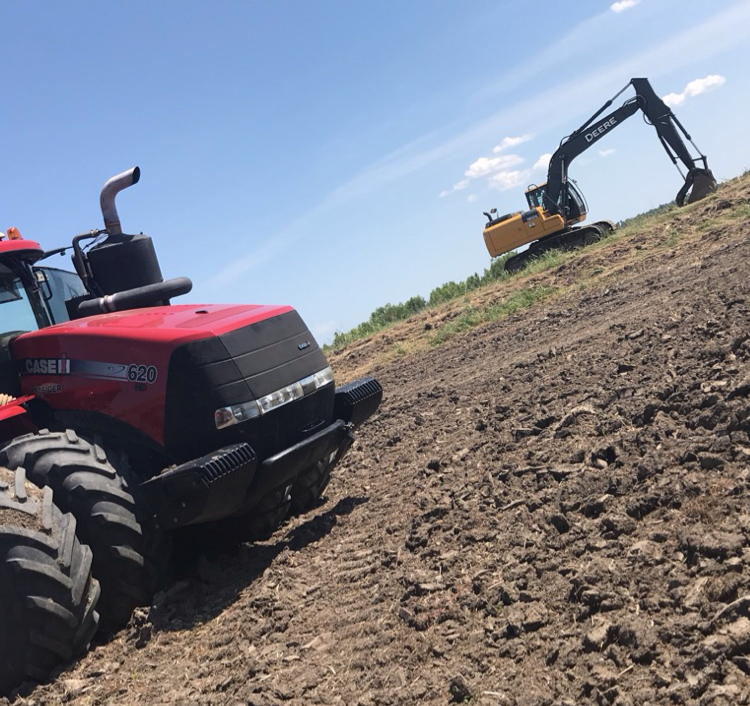
EARTHWORK OUTLAWS
EARTHWORK OUTLAWS
Emergency services offered
Let us help you improve your property value with our top of the line equipment and staff! We pride ourselves on our customer satisfaction and hospitality. We offer all earthwork, landscaping, driveway, dirt, fencing, and many more services with FREE ESTIMATES!!!
Let us help you improve your property value with our top of the line equipment and staff! We pride ourselves on our customer satisfaction and hospitality. We offer all earthwork, landscaping, driveway, dirt, fencing, and many more services with FREE ESTIMATES!!!
North Louisiana Land Leveling & Clearing
North Louisiana Land Leveling & Clearing
At North Louisiana Land Leveling we specialize in Dirt work of all kinds. Some of witch include Precision leveling for irrigation, land clearing, roads, ditches, and pads. We have been in business for over 35 years. Family owned and insured.
At North Louisiana Land Leveling we specialize in Dirt work of all kinds. Some of witch include Precision leveling for irrigation, land clearing, roads, ditches, and pads. We have been in business for over 35 years. Family owned and insured.
CMC Florida Investment Construction
CMC Florida Investment Construction
19 years of experience
Our company offers new construction and project management services for commercial, multifamily buildings and homes.
Our company offers new construction and project management services for commercial, multifamily buildings and homes.
Land Surveying questions, answered by experts
The Ruston, LA homeowners’ guide to land surveying services
From average costs to expert advice, get all the answers you need to get your job done.
 •
•Discover site preparation cost estimates, including average prices, cost factors, and tips to help homeowners budget for their next project.

A land survey can determine your property’s borders and settle property disputes. Learn how much a land survey costs and what can affect the price.
 •
•Just bought a plot of land and need to get it build-ready? Learn how much it costs to clear land to gauge your initial budget before you break ground.

Not sure what kind of property survey you need? Learn about the differences between a land survey vs. a boundary survey to get started.

What is a property line? Find out everything you need to know about property lines, from easements to where to build a fence and how land surveys work.

Real estate transactions often require a survey, but who pays for it? Learn who pays for a land survey in most cases and some exceptions to the norm.
- Roofing in Ruston
- Swimming Pools in Ruston
- Kitchen And Bath Remodeling in Ruston
- Electrical in Ruston
- Lawn And Yard Work in Ruston
- Flooring in Ruston
- Excavating in Ruston
- Mold Testing And Remediation in Ruston
- Exterior Painting in Ruston
- Tree Service in Ruston
- Landscaping in Ruston
- Windows in Ruston
- Drywall in Ruston
- Handyman Service in Ruston
- Pressure Washing in Ruston
- Moving in Ruston
- Concrete Driveways in Ruston
- Deck Maintenance in Ruston
- Mulch And Topsoil in Ruston
- Plumbing in Ruston
- Painting in Ruston
- Garage Doors in Ruston
- Concrete Repair in Ruston
- Small Appliance Repair in Ruston
- Septic Tank in Ruston
- Upholstering in Ruston
- Computer Repair in Ruston
- Mailbox Repair in Ruston
- Stone And Gravel in Ruston
- Doors in Ruston
What do you need done? We’ll find top pros.
- 🌱 "Mow a small front yard"
- 🛠 "Fix a leaking pipe under the sink"
- 🏠 "Repair shingles on an asphalt roof"