Get matched with top land surveyors in Guerneville, CA
Enter your ZIP and get matched with up to 5 pros
Need a pro for your land surveying project in Guerneville, CA?
Find Land surveyors in Guerneville

California Engineering & Surveying Inc
California Engineering & Surveying Inc
Land Surveying, Land Development, ALTA Survey, ADU Survey, Civil Engineering, Tentative Maps, Parcel Maps, Tract Maps, Lot Line Adjustments, Elevation Certifications, SWPPP, Stormwater, Street Plans, Sewer Plans, Site Plans, Water Plans, Improvement Plans, Utility Plans, Grading Plans
"We had been looking for someone for weeks. Larry responded to my inquiry within 24 hours and was able to help us with the land survey in less than a week. Very pleased with his quick response. I will definitely recommend him to friends and family."
Leticia G on April 2024

North Bay Land Surveyors
North Bay Land Surveyors
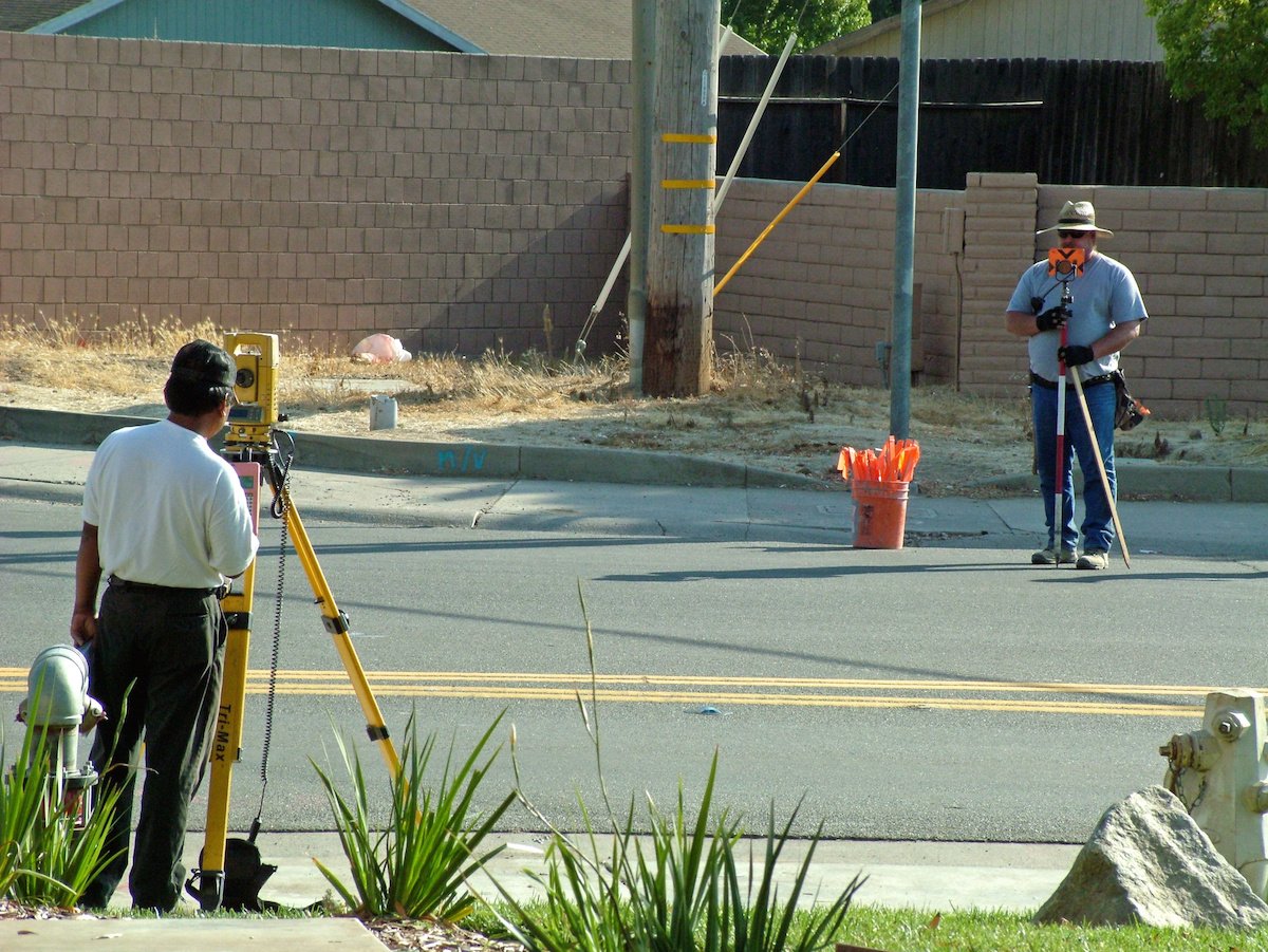
North Bay Land Surveyors have been providing boundary, staking and construction support services to Sonoma County and the North Bay for over 35 years. We're locally owned and available for quick turnaround projects. Our competitive rates and efficiency in the field means jobs are done within their budget and, most importantly, on-time. Whether its locating a property line to build a fence, topographic maps for future construction or staking a site for the home of your dreams, North Bay Land Surveyors are who Sonoma County locals call to get the job done right.
North Bay Land Surveyors have been providing boundary, staking and construction support services to Sonoma County and the North Bay for over 35 years. We're locally owned and available for quick turnaround projects. Our competitive rates and efficiency in the field means jobs are done within their budget and, most importantly, on-time. Whether its locating a property line to build a fence, topographic maps for future construction or staking a site for the home of your dreams, North Bay Land Surveyors are who Sonoma County locals call to get the job done right.
Adobe Associates Inc.
Adobe Associates Inc.
[Visit www.adobeinc.com for more details.] Recognized as one of the top Land Surveying and Civil Engineering firms in the North Bay, Adobe Associates, Inc. provides Land Surveying, Civil Engineering, Land Planning, and Wastewater Design services for the development of private and public projects. Since 1982 Adobe Associates, Inc. has helped thousands of clients to maximize the value of their projects by finding potential opportunities others often miss, creating practical, accurate design solutions, and guiding projects through the often onerous Regulatory Process. Our Civil Engineering and Land Surveying company is proud to be a family business built on honesty, integrity, and dependability.
[Visit www.adobeinc.com for more details.] Recognized as one of the top Land Surveying and Civil Engineering firms in the North Bay, Adobe Associates, Inc. provides Land Surveying, Civil Engineering, Land Planning, and Wastewater Design services for the development of private and public projects. Since 1982 Adobe Associates, Inc. has helped thousands of clients to maximize the value of their projects by finding potential opportunities others often miss, creating practical, accurate design solutions, and guiding projects through the often onerous Regulatory Process. Our Civil Engineering and Land Surveying company is proud to be a family business built on honesty, integrity, and dependability.
Focused Aerial Imagery
Focused Aerial Imagery
Focused Aerial Imagery Service supercharges marketing materials with jaw dropping aerial videos and photos. We'll increase awareness of your property and highlight it's attributes with our Emmy Award winning staff! SF Bay, CA
Focused Aerial Imagery Service supercharges marketing materials with jaw dropping aerial videos and photos. We'll increase awareness of your property and highlight it's attributes with our Emmy Award winning staff! SF Bay, CA

Mashiach Exploration LLC
Mashiach Exploration LLC
Mashiach Exploration LLC is committed to our clients success. Our over 30 years of experience will lead your project needs from Permitting, Surveying, Planning, Engineering, Geological investigations, Modeling, Quality control, to Reclamation.
Mashiach Exploration LLC is committed to our clients success. Our over 30 years of experience will lead your project needs from Permitting, Surveying, Planning, Engineering, Geological investigations, Modeling, Quality control, to Reclamation.
Southwest Surveying, Inc.
Southwest Surveying, Inc.
Contact Southwest Surveying, Inc. in Joshua Tree, CA, to hire land surveying and mapping technology services.
Contact Southwest Surveying, Inc. in Joshua Tree, CA, to hire land surveying and mapping technology services.

DZC Archaeology & Historic Consulting
DZC Archaeology & Historic Consulting
DZC Consulting is a Woman-Owned Small Business committed to providing archaeological, historical, and cultural resource management services to private clients, and State and Federal agencies. We offer timely and effective guidance through the regulatory process, anticipating problem areas & helping clients plan for optimal solutions and successful project completion. We produce client oriented results and minimize cost while protecting our collective cultural heritage. DZC Consulting would like to partner with you in Northern California & Southern Oregon.
DZC Consulting is a Woman-Owned Small Business committed to providing archaeological, historical, and cultural resource management services to private clients, and State and Federal agencies. We offer timely and effective guidance through the regulatory process, anticipating problem areas & helping clients plan for optimal solutions and successful project completion. We produce client oriented results and minimize cost while protecting our collective cultural heritage. DZC Consulting would like to partner with you in Northern California & Southern Oregon.

Oberkamper & Associates
Oberkamper & Associates
We offer Land Surveying services including: SB9 Lot Splits, FEMA Elevations Certs, Boundary Surveys, Topographic Surveys, Construction Staking and more! Give us a call or email and we can take care of your building needs.
We offer Land Surveying services including: SB9 Lot Splits, FEMA Elevations Certs, Boundary Surveys, Topographic Surveys, Construction Staking and more! Give us a call or email and we can take care of your building needs.
Curtis & Associate
Curtis & Associate
Family Owned since 1964
Family Owned since 1964
The Guerneville, CA homeowners’ guide to land surveying services
From average costs to expert advice, get all the answers you need to get your job done.
 •
•Discover site preparation cost estimates, including average prices, cost factors, and tips to help homeowners budget for their next project.

A land survey can determine your property’s borders and settle property disputes. Learn how much a land survey costs and what can affect the price.

Just bought a plot of land and need to get it build-ready? Learn how much it costs to clear land to gauge your initial budget before you break ground.

Boundary surveys and topographic surveys provide important information about a property. Learn the differences between boundary and topographic surveys.

Land surveys provide an accurate record of your property. Learn how long a land survey is good for and when you should have your property resurveyed.

Knowing where your property lines are can help settle a dispute with a neighbor and even prevent an ugly legal battle. This guide will help you draw the line.
- Monte Rio, CA Land surveyors
- Forestville, CA Land surveyors
- Occidental, CA Land surveyors
- Graton, CA Land surveyors
- Bodega, CA Land surveyors
- Windsor, CA Land surveyors
- Sebastopol, CA Land surveyors
- Bodega Bay, CA Land surveyors
- Healdsburg, CA Land surveyors
- Fulton, CA Land surveyors
- Geyserville, CA Land surveyors
- Santa Rosa, CA Land surveyors
- Rohnert Park, CA Land surveyors
- Cotati, CA Land surveyors
- Cloverdale, CA Land surveyors
- Kenwood, CA Land surveyors
- Penngrove, CA Land surveyors
- Calistoga, CA Land surveyors
- Petaluma, CA Land surveyors
- Glen Ellen, CA Land surveyors
- Eldridge, CA Land surveyors
- Cobb, CA Land surveyors
- Inverness, CA Land surveyors
- Angwin, CA Land surveyors
- Saint Helena, CA Land surveyors
- Boyes Hot Springs, CA Land surveyors
- Middletown, CA Land surveyors
- Sonoma, CA Land surveyors
- Hidden Valley Lake, CA Land surveyors
- Yountville, CA Land surveyors
- Plumbing in Guerneville
- Tree Service in Guerneville
- Roofing in Guerneville
- Foundation Repair in Guerneville
- Kitchen And Bath Remodeling in Guerneville
- Cleaning in Guerneville
- Electrical in Guerneville
- Landscaping in Guerneville
- Mailbox Repair in Guerneville
- Lawn And Yard Work in Guerneville
- Exterior Painting in Guerneville
- Deck Maintenance in Guerneville
- Contractor in Guerneville
- Painting in Guerneville
- Carpet Cleaning in Guerneville
- Septic Tank in Guerneville
- Window Cleaning in Guerneville
- Pest Control in Guerneville
- Stone And Gravel in Guerneville
- Mold Testing And Remediation in Guerneville
- Flooring in Guerneville
- Windows in Guerneville
- Moving in Guerneville
- Handyman Service in Guerneville
- Garbage Collection in Guerneville
- Chimney Sweep in Guerneville
- Glass And Mirrors in Guerneville
- Leaf Removal in Guerneville
- Roof Cleaning in Guerneville
- Fireplaces in Guerneville
- 🌱 "Mow a small front yard"
- 🛠 "Fix a leaking pipe under the sink"
- 🏠 "Repair shingles on an asphalt roof"