
Get matched with top land surveyors in Cottonwood, AL
Enter your ZIP and get matched with up to 5 pros
Need a pro for your land surveying project in Cottonwood, AL?
Select your specific project to find the pro for you.
Verified Reviews for Land Surveying pros in Cottonwood, AL
*The Angi rating for Land Surveying companies in Cottonwood, AL is a rating based on verified reviews from our community of homeowners who have used these pros to meet their Land Surveying needs.
*The HomeAdvisor rating for Land Surveying companies in Cottonwood, AL is a rating based on verified reviews from our community of homeowners who have used these pros to meet their Land Surveying needs.
Last update on December 03, 2025
Find Land surveyors in Cottonwood
Goodwin Lawncare
Goodwin Lawncare
General Lawn care, Excavator and Skid steer work, Dirt Work, Tree and stump removal, Land Clearing, Storm Clean Up, Trenching and Bush Hogging
General Lawn care, Excavator and Skid steer work, Dirt Work, Tree and stump removal, Land Clearing, Storm Clean Up, Trenching and Bush Hogging

Polysurveying
Polysurveying
1971 years of experience
Polysurveying, founded in 1971, has provided land surveying and mapping services to a wide variety of professional industries along the Gulf Coast, for over fifty years. Our mission is to provide fast and reliable service, while maintaining, the quality of work our clients have come to expect in order to put their needs ahead of our own. We are a family owned and operated firm that has maintained a strong hold in our roots at our Corporate office in Mobile, AL. We since expanded over the years to cover the Gulf Coast Regions of Alabama, Mississippi and Florida with our field divisions to better serve our clients to ensure we provide the foundation for their future growth and expansion within both the Homebuilding and private sectors, as well as in support of our ALTA and Drone divisions.
Polysurveying, founded in 1971, has provided land surveying and mapping services to a wide variety of professional industries along the Gulf Coast, for over fifty years. Our mission is to provide fast and reliable service, while maintaining, the quality of work our clients have come to expect in order to put their needs ahead of our own. We are a family owned and operated firm that has maintained a strong hold in our roots at our Corporate office in Mobile, AL. We since expanded over the years to cover the Gulf Coast Regions of Alabama, Mississippi and Florida with our field divisions to better serve our clients to ensure we provide the foundation for their future growth and expansion within both the Homebuilding and private sectors, as well as in support of our ALTA and Drone divisions.
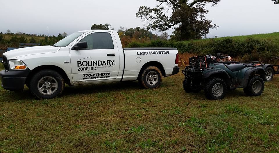
Boundary Zone - Miramar Beach
Boundary Zone - Miramar Beach
2004 years of experience
We have a team of Professional Surveyors that provide residential surveying and construction staking. Our Specialties include Boundary Surveys, ALTA (American Land Title Association), Topographic and Tree Surveys, Existing Conditions, As-built, Site Maps, Plot Surveys, Construction Surveys, Drone Mapping, & Elevation Certificates. We take pride in serving our clients with accurate surveys that are orientated to customer service.
We have a team of Professional Surveyors that provide residential surveying and construction staking. Our Specialties include Boundary Surveys, ALTA (American Land Title Association), Topographic and Tree Surveys, Existing Conditions, As-built, Site Maps, Plot Surveys, Construction Surveys, Drone Mapping, & Elevation Certificates. We take pride in serving our clients with accurate surveys that are orientated to customer service.
Land Surveying questions, answered by experts
The Cottonwood, AL homeowners’ guide to land surveying services
From average costs to expert advice, get all the answers you need to get your job done.
 •
•Discover site preparation cost estimates, including average prices, cost factors, and tips to help homeowners budget for their next project.

A land survey can determine your property’s borders and settle property disputes. Learn how much a land survey costs and what can affect the price.

Just bought a plot of land and need to get it build-ready? Learn how much it costs to clear land to gauge your initial budget before you break ground.

Not sure what kind of property survey you need? Learn about the differences between a land survey vs. a boundary survey to get started.

Wondering whether you need a land survey or a plot plan? Learn about the differences between the two, when to do each, and what information they provide.

Knowing where your property lines are can help settle a dispute with a neighbor and even prevent an ugly legal battle. This guide will help you draw the line.
- Pansey, AL Land surveyors
- Rehobeth, AL Land surveyors
- Taylor, AL Land surveyors
- Dothan, AL Land surveyors
- Graceville, FL Land surveyors
- Kinsey, AL Land surveyors
- Greenwood, FL Land surveyors
- Slocomb, AL Land surveyors
- Midland City, AL Land surveyors
- Headland, AL Land surveyors
- Cottondale, FL Land surveyors
- Marianna, FL Land surveyors
- Hartford, AL Land surveyors
- Newville, AL Land surveyors
- Newton, AL Land surveyors
- Donalsonville, GA Land surveyors
- Level Plains, AL Land surveyors
- Bonifay, FL Land surveyors
- Blakely, GA Land surveyors
- Alford, FL Land surveyors
- Grand Ridge, FL Land surveyors
- Chipley, FL Land surveyors
- Tree Service in Cottonwood
- Septic Tank in Cottonwood
- Pressure Washing in Cottonwood
- Roofing in Cottonwood
- Lawn And Yard Work in Cottonwood
- Windows in Cottonwood
- Painting in Cottonwood
- Driveways in Cottonwood
- Pest Control in Cottonwood
- Chimney Sweep in Cottonwood
- Mailbox Repair in Cottonwood
- Swimming Pools in Cottonwood
- Garbage Collection in Cottonwood
- Plumbing in Cottonwood
- Cleaning in Cottonwood
- Flooring in Cottonwood
- Furniture Refinishing in Cottonwood
- Garage Builders in Cottonwood
- Deck Maintenance in Cottonwood
- Air Duct Cleaning in Cottonwood
- Roof Cleaning in Cottonwood
- Animal Removal in Cottonwood
- Exterior Painting in Cottonwood
- Kitchen And Bath Remodeling in Cottonwood
- Electrical in Cottonwood
- Pet Fencing in Cottonwood
- Computer Repair in Cottonwood
- Foundation Repair in Cottonwood
- Mold Testing And Remediation in Cottonwood
- Moving in Cottonwood