

Just bought a plot of land and need to get it build-ready? Learn how much it costs to clear land in Austin, TX, to gauge your initial budget before you break ground.
Land surveying costs depend on your project and location. Check with a local pro for your specific job.

Property owners can expect to pay $1,600 to $3,700 for a one-acre land survey in Austin, TX.
Survey type impacts cost, with a boundary survey costing the least and an American Land Title Association (ALTA) survey costing the most.
In Austin, TX, labor makes up 60% to 80% of land surveying costs, depending on property size and survey complexity.
Hiring a professional Austin, TX, land surveyor keeps your project compliant and ensures accuracy.
Property owners in Austin, TX, budgeting for a land survey should expect costs slightly above the national average, influenced by the city’s rapid growth and high demand for real estate services. In Austin, TX, land surveying costs range from $785 to $5,396, with an average project price of $2,256. Survey costs are influenced by factors such as the survey type, property size, and site conditions.
The price you’ll pay for a land survey in Austin, TX, is dependent on two major factors: the size of your property and the type of survey you need performed. Here’s a breakdown of how those costs affect your pricing.
The size of your property plays a big role in survey cost. A property spanning less than an acre can cost as little as $600, while a one-acre survey starts at $1,600, depending on the survey's complexity and the terrain. Like most things, buying in bulk can help lower your rate. In most cases, the larger the property, the lower the price per acre.
| Property Size (Acres) | Average Cost |
|---|---|
| 1 | $1,600–$3,700 |
| 5 | $2,900–$4,800 |
| 10 | $4,000–$6,900 |
| 25 | $6,000–$12,500 |
| 50 | $10,500–$26,000 |

There are several types of land surveys, each designed to meet specific needs depending on the project's purpose. This reasoning impacts the price. Surveyors charge higher fees when a project requires collecting additional land data beyond what’s needed to establish basic property boundaries.
| Survey Type | Average Cost |
|---|---|
| Boundary | $1,200–$5,500 |
| Topographic | $2,000–$6,500 |
| Mortgage | $1,500–$4,500 |
| Fence land | $1,000–$3,200 |
| As-built | $1,600–$3,800 |
| American Land Title Association (ALTA) | $2,500–$10,000 |
| New construction | $1,800–$6,500 |
Landowners in Austin, TX, should also plan for local labor, permitting, and other regional costs that can influence the price of a land survey. Below is a breakdown of common expenses Austin, TX, land surveyors consider when estimating project budgets.
In Austin, TX, labor is a major factor in land surveying costs, accounting for 60% to 80% of the price. Surveyors in the area charge between $130 and $240 per hour, or $800 to $4,500 per project, depending on the property’s size, terrain, accessibility, and the survey's complexity.
Licensed Austin, TX, surveyors handle most residential projects, offering expertise in boundary determination, topographic mapping, and construction layout. They also research historical property records and resolve disputes in property lines. Familiarity with Texas regulations and Travis County land records ensures results that are both accurate and compliant.
Most standard residential land surveys in Austin, TX, do not require a permit. Surveys tied to new construction, property subdivisions, or larger development projects may need review and approval by local authorities. Licensed surveyors in Travis County and the city coordinate with planning and permitting offices to ensure compliance with local codes and prevent delays in project timelines.
In Austin, TX, a professional land survey can protect and potentially increase a property’s value, especially during a sale, purchase, or development project. While surveys do not offer a traditional return on investment (ROI), they can help prevent boundary disputes, zoning issues, or construction setbacks in the city’s competitive real estate market.
A detailed survey provides clear documentation of property lines, easements, and improvements, giving buyers and developers confidence. In a fast-paced and growing market like Austin, TX, an up-to-date survey can make a property more appealing, streamline transactions, and ensure compliance with local regulations and Travis County standards.
To help homeowners plan their next project, Angi provides readers with carefully researched cost data and upholds strict editorial standards. We start with national average project costs, which we collect by analyzing competitor information, retailer material costs, and input from professional contractors. We then apply local price index data to calculate location-specific estimates that reflect what homeowners typically pay in their local area. To do that, we use data from the U.S. Bureau of Economic Analysis (BEA), including its Regional Price Parities (RPPs), which measure price differences across cities. This helps us account for differences in labor, materials, and overall cost of living, so estimates in higher- or lower-cost areas better reflect real-world local pricing.
Every estimate undergoes a thorough editorial review to verify accuracy, consistency, and alignment with observed market conditions.
Want to help us improve our cost data? Send us a recent project quote to [email protected]. Quotes and personal information will not be shared publicly.
I highly recommend JP Exteriors. I have used them for 3 major projects over the last 5 years and the results always exceeded my expectations. The 1st job was the replacement of my siding with Hardie plank and repainting. The quality of the installation was outstanding and the siding still...
 JP Exteriors
Lupe and his team did a beautiful and efficient job preparing the soil, laying the new sod and clean up. He responded to my inquiry immediately and was easy to work with. I will ask him to do additional landscaping in the future. Highly recommend!
 Rivera Landscaping
I wish nobody would send surveys like this one. The offered options don't cover the territory. Either ask for comments or let it go.
 Hernandez Masonry & Construction
I hired Josue and team to survey my propery in central Austin for upcoming renovations. They were prompt, professional, and very reasonably priced. I was happy with the service and the survey output. I'd highly recommend Josue, if you're looking for a high quality survey without the big...
 Josue Miranda, RPLS
Your matching software is flawed. I requested a bid and services from landscaping services. Great owner of the land clearing company called me and recommended someone to help me With my landscaping.
The service provider came out to to survey the tiled area . The cost of the Big Deal would only cover about 1/4th of the amount of tile that I have. I decided to get a refund for the Big Deal because I won't be able to use it.
 Great Grout Tile Care
Chris Griffith, owner and designer for Allandale Land Design, the creative wing of Allandale Lawn and Landscape, met with us on several occasions to discuss our concept of turning yards that were primarily St. Augustine grass lawns into much lower water usage landscapes. We wanted to create...
In less than a week, Shane came out and performed the survey that I needed before building a new fence on my property. He was prompt, courteous and professional, and he answered all my questions. <br />
Douglas Foundation was amazing to work with from the initial inspection to the very end. The inspector from Douglas was the only one (out of three companies) to inquire about how much we wanted to invest in the property, and understood that where we live sometimes the land is more valuable...
 DOUGLAS FOUNDATION REPAIR
Rose's Fence company was a great experience overall including when we first went to their offices in Freeport. I showed the survey and the ballpark estimate was around $4,000. I called them a few weeks later to see if they can come to the house to measure and provide us an estimate. I...
From average costs to expert advice, get all the answers you need to get your job done.
Just bought a plot of land and need to get it build-ready? Learn how much it costs to clear land in Austin, TX, to gauge your initial budget before you break ground.

Leveling your yard can help with drainage and prevent damage to your home. Learn the cost to level a yard in Austin, TX, and what factors can affect the price.
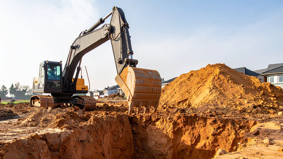
Find out the average excavation cost in Austin, TX. Learn what you can expect to pay for local land clearing and grading services to prep your property.

Planning to build a fence or home addition? Learn about land surveying costs, property boundaries, and how to hire the right local pro for your project.

A land surveyor can perform a land survey and help clarify your property boundaries and features. Use this guide to find the right professional.

Not sure what kind of property survey you need? Learn about the differences between a land survey vs. a boundary survey to get started.